Acquedotto medievale di Perugia
About Acquedotto medievale di Perugia
Key Features
More Details
Updated October 31, 2025
## Acquedotto medievale di Perugia: a practical guide to Perugia’s elevated medieval walkway
Location: Via Appia, 06123 Perugia, Italy (historic center)
Coordinates: 43.1138955, 12.3884271
Category: Historic/architectural sight & pedestrian route (public thoroughfare)
### Why this matters
Perugia’s Medieval Aqueduct isn’t just a relic; it’s an elevated urban footpath through alleys and rooftops that still traces the line that once carried water into the city’s heart. Built in the 13th century to bring water from Monte Pacciano to the Fontana Maggiore, it’s one of the simplest ways to understand Perugia’s topography, engineering, and civic ambition—on foot, in minutes.
—
## Fast facts (verified)
– Construction: largely 1254–1277, when Perugia expanded its water supply.
– Route: c. 4–5 km from Monte Pacciano (San Marco area) to Fontana Maggiore on today’s Piazza IV Novembre. Expect small variations in reported length depending on source. Umbria
– Design/oversight often attributed to: Fra Bevignate and Boninsegna (da Venezia), key figures in Perugia’s monumental works of the era. Prosciutto in Italy
– Status today: water function decommissioned after recurrent maintenance issues; sections survive as a public pedestrian way (Via dell’Acquedotto) skimming upper building levels.
– Main city approach point: the Arch of the Aqueduct along the old Via Appia, close to the historic core.
—
## What you’ll see on the ground
### The Arch & the city-side approach
Aim for Via Appia and the Arch of the Aqueduct—this is the historic entry where the channel reached the urban walls before descending to the Fontana Maggiore. You immediately get an elevated perspective over the streets and tiled roofs, uncommon for a route that’s technically part of the city fabric.
### The elevated walkway (Via dell’Acquedotto)
The surviving stretch functions as a narrow, raised footpath with modest parapets, undulating gently as it crosses between and alongside buildings. The surface is uneven in places; it’s not a polished promenade, and that’s the point—it reads as historic infrastructure repurposed. Expect rewarding photo angles down lanes and into courtyards.
> Tip: Some local write-ups recommend linking the walk with Via del Fagiano and Via Benedetta to keep the route visually strong and coherent through the urban grain.
### Fontana Maggiore connection
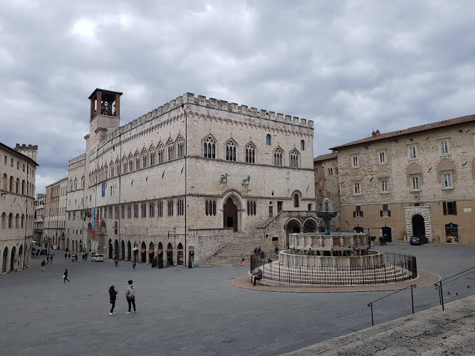
The aqueduct’s entire reason for being was to feed the Fontana Maggiore, the civic fountain on Piazza IV Novembre—still the city’s symbolic center. Pairing the walkway with a stop at the fountain tightens the story: source → channel → civic display. (The route-to-fountain relationship is well documented in regional tourism literature.)
—
## Short historical context (no fluff, just facts)
– Motivation: Rapid urban growth and civic prestige pushed Perugia to secure a long-distance gravity supply from Monte Pacciano in the mid-1200s. Umbria
– Engineering: A mostly covered gravity conduit with distribution culminating at the Fontana Maggiore. Attributions cite Fra Bevignate—also associated with other Umbrian works—and Boninsegna as key actors. Prosciutto in Italy
– Afterlife: From the late 19th century, chronic maintenance troubles and newer systems made the aqueduct obsolete as hydraulic infrastructure; the urban section survived as a walkway—a fortunate byproduct for today’s visitors.
—
## Route planning & wayfinding
– Start/finish idea (compact loop):
– Begin at Via Appia / Arch of the Aqueduct → follow Via dell’Acquedotto → optionally continue via Via del Fagiano and Via Benedetta → connect to Piazza IV Novembre for Fontana Maggiore.
– Time-on-foot: 20–40 minutes for a casual stop-and-shoot amble, excluding piazza time. (This is a practical estimate based on segment length and urban speeds; no official timed route is published.)
– Footwear: Treat it as old masonry: slightly irregular stones and level changes. Trainers help.
—
## Nearby add-ons that deepen the story
– Fontana Maggiore: Understand the aqueduct’s civic endpoint where water became public art and resource.
– Torre degli Sciri: Perugia’s last complete medieval tower—great for reading the skyline the aqueduct crosses beneath. Combine the elevated walk with a tower climb for a plan-view of the same urban fabric.
(If you maintain destination pages, these are natural internal-link targets.)
—
## Practicalities
– Cost: Walking the surviving urban section is free (public thoroughfare). (No official ticketing is referenced in regional or city materials that describe it as a public route.)
– Best light: Morning for façades on the east-facing lanes; late afternoon for warm stones and long shadows across the parapets (photographic rule-of-thumb; conditions vary with season and weather).
– Crowds: This is a functional city path, so you’ll meet commuters and residents alongside visitors—be considerate in narrower spots.
Accessibility note: Surfaces can be uneven and narrow, with occasional steps. Visitors with mobility concerns may prefer exploring the endpoints (Via Appia arch; Piazza IV Novembre) rather than committing to the whole elevated stretch.
—
## Accuracy & data integrity
– Date ranges & length discrepancies: Regional sources place construction mainly 1254–1277; route length appears in the ~4–5 km band depending on whether the count includes specific feeders and terminal distribution. We state a range to avoid false precision.
– Architect attributions: Attributions to Fra Bevignate and Boninsegna occur in multiple cultural summaries; medieval projects can involve long timelines and changing teams, so treat names as leading figures rather than sole designers. Prosciutto in Italy
– Function today: Hydraulics are decommissioned; the structure’s urban segment functions as a walkway—this is consistent across regional tourism and city descriptions.
—
## Quick map & address reference
– Primary city access: Arch of the Aqueduct (Via Appia), historic center.
– General coordinates for the central section: 43.1138955, 12.3884271 (Via Appia area in Perugia’s center).
—
### Bottom line
If you want a short, high-yield walk that layers medieval infrastructure over a lived-in Italian hill town, the Acquedotto medievale di Perugia delivers: engineering significance, quick rooftop vantages, and a direct line to the Fontana Maggiore—with almost no logistics to worry about.
Inclusivity note: As a public route, there’s no dress code or gate; just mind steps and narrow spots. If mobility is a concern, prioritize ground-level viewpoints and the piazza.
—
Sources: Regione Umbria tourism pages; city/route descriptions; architectural notes tied to Perugia’s civic water system. Cross-checked for dates, attributions, and present-day use.
Table of Contents
- Key Highlights
- Location
- Places to Stay Near Acquedotto medievale di Perugia"One of the best attraction places in the city"
- Find and Book a Tour
- Explore More Travel Guides
- Acquedotto medievale di Perugia: a practical guide to Perugia’s elevated medieval walkway
- Why this matters
- Fast facts (verified)
- What you’ll see on the ground
- The Arch & the city-side approach
- The elevated walkway (Via dell’Acquedotto)
- Fontana Maggiore connection
- Short historical context (no fluff, just facts)
- Route planning & wayfinding
- Nearby add-ons that deepen the story
- Practicalities
- Accuracy & data integrity
- Quick map & address reference
- Bottom line
- Nearby Places You Might Like
- Traveler Reviews for Acquedotto medievale di Perugia
- Share Your Experience
Key Highlights
Construction: largely 1254–1277, when Perugia expanded its water supply. oai_citation:2‡umbriatourism.it
Route: c. 4–5 km from Monte Pacciano (San Marco area) to Fontana Maggiore on today’s Piazza IV Novembre. Expect small variations in reported length depending on source. oai_citation:3‡Exploring Umbria
Design/oversight often attributed to: Fra Bevignate and Boninsegna (da Venezia), key figures in Perugia’s monumental works of the era. oai_citation:4‡Renato Prosciutto in Italy
Status today: water function decommissioned after recurrent maintenance issues; sections survive as a public pedestrian way (Via dell’Acquedotto) skimming upper building levels. oai_citation:5‡umbriatourism.it
Main city approach point: the Arch of the Aqueduct along the old Via Appia, close to the historic core. oai_citation:6‡GPSmyCity
Location
Places to Stay Near Acquedotto medievale di Perugia"One of the best attraction places in the city"
Find and Book a Tour
Explore More Travel Guides
No reviews found! Be the first to review!
Acquedotto medievale di Perugia: a practical guide to Perugia’s elevated medieval walkway
Location: Via Appia, 06123 Perugia, Italy (historic center)
Coordinates: 43.1138955, 12.3884271
Category: Historic/architectural sight & pedestrian route (public thoroughfare)
Why this matters
Perugia’s Medieval Aqueduct isn’t just a relic; it’s an elevated urban footpath through alleys and rooftops that still traces the line that once carried water into the city’s heart. Built in the 13th century to bring water from Monte Pacciano to the Fontana Maggiore, it’s one of the simplest ways to understand Perugia’s topography, engineering, and civic ambition—on foot, in minutes. oai_citation:1‡umbriatourism.it
Fast facts (verified)
- Construction: largely 1254–1277, when Perugia expanded its water supply. oai_citation:2‡umbriatourism.it
- Route: c. 4–5 km from Monte Pacciano (San Marco area) to Fontana Maggiore on today’s Piazza IV Novembre. Expect small variations in reported length depending on source. oai_citation:3‡Exploring Umbria
- Design/oversight often attributed to: Fra Bevignate and Boninsegna (da Venezia), key figures in Perugia’s monumental works of the era. oai_citation:4‡Renato Prosciutto in Italy
- Status today: water function decommissioned after recurrent maintenance issues; sections survive as a public pedestrian way (Via dell’Acquedotto) skimming upper building levels. oai_citation:5‡umbriatourism.it
- Main city approach point: the Arch of the Aqueduct along the old Via Appia, close to the historic core. oai_citation:6‡GPSmyCity
What you’ll see on the ground
The Arch & the city-side approach
Aim for Via Appia and the Arch of the Aqueduct—this is the historic entry where the channel reached the urban walls before descending to the Fontana Maggiore. You immediately get an elevated perspective over the streets and tiled roofs, uncommon for a route that’s technically part of the city fabric. oai_citation:7‡GPSmyCity
The elevated walkway (Via dell’Acquedotto)
The surviving stretch functions as a narrow, raised footpath with modest parapets, undulating gently as it crosses between and alongside buildings. The surface is uneven in places; it’s not a polished promenade, and that’s the point—it reads as historic infrastructure repurposed. Expect rewarding photo angles down lanes and into courtyards. oai_citation:8‡Wanderlog
Tip: Some local write-ups recommend linking the walk with Via del Fagiano and Via Benedetta to keep the route visually strong and coherent through the urban grain. oai_citation:9‡Tripadvisor
Fontana Maggiore connection
The aqueduct’s entire reason for being was to feed the Fontana Maggiore, the civic fountain on Piazza IV Novembre—still the city’s symbolic center. Pairing the walkway with a stop at the fountain tightens the story: source → channel → civic display. (The route-to-fountain relationship is well documented in regional tourism literature.) oai_citation:10‡umbriatourism.it
Short historical context (no fluff, just facts)
- Motivation: Rapid urban growth and civic prestige pushed Perugia to secure a long-distance gravity supply from Monte Pacciano in the mid-1200s. oai_citation:11‡Exploring Umbria
- Engineering: A mostly covered gravity conduit with distribution culminating at the Fontana Maggiore. Attributions cite Fra Bevignate—also associated with other Umbrian works—and Boninsegna as key actors. oai_citation:12‡Renato Prosciutto in Italy
- Afterlife: From the late 19th century, chronic maintenance troubles and newer systems made the aqueduct obsolete as hydraulic infrastructure; the urban section survived as a walkway—a fortunate byproduct for today’s visitors. oai_citation:13‡umbriatourism.it
Route planning & wayfinding
- Start/finish idea (compact loop):
- Begin at Via Appia / Arch of the Aqueduct → follow Via dell’Acquedotto → optionally continue via Via del Fagiano and Via Benedetta → connect to Piazza IV Novembre for Fontana Maggiore. oai_citation:14‡GPSmyCity
- Time-on-foot: 20–40 minutes for a casual stop-and-shoot amble, excluding piazza time. (This is a practical estimate based on segment length and urban speeds; no official timed route is published.)
- Footwear: Treat it as old masonry: slightly irregular stones and level changes. Trainers help. oai_citation:15‡Wanderlog
Nearby add-ons that deepen the story
- Fontana Maggiore: Understand the aqueduct’s civic endpoint where water became public art and resource. oai_citation:16‡umbriatourism.it
- Torre degli Sciri: Perugia’s last complete medieval tower—great for reading the skyline the aqueduct crosses beneath. Combine the elevated walk with a tower climb for a plan-view of the same urban fabric. oai_citation:17‡museiapperugia.it
(If you maintain destination pages, these are natural internal-link targets.)
Practicalities
- Cost: Walking the surviving urban section is free (public thoroughfare). (No official ticketing is referenced in regional or city materials that describe it as a public route.) oai_citation:18‡umbriatourism.it
- Best light: Morning for façades on the east-facing lanes; late afternoon for warm stones and long shadows across the parapets (photographic rule-of-thumb; conditions vary with season and weather).
- Crowds: This is a functional city path, so you’ll meet commuters and residents alongside visitors—be considerate in narrower spots.
Accessibility note: Surfaces can be uneven and narrow, with occasional steps. Visitors with mobility concerns may prefer exploring the endpoints (Via Appia arch; Piazza IV Novembre) rather than committing to the whole elevated stretch. oai_citation:19‡Wanderlog
Accuracy & data integrity
- Date ranges & length discrepancies: Regional sources place construction mainly 1254–1277; route length appears in the ~4–5 km band depending on whether the count includes specific feeders and terminal distribution. We state a range to avoid false precision. oai_citation:20‡umbriatourism.it
- Architect attributions: Attributions to Fra Bevignate and Boninsegna occur in multiple cultural summaries; medieval projects can involve long timelines and changing teams, so treat names as leading figures rather than sole designers. oai_citation:21‡Renato Prosciutto in Italy
- Function today: Hydraulics are decommissioned; the structure’s urban segment functions as a walkway—this is consistent across regional tourism and city descriptions. oai_citation:22‡umbriatourism.it
Quick map & address reference
- Primary city access: Arch of the Aqueduct (Via Appia), historic center. oai_citation:23‡GPSmyCity
- General coordinates for the central section: 43.1138955, 12.3884271 (Via Appia area in Perugia’s center).
Bottom line
If you want a short, high-yield walk that layers medieval infrastructure over a lived-in Italian hill town, the Acquedotto medievale di Perugia delivers: engineering significance, quick rooftop vantages, and a direct line to the Fontana Maggiore—with almost no logistics to worry about. oai_citation:24‡umbriatourism.it
Inclusivity note: As a public route, there’s no dress code or gate; just mind steps and narrow spots. If mobility is a concern, prioritize ground-level viewpoints and the piazza. oai_citation:25‡Wanderlog
Sources: Regione Umbria tourism pages; city/route descriptions; architectural notes tied to Perugia’s civic water system. Cross-checked for dates, attributions, and present-day use.
Traveler Reviews for Acquedotto medievale di Perugia
There are no reviews yet. Be the first one to write one.
Have you visited Acquedotto medievale di Perugia? Help other travelers by sharing your review.
You Might Also Like

National Archaeological Museum of Umbria
Chiesa di San Michele Arcangelo
Piazza IV Novembre
Find Accommodations Nearby
Recommended Tours & Activities
Visitor Reviews
There are no reviews yet. Be the first one to write one.
Share Your Experience
Have you visited Acquedotto medievale di Perugia? Help other travelers by leaving a review.