Cascais Tide Gauge
About Cascais Tide Gauge
Key Features
- Historic tide gauge installed in 1882, one of Portugal’s oldest continuous sea-level records
- Small white dome and instrument house located directly on the seafront promenade
- Informative plaques and nearby signage explaining its role in national altimetry and sea-level monitoring (check locally)
- Picturesque setting with views over the Bay of Cascais and easy access from town
- Proximity to other Cascais maritime and cultural attractions for combined visits
More Details
Updated June 11, 2025
Marégrafo de Cascais – Cascais Tide Gauge – Alles wat u moet weten …
## Cascais Tide Gauge: The Little White Dome That Measures a Changing Ocean
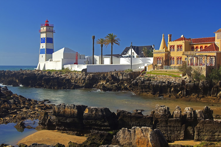
On the edge of the Bay of Cascais, along Passeio Maria Pia de Sabóia, there’s a small white dome that most people stroll past without realizing how important it is. The Cascais Tide Gauge (Marégrafo de Cascais) isn’t just a quirky seafront structure – it’s one of the world’s longest-running sea-level observatories and the reference point for how altitude is measured across mainland Portugal.
If you’re planning time on the Lisbon coast and you’re curious about climate, ocean science, or the quiet infrastructure that keeps ships, charts, and coastal cities safe, this is a rewarding short stop.
Jump to:
– How the Cascais Tide Gauge works
– Practical information for visiting
—
## Quick Overview
– What it is: Historic tide gauge (marégrafo) and sea-level observatory, first installed in 1882 – the first tide gauge in Portugal and one of the earliest on the European Atlantic coast.
– Location: Passeio Maria Pia de Sabóia, 2750-411 Cascais, at the entrance to Cascais Bay, just below the Citadel and next to the modern marina.
– Function: Measures tides and long-term sea level; its data underpins Portugal’s national altitude reference (“Datum altimétrico” / reference zero).
– Access: Small historic building on a stone platform over the water; according to the municipality, visits are free and usually by appointment on Tuesday and Thursday afternoons, with additional open days on certain international observance dates. 360º
– Why it matters: Provides a continuous sea-level record used in climate-change and coastal-risk research worldwide.
—
## A Small Building with Global Impact
### From Paris to Cascais: 19th-Century Ocean Science
The Cascais Tide Gauge dates back to the late 19th century, when Portugal was investing heavily in geodesy, cartography and oceanography.
Key historical milestones:
– The analog system was built in 1877 in Paris by clockmaker Amédée-Philippe Borrel (and Jean Wagner, per technical records).
– It was installed in Cascais in 1882, initially next to the marine biology and oceanographic laboratory championed by King Carlos I, who personally supported oceanographic research along this coast.
– At the time it began operating, there were only a few similar precision tide gauges elsewhere in Europe (including Brest, Aberdeen and Hook of Holland), making Cascais part of a very small early network of sea-level observatories.
By the end of the 19th century, the first installation site proved less than ideal – the gauge was too sheltered from open-ocean conditions. The instrument was relocated about 30 metres on 23 August 1900 to its current position on a small rock platform at the bay entrance, where wave and tide signals are more representative of the Atlantic coast.
### Portugal’s “Zero of Altitude”
One of the most important – and least obvious – roles of the Cascais Tide Gauge is in defining altitude across mainland Portugal:
– The gauge’s long-term mean sea-level record was adopted as the altimetric “reference zero” used in Portuguese cartography.
– That means when you read that a peak in Sintra rises to 528 m, that number is ultimately referenced back to the sea level observed here in Cascais. Out Worldwide
In other words, this unassuming dome is the baseline against which mountain heights, river valley elevations and engineering projects across the country are measured.
The records have also been used to map submerged coastal areas and to support navigation, including calculating safe depths for ships entering estuaries – another reason the gauge was originally installed, given the challenging sand bar at the mouth of the Tagus River leading to Lisbon.
### One of the World’s Longest Sea-Level Records
The Cascais record is valuable because it is both old and continuous:
– The tide gauge has data extending back to the 1880s, with continuous operation from the 1890s onwards, forming one of the longest relative sea-level time series in the world.
– Its observations are incorporated into international datasets such as the Permanent Service for Mean Sea Level (PSMSL), which makes monthly and annual mean sea-level data for Cascais publicly available as Station 52.
Researchers use this record to:
– Quantify sea-level rise along the Atlantic Iberian coast.
– Test and refine global climate models.
– Study extreme events like storm surges and seiches (harbour oscillations).
A 2009 scientific analysis integrating analog and modern digital data found:
– Long-term relative sea-level rise at Cascais during much of the 20th century averaged around 1.6–1.9 mm per year.
– For the 1990s and 2000s, rates closer to 2.1–2.5 mm per year were estimated, consistent with an acceleration compared with earlier decades.
> Data note (possible outdated figures):
> These rates come from work published up to 2009. Newer analyses that include recent decades may refine the exact numbers as more data are digitised and processed.
Local interpretive materials and summaries aimed at the public still often cite an older figure of about 15 cm of mean sea-level rise (≈1.3 mm/year) over roughly the first century of observations – a useful historical benchmark, but slightly lower than more recent scientific estimates that focus on the later 20th century.
—
## A Living Instrument in a Digital Age
### How the Cascais Tide Gauge Works
Inside the small dome, the original analog mechanism still operates:
– A float sits in a vertical well connected to the sea through openings near the bottom, which helps filter out short-lived disturbances from boat wakes or wind chop.
– The float is attached by cable and pulleys to a clock-driven drum. As the tide rises and falls, a pen traces the water level onto a sheet of paper wrapped around the drum, creating a week-long tidal curve known as a “maregrama” (maregram).
– Historically, staff changed the paper once a week and swapped pen colours daily to distinguish each day’s trace. Out Worldwide
This analog record is still used today:
– The original gauge is kept in operation, and its readings are used to calibrate the more modern digital system.
### Modern Digital Monitoring
In the 1990s and early 2000s, the system was modernised:
– Upgrades in 1996 improved measurement systems while retaining the historic mechanism.
– A digital acoustic tide gauge with additional sensors (including air pressure) was installed in the marina administration building about 250 m away and has been operating since late 2003, transmitting data in near-real time.
These data streams feed into international monitoring networks for sea-level change, storm surges, and tsunami signals, making Cascais relevant far beyond Portugal.
### Recent Sea-Level Records
According to an early-2025 news summary, 2024 produced the highest mean sea level yet recorded at Cascais, reaching around 23.3 cm above the “Cascais1938” benchmark – a clear sign of ongoing sea-level rise in the region. Resident
> Outdated vs. current context:
> Long-term averages like “15 cm in 100 years” were based on earlier slices of the record; more recent work and the 2024 peak underscore that sea-level trends are not static and that newer data continue to push those numbers higher.
—
## What It’s Like to Visit
### Setting and First Impressions
The tide gauge sits at the end of a short stone causeway on the seafront, with Cascais Marina on one side and the old harbour and Citadel on the other.
From the public promenade you see:
– The compact whitewashed dome labelled “Marégrafo”.
– The platform and railings above the water.
– Measuring staffs and supporting structures that make its purpose clear to anyone with a scientific eye.
Most visitor reviews describe it as a small but interesting stop, often combined with a walk around the marina or the nearby lighthouse and museums, rather than a destination on its own.
### Practical Information for Visiting the Cascais Tide Gauge
Location
– Address: Passeio Maria Pia de Sabóia, 2750-411 Cascais, Portugal. 360º
– Coordinates: Approximately 38.694° N, −9.418° W, right at the entrance to Cascais Bay.
It is walkable from central Cascais and the train station along the waterfront; the exact walking time will depend on your pace and route.
Opening and access
Information from the municipality and local tourism sources indicates:
– Price: Free. 360º
– Regular visits:
– Visits are by appointment, typically Tuesdays and Thursdays in the afternoon (the municipality currently lists 14:00–17:00). 360º
– Time Out Lisboa additionally notes guided tours at around 15:00 on those days. Out Worldwide
– Special open days (no appointment):
– The municipal site lists several dates where the general public can visit between 10:00 and 17:00, such as International Day of Monuments and Sites (18 April), International Museum Day (18 May), International Children’s Day (1 June), World Environment Day (5 June), World Oceans Day (8 June) and International Day of the Sea (16 November). 360º
– Booking contacts:
– Phone and email contacts for appointments are published by the municipality; travellers should use the current details on the Cascais 360 / municipal website, as these can change over time. 360º
> Important: Opening times, booking requirements and contact details are subject to change. Always confirm on the official Cascais municipal or museum websites before planning a timed visit.
Accessibility considerations
Photos and municipal descriptions show a stone walkway and steps leading down toward the structure. This may present challenges for visitors with limited mobility, so it’s worth asking the museum team directly about current accessibility arrangements if that’s relevant to your group. 360º
—
Key Highlights
- Historic tide gauge installed in 1882, one of Portugal’s oldest continuous sea-level records
- Small white dome and instrument house located directly on the seafront promenade
- Informative plaques and nearby signage explaining its role in national altimetry and sea-level monitoring (check locally)
- Picturesque setting with views over the Bay of Cascais and easy access from town
- Proximity to other Cascais maritime and cultural attractions for combined visits
Location
Places to Stay Near Cascais Tide Gauge"Os registos do Marégrafo de Cascais permitem medir com rigor, ..."
Find and Book a Tour
Explore More Travel Guides
No reviews found! Be the first to review!
Traveler Reviews for Cascais Tide Gauge
There are no reviews yet. Be the first one to write one.
Have you visited Cascais Tide Gauge? Help other travelers by sharing your review.
Nearby Attractions
You Might Also Like
Casa Sommer
Santa Maria House Museum
Citadel Art District
Find Accommodations Nearby
Recommended Tours & Activities
Visitor Reviews
There are no reviews yet. Be the first one to write one.
Share Your Experience
Have you visited Cascais Tide Gauge? Help other travelers by leaving a review.