Perins Peak State Wildlife Area
About Perins Peak State Wildlife Area
Description
Perins Peak State Wildlife Area stands as one of Colorado's more understated natural treasures, and honestly, that's part of what makes it so appealing to those who venture there. This expansive forested area sprawls across terrain that rewards visitors with stunning panoramic mountain views that'll make you forget about scrolling through your phone for a good while. The wildlife area serves multiple purposes throughout the year - from providing crucial habitat for native species to offering recreational opportunities that draw hikers, nature photographers, and seasonal hunters alike. What strikes most travelers when they first arrive is the sense of remoteness you get despite not being terribly far from civilization. The landscape transitions beautifully from dense ponderosa pine forests to open meadows where wildflowers put on quite a show during the right season. I've always believed that the best outdoor spaces are the ones that haven't been manicured to death, and Perins Peak definitely falls into that category. You're getting nature pretty much as it wants to be, which means trails that follow the natural contours of the land rather than being paved into submission. The wildlife area encompasses several hundred acres of classic Colorado high country terrain. Elk, mule deer, black bears, and mountain lions all call this area home, along with smaller critters like rabbits, squirrels, and an impressive variety of bird species. And while you might not see a mountain lion on your visit - they're famously elusive - knowing you're sharing space with these apex predators adds a certain edge to your hiking experience that's honestly pretty thrilling.Key Features
The attributes that make Perins Peak State Wildlife Area worth adding to your Colorado itinerary include:- Multiple hiking trails that range from moderate to challenging difficulty levels, accommodating different fitness levels and time commitments
- Spectacular 360-degree mountain views from higher elevations that showcase the surrounding La Plata Mountains and valleys
- Well-maintained trail system despite the natural, rugged character of the terrain
- Excellent wildlife viewing opportunities throughout all seasons, particularly during dawn and dusk hours
- Family-friendly options with kid-appropriate trails that aren't too demanding for younger hikers
- Seasonal hunting opportunities that follow Colorado Parks and Wildlife regulations
- Less crowded than many of Colorado's more famous outdoor destinations, offering a more solitary wilderness experience
- Dense forest coverage providing natural shade during summer months and stunning fall colors when aspens change
- Wildflower displays during late spring and early summer that transform meadows into natural gardens
- Photography opportunities that span landscapes, wildlife, macro flower shots, and dramatic lighting conditions
- Free access with no entrance fees or parking charges
- Relatively close proximity to Durango for those basing their travels in that area
Best Time to Visit
Timing your visit to Perins Peak State Wildlife Area really depends on what kind of experience you're after, because each season offers something distinctly different. Late spring through early fall - roughly May through October - represents peak visitation for hikers and general recreationists. During these months, you'll find trails that are mostly snow-free and temperatures that make spending hours outdoors genuinely pleasant rather than an endurance test. Summer months from June through August bring the warmest weather and the longest daylight hours, giving you maximum flexibility for your adventures. But here's the thing - afternoon thunderstorms are practically a daily occurrence in the Colorado high country during summer. Plan your hikes for morning starts, and be prepared to head back down if you see those dark clouds rolling in. Lightning at elevation is no joke, and the exposed areas along some of the higher trails leave you pretty vulnerable. Fall might actually be my personal favorite time at Perins Peak. September and early October deliver cooler temperatures that make hiking more comfortable, fewer bugs buzzing around your head, and those incredible golden aspen displays that Colorado is famous for. The wildlife becomes more active too as animals prepare for winter. You'll often spot elk during the rut, when bulls bugle in ways that sound almost prehistoric echoing through the valleys. Winter transforms Perins Peak into a completely different environment. Snow covers the trails from November through April, and access becomes significantly more challenging. Some folks do venture out on snowshoes or cross-country skis, but you need to be properly equipped and experienced in winter backcountry travel. The area sees far fewer visitors during these months, which appeals to those seeking true solitude. Spring can be tricky - we're talking late April through May here. Snow lingers at higher elevations, trails turn muddy as things thaw, and conditions change rapidly. But if you catch it right, spring wildflowers start emerging and baby animals appear, which creates some magical moments for patient visitors. For families with kids, stick to late spring through early fall when trail conditions are most predictable and weather less likely to throw dangerous curveballs at you.How to Get There
Getting to Perins Peak State Wildlife Area requires a bit of navigation since it's not exactly sitting right off a major highway with giant signs pointing the way. Most travelers approach from Durango, which serves as the logical base for exploring this region of southwestern Colorado. From Durango, you're looking at roughly a 15-20 minute drive depending on where exactly you're starting from and which trailhead you're aiming for. The route takes you north from Durango, and you'll need to follow local roads that wind through residential areas before reaching the wildlife area boundaries. A GPS or smartphone with a reliable maps application is pretty much essential because the turnoffs aren't always intuitive, especially if you're unfamiliar with the area. And cell service can get spotty as you approach the trailheads, so download offline maps before you leave town. The roads leading to Perins Peak are generally maintained but not always paved as you get closer to trailhead parking areas. A standard passenger vehicle can usually make the trip during dry conditions, but high clearance vehicles definitely have an advantage, particularly after storms or during spring when rutting and mud become issues. Four-wheel drive isn't typically necessary in summer, but it's smart to have during other seasons or after significant weather events. Parking at the main trailheads consists of small dirt lots that can accommodate maybe a dozen vehicles or so. During peak season weekends, you might find these lots full, which means getting creative with roadside parking or arriving earlier in the morning. I've learned that showing up by 7 or 8 am pretty much guarantees you a spot and also gets you on the trail before afternoon weather moves in. If you're flying in for your Colorado adventure, the closest major airport is Durango-La Plata County Airport, which receives flights from several hub cities. From there, you'll need a rental car since public transportation doesn't serve the wildlife area. The larger Albuquerque International Sunport sits about 3.5 hours away and sometimes offers better flight options and prices, though that's obviously a longer drive.Tips for Visiting
Let me share some practical wisdom that'll make your Perins Peak experience better, drawn from both personal experience and what I've learned from others who frequent this area. First off, water is critical. There aren't reliable water sources along the trails, and the combination of altitude and Colorado's dry air means you'll dehydrate faster than you expect. Bring more water than seems reasonable - at least two liters per person for a half-day hike, more if you're planning longer adventures or visiting during summer heat. The elevation here hovers around 7,000 to 8,000 feet, which affects people differently. If you're coming from sea level, give yourself a day or two in the region before attempting longer or more strenuous hikes. Altitude sickness isn't fun, and it can sneak up on you. Symptoms include headaches, nausea, and fatigue that goes beyond normal exercise tiredness. Wildlife encounters require smart behavior. You're in their home, not a zoo. Keep your distance - use binoculars or zoom lenses for closer views. Store food securely, don't feed animals (this should be obvious but apparently needs repeating), and make noise as you hike to avoid surprising bears or mountain lions. I usually chat with my hiking companions or occasionally clap when rounding blind corners on the trail. Trail conditions vary significantly and aren't always updated online. The wildlife area management focuses on habitat conservation rather than recreational infrastructure, which means trail maintenance happens but isn't as frequent as in state parks. Expect fallen trees across paths, rocky sections, and occasional route-finding challenges. A trail map or GPS device helps tremendously. Dress in layers because mountain weather changes fast. That sunny 75-degree morning can turn into a 50-degree afternoon with rain and wind. Pack a lightweight rain jacket and an extra insulating layer even when the forecast looks perfect. Bug spray becomes your best friend during early summer when mosquitos and flies emerge in force, particularly in shaded, damp areas. Ticks are also present, so check yourself thoroughly after hiking. The wildlife area allows dogs but they must remain on leash, both for their protection and to minimize disturbance to wildlife. Honestly though, this is serious predator country, and keeping your dog close isn't just about following rules - it's about keeping them safe from becoming prey. Cell phone coverage is unreliable to nonexistent in many parts of the wildlife area. Tell someone your plans before heading out, including expected return time. Carry a basic first aid kit and know how to use it. During hunting seasons - primarily fall - wear blaze orange even if you're just hiking. Hunters have legal rights to pursue game here, and making yourself visible prevents tragic accidents. Check the Colorado Parks and Wildlife website for current hunting season dates before your visit. Photography enthusiasts should bring telephoto lenses for wildlife shots and wide-angle options for landscape work. The golden hours around sunrise and sunset offer the most dramatic lighting, and animals are more active during these times too. Leave no trace principles apply fully here. Pack out everything you bring in, stay on established trails to prevent erosion and habitat damage, and be respectful of the space. This place remains special partly because visitors treat it well. Finally, don't rush. Perins Peak State Wildlife Area rewards those who slow down, observe, and immerse themselves in the environment rather than just checking it off a list. Some of my best moments in places like this have come from simply sitting quietly and watching the landscape reveal itself.Key Features
- Panoramic views of the Animas River valley and La Plata Mountains
- Network of hiking trails of moderate difficulty (including Perins Peak Trail)
- Accessible location just north of Durango with quick trailhead options
- Good wildlife and raptor viewing habitat managed by Colorado Parks and Wildlife
- Seasonal wildflowers and volcanic rock formations/mesa terrain
More Details
Updated April 5, 2026
Table of Contents
- Description
- Key Features
- Best Time to Visit
- How to Get There
- Tips for Visiting
- Key Highlights
- Location
- Places to Stay Near Perins Peak State Wildlife Area
- Find and Book a Tour
- Explore More Travel Guides
- Key Takeaways
- Essential Facts About Perins Peak State Wildlife Area
- Location Near Durango
- Land Area and Elevation
- Seasonal Accessibility
- Colorado Parks and Wildlife Management
- Exploring the Trails and Hiking Experience
- Perins Peak Trail Overview
- Route Details and Terrain
- Best Times for Hiking
- Wildlife Watching and Birding Opportunities
- Key Wildlife Species
- Best Viewpoints for Spotting Animals
- Tips for Birdwatchers
- Unique Flora and Scenic Landscapes
- Forest Habitats and Tree Species
- Meadow and Cliffside Ecology
- Outdoor Recreation: Beyond Hiking
- Mountain Biking Adventures
- Climbing at Perins Peak
- Hunting Regulations and Seasons
- Visitor Guidelines and Conservation Practices
- Entry Requirements and Closures
- Leave No Trace Principles
- Responsible Wildlife Interaction
- Historical and Cultural Insights
- Origin of the Name and Charles Perins
- Denver and Rio Grande Railroad Connection
- Local Landmarks and Surrounding Features
- Frequently Asked Questions
- What’s the easiest way to get there by car, and which access roads tend to be rough or seasonally impassable?
- Are there any current closures or restricted areas, and where can I check for last-minute updates before I go?
- Which hiking route offers the best summit views with the least scrambling, and what should first-timers know about the steep sections?
- Is camping allowed nearby, and what are the closest legal options if overnight stays aren’t permitted on-site?
- Nearby Places You Might Like
- Traveler Reviews for Perins Peak State Wildlife Area
- Share Your Experience
Description
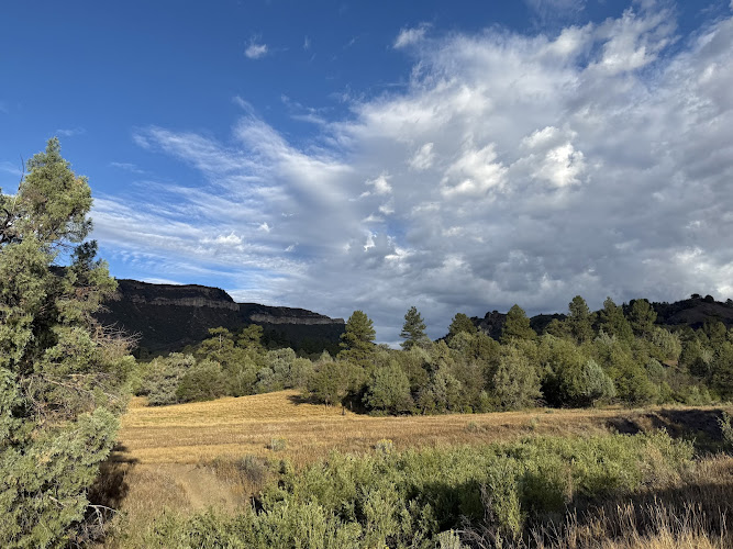
Perins Peak State Wildlife Area stands as one of Colorado’s more understated natural treasures, and honestly, that’s part of what makes it so appealing to those who venture there. This expansive forested area sprawls across terrain that rewards visitors with stunning panoramic mountain views that’ll make you forget about scrolling through your phone for a good while. The wildlife area serves multiple purposes throughout the year – from providing crucial habitat for native species to offering recreational opportunities that draw hikers, nature photographers, and seasonal hunters alike.
What strikes most travelers when they first arrive is the sense of remoteness you get despite not being terribly far from civilization. The landscape transitions beautifully from dense ponderosa pine forests to open meadows where wildflowers put on quite a show during the right season. I’ve always believed that the best outdoor spaces are the ones that haven’t been manicured to death, and Perins Peak definitely falls into that category. You’re getting nature pretty much as it wants to be, which means trails that follow the natural contours of the land rather than being paved into submission.
The wildlife area encompasses several hundred acres of classic Colorado high country terrain. Elk, mule deer, black bears, and mountain lions all call this area home, along with smaller critters like rabbits, squirrels, and an impressive variety of bird species. And while you might not see a mountain lion on your visit – they’re famously elusive – knowing you’re sharing space with these apex predators adds a certain edge to your hiking experience that’s honestly pretty thrilling.
Key Features
The attributes that make Perins Peak State Wildlife Area worth adding to your Colorado itinerary include:
- Multiple hiking trails that range from moderate to challenging difficulty levels, accommodating different fitness levels and time commitments
- Spectacular 360-degree mountain views from higher elevations that showcase the surrounding La Plata Mountains and valleys
- Well-maintained trail system despite the natural, rugged character of the terrain
- Excellent wildlife viewing opportunities throughout all seasons, particularly during dawn and dusk hours
- Family-friendly options with kid-appropriate trails that aren’t too demanding for younger hikers
- Seasonal hunting opportunities that follow Colorado Parks and Wildlife regulations
- Less crowded than many of Colorado’s more famous outdoor destinations, offering a more solitary wilderness experience
- Dense forest coverage providing natural shade during summer months and stunning fall colors when aspens change
- Wildflower displays during late spring and early summer that transform meadows into natural gardens
- Photography opportunities that span landscapes, wildlife, macro flower shots, and dramatic lighting conditions
- Free access with no entrance fees or parking charges
- Relatively close proximity to Durango for those basing their travels in that area
Best Time to Visit
Timing your visit to Perins Peak State Wildlife Area really depends on what kind of experience you’re after, because each season offers something distinctly different. Late spring through early fall – roughly May through October – represents peak visitation for hikers and general recreationists. During these months, you’ll find trails that are mostly snow-free and temperatures that make spending hours outdoors genuinely pleasant rather than an endurance test.
Summer months from June through August bring the warmest weather and the longest daylight hours, giving you maximum flexibility for your adventures. But here’s the thing – afternoon thunderstorms are practically a daily occurrence in the Colorado high country during summer. Plan your hikes for morning starts, and be prepared to head back down if you see those dark clouds rolling in. Lightning at elevation is no joke, and the exposed areas along some of the higher trails leave you pretty vulnerable.
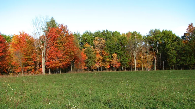
Fall might actually be my personal favorite time at Perins Peak. September and early October deliver cooler temperatures that make hiking more comfortable, fewer bugs buzzing around your head, and those incredible golden aspen displays that Colorado is famous for. The wildlife becomes more active too as animals prepare for winter. You’ll often spot elk during the rut, when bulls bugle in ways that sound almost prehistoric echoing through the valleys.
Winter transforms Perins Peak into a completely different environment. Snow covers the trails from November through April, and access becomes significantly more challenging. Some folks do venture out on snowshoes or cross-country skis, but you need to be properly equipped and experienced in winter backcountry travel. The area sees far fewer visitors during these months, which appeals to those seeking true solitude.
Spring can be tricky – we’re talking late April through May here. Snow lingers at higher elevations, trails turn muddy as things thaw, and conditions change rapidly. But if you catch it right, spring wildflowers start emerging and baby animals appear, which creates some magical moments for patient visitors.
For families with kids, stick to late spring through early fall when trail conditions are most predictable and weather less likely to throw dangerous curveballs at you.
How to Get There
Getting to Perins Peak State Wildlife Area requires a bit of navigation since it’s not exactly sitting right off a major highway with giant signs pointing the way. Most travelers approach from Durango, which serves as the logical base for exploring this region of southwestern Colorado. From Durango, you’re looking at roughly a 15-20 minute drive depending on where exactly you’re starting from and which trailhead you’re aiming for.
The route takes you north from Durango, and you’ll need to follow local roads that wind through residential areas before reaching the wildlife area boundaries. A GPS or smartphone with a reliable maps application is pretty much essential because the turnoffs aren’t always intuitive, especially if you’re unfamiliar with the area. And cell service can get spotty as you approach the trailheads, so download offline maps before you leave town.
The roads leading to Perins Peak are generally maintained but not always paved as you get closer to trailhead parking areas. A standard passenger vehicle can usually make the trip during dry conditions, but high clearance vehicles definitely have an advantage, particularly after storms or during spring when rutting and mud become issues. Four-wheel drive isn’t typically necessary in summer, but it’s smart to have during other seasons or after significant weather events.
Parking at the main trailheads consists of small dirt lots that can accommodate maybe a dozen vehicles or so. During peak season weekends, you might find these lots full, which means getting creative with roadside parking or arriving earlier in the morning. I’ve learned that showing up by 7 or 8 am pretty much guarantees you a spot and also gets you on the trail before afternoon weather moves in.
If you’re flying in for your Colorado adventure, the closest major airport is Durango-La Plata County Airport, which receives flights from several hub cities. From there, you’ll need a rental car since public transportation doesn’t serve the wildlife area. The larger Albuquerque International Sunport sits about 3.5 hours away and sometimes offers better flight options and prices, though that’s obviously a longer drive.
Tips for Visiting
Let me share some practical wisdom that’ll make your Perins Peak experience better, drawn from both personal experience and what I’ve learned from others who frequent this area.
First off, water is critical. There aren’t reliable water sources along the trails, and the combination of altitude and Colorado’s dry air means you’ll dehydrate faster than you expect. Bring more water than seems reasonable – at least two liters per person for a half-day hike, more if you’re planning longer adventures or visiting during summer heat.
The elevation here hovers around 7,000 to 8,000 feet, which affects people differently. If you’re coming from sea level, give yourself a day or two in the region before attempting longer or more strenuous hikes. Altitude sickness isn’t fun, and it can sneak up on you. Symptoms include headaches, nausea, and fatigue that goes beyond normal exercise tiredness.
Wildlife encounters require smart behavior. You’re in their home, not a zoo. Keep your distance – use binoculars or zoom lenses for closer views. Store food securely, don’t feed animals (this should be obvious but apparently needs repeating), and make noise as you hike to avoid surprising bears or mountain lions. I usually chat with my hiking companions or occasionally clap when rounding blind corners on the trail.
Trail conditions vary significantly and aren’t always updated online. The wildlife area management focuses on habitat conservation rather than recreational infrastructure, which means trail maintenance happens but isn’t as frequent as in state parks. Expect fallen trees across paths, rocky sections, and occasional route-finding challenges. A trail map or GPS device helps tremendously.
Dress in layers because mountain weather changes fast. That sunny 75-degree morning can turn into a 50-degree afternoon with rain and wind. Pack a lightweight rain jacket and an extra insulating layer even when the forecast looks perfect.
Bug spray becomes your best friend during early summer when mosquitos and flies emerge in force, particularly in shaded, damp areas. Ticks are also present, so check yourself thoroughly after hiking.
The wildlife area allows dogs but they must remain on leash, both for their protection and to minimize disturbance to wildlife. Honestly though, this is serious predator country, and keeping your dog close isn’t just about following rules – it’s about keeping them safe from becoming prey.
Cell phone coverage is unreliable to nonexistent in many parts of the wildlife area. Tell someone your plans before heading out, including expected return time. Carry a basic first aid kit and know how to use it.
During hunting seasons – primarily fall – wear blaze orange even if you’re just hiking. Hunters have legal rights to pursue game here, and making yourself visible prevents tragic accidents. Check the Colorado Parks and Wildlife website for current hunting season dates before your visit.
Photography enthusiasts should bring telephoto lenses for wildlife shots and wide-angle options for landscape work. The golden hours around sunrise and sunset offer the most dramatic lighting, and animals are more active during these times too.
Leave no trace principles apply fully here. Pack out everything you bring in, stay on established trails to prevent erosion and habitat damage, and be respectful of the space. This place remains special partly because visitors treat it well.
Finally, don’t rush. Perins Peak State Wildlife Area rewards those who slow down, observe, and immerse themselves in the environment rather than just checking it off a list. Some of my best moments in places like this have come from simply sitting quietly and watching the landscape reveal itself.
Key Highlights
- Panoramic views of the Animas River valley and La Plata Mountains
- Network of hiking trails of moderate difficulty (including Perins Peak Trail)
- Accessible location just north of Durango with quick trailhead options
- Good wildlife and raptor viewing habitat managed by Colorado Parks and Wildlife
- Seasonal wildflowers and volcanic rock formations/mesa terrain
Location
Places to Stay Near Perins Peak State Wildlife Area
Find and Book a Tour
Explore More Travel Guides
No reviews found! Be the first to review!
Just outside Durango, Colorado, Perins Peak State Wildlife Area stretches over 7,720 acres of rugged terrain, creating a critical habitat for elk, black bears, and mule deer. It’s not your average, bustling tourist destination—and honestly, that’s a big part of its charm. The trails twist through dense forests and climb up to some pretty epic mountain views.
If you’re 16 or older, you’ll need a valid hunting or fishing license or a State Wildlife Area pass to visit. Seasonal restrictions help protect wildlife during sensitive times, so check before you go. When the area opens up, you get almost 7 miles of tough trails, awesome wildlife watching, and the kind of quiet that makes you forget about your phone for a while.
These trails aren’t exactly a walk in the park—they range from moderate to tough, with elevation gains that’ll make your legs burn. But the views? Totally worth it.
Key Takeaways
- Perins Peak State Wildlife Area covers 7,720 acres near Durango and has seasonal access rules to protect wildlife
- Visitors 16+ need a hunting or fishing license or SWA pass; dog rules change by season and area
- The area offers tough hiking, wildlife viewing for elk and bears, and a quieter outdoor experience compared to the usual tourist spots
Essential Facts About Perins Peak State Wildlife Area
Perins Peak State Wildlife Area sits just outside Durango and covers over 7,700 acres. Elevation ranges from 6,848 to 9,062 feet, so you’ll feel the climb. You’ll need a hunting or fishing license or a State Wildlife Area pass if you’re 16 or older.
Location Near Durango
You’ll find Perins Peak State Wildlife Area practically on Durango’s doorstep. It’s one of the easiest ways to escape into the wild in southwestern Colorado. The main entrance is along La Plata County Road 208, which kind of splits the place into east and west sections.
The wildlife area wraps around Perins Peak itself, which towers over everything and gives you those classic San Juan Mountain views. It’s close enough to Durango to get hiking in 15 minutes, but far enough that you’ll feel like you’ve actually gotten away.
Land Area and Elevation
Depending on who you ask, the State Wildlife Area covers either 7,720 or 13,442 acres. Either way, it’s a big chunk of land with a lot of elevation change.
You’ll start around 6,848 feet and, if you’re up for it, climb to 9,062 feet near the summit. That’s over 2,200 feet of elevation gain, so you’ll move through different habitat zones as you go higher.
The lower parts have dense ponderosa pine forests. As you climb, you’ll see more mixed conifers. All these changes create the perfect setup for a bunch of different wildlife species.
Seasonal Accessibility
Here’s where things get a little tricky. West of County Road 208, the area closes from December 1 through April 30, except for turkey hunters. The east side? That’s closed from December 1 all the way through July 31.
So, if you want full access, aim for August through November. Both sides are open then, and you won’t have to stress about which side of the road you’re on.
Dogs have their own set of rules. West of CR 208, you can bring them (on leash) from May 1 through September 30. On the east side, dogs are only allowed August 1 through September 30. In October and November, dogs are limited to hunting, service animals, or licensed field trials.
Colorado Parks and Wildlife Management
Colorado Parks and Wildlife owns and manages Perins Peak to protect critical wildlife habitat. When you buy a hunting or fishing license—or a State Wildlife Area pass—you’re helping fund places like this.
The main focus here is protecting habitat for elk, mule deer, black bears, and dusky grouse. That’s why they set up the seasonal closures—to keep wildlife safe during winter and breeding seasons.
Camping is only for licensed hunters during big game seasons, plus three days before and after each season. You can’t just show up and pitch a tent. Shooting firearms or bows? Only during legal hunting activities.
Exploring the Trails and Hiking Experience
The trail system at Perins Peak is tough but rewarding. You get about 7 miles of trails winding through all kinds of terrain, with some killer overlook views. You’ll need a hunting or fishing license to hike here since it’s a state wildlife area.
Perins Peak Trail Overview
Perins Peak Trail is one of Durango’s tougher day hikes, but it’s totally worth it. Depending on your route, you’ll gain anywhere from 734 to 1,535 feet in elevation.
The solitude makes this hike special. You won’t find crowds on these trails, so you get a real wilderness vibe even though you’re close to town.
The trail’s overhang is probably the most famous spot—it’s a dramatic rock ledge that juts out over a cliff, giving you sweeping views of Durango. Don’t forget binoculars; the vantage point is perfect for spotting wildlife in the valleys below.
Trail difficulty: Intermediate to tough
Total distance: Around 7 miles roundtrip
Time needed: 1-3 hours, depending on your pace and how many stops you make
Route Details and Terrain
You’ve got two main ways to get to Perins Peak. One starts from Overend Mountain Park—just follow the signs toward Perins Peak, not the Hogsback Trail. The other begins at Rockridge Drive and Tanglewood Drive, which takes you up the backside.
The terrain feels like classic Colorado high country. You’ll walk through ponderosa pine stands (which smell amazing on warm days), pick your way through rocky spots, and cross open meadows where elk sometimes hang out in the mornings.
Most of the trail is singletrack, so you’ll want to watch your footing. Some parts get steep and loose—trekking poles help a lot. But the route is well-marked with signs at the key junctions.
Best Times for Hiking
Spring and fall are prime time for Perins Peak. In late April through June, wildflowers pop up everywhere and wildlife is active. Fall (September and October) brings cooler temps and golden aspen trees.
Summer works too, but start early. By mid-morning, the sun gets intense on exposed sections, and afternoon storms roll in pretty often during July and August.
You can hike in winter, but check trail conditions first. Snow and ice make the steep parts sketchy without the right gear. The trail sometimes closes for wildlife protection, so always check Colorado Parks and Wildlife’s website before heading out.
If you want to see wildlife, go early in the morning. That’s when deer, elk, and birds are most active. Plus, the morning light from the overhang is unbeatable for photos.
Wildlife Watching and Birding Opportunities
Perins Peak State Wildlife Area’s 7,720 acres create a haven for all sorts of animals—from big mammals to songbirds. You’ll get your best wildlife viewing along the edges where forests meet meadows, especially at sunrise or dusk.
Key Wildlife Species
Elk are probably the stars of the show, especially during the fall rut when bulls bugle across the valleys. Mule deer are around all year, and you’ll spot them most easily in open meadows west of County Road 208.
Black bears show up a lot in the warmer months, foraging for acorns near oak brush stands. Seriously, keep your distance—at least 100 yards—and make some noise as you hike. Mountain lions also live here, but they’re super secretive, so don’t count on seeing one.
Smaller mammals are everywhere too. Squirrels chatter in the trees, and bobcats sometimes appear at dawn. Occasionally, visitors spot mountain goats or bighorn sheep on the higher ridges—though that’s pretty rare. Marmots whistle from the rocks, and you might catch rabbits darting through the brush if you’re patient.
Best Viewpoints for Spotting Animals
The western section, accessible from Tanglewood Drive, gives you wide-open views across meadows where deer and elk graze early in the day. Bring binoculars—the animals usually keep their distance.
From Perins Peak’s summit, you can scan the valleys for wildlife. The climb is tough, but spotting elk herds from above is pretty cool. The transition zones—where forest meets open space—are usually the best spots for wildlife activity.
You’ll have better luck east of County Road 208 in August and September, when access opens up. The thicker forests there attract bears and provide habitat for grouse and turkeys.
Tips for Birdwatchers
Dusky grouse (sometimes called blue grouse) hang out in the higher forests, and you’ll hear their weird hooting in spring. Wild turkeys wander the lower areas, especially near oak stands and clearings.
Birds are most active early in the morning, so set your alarm and get out there at sunrise. Raptors—hawks and eagles—soar above the ridges during the day. Songbirds get noisy in May and June when they’re claiming their turf.
Bring a Colorado bird guide if you’re into identification—there’s a lot of variety depending on elevation. If you stand quietly near water sources, you’ll usually spot birds coming in for a drink.
Unique Flora and Scenic Landscapes
The landscape at Perins Peak State Wildlife Area changes fast as you climb—from thick forest floors to dramatic cliffs. You’ll see distinct plant communities that have adapted to the La Plata Mountains’ high desert environment. There’s everything from huge conifers to scrappy alpine wildflowers.
Forest Habitats and Tree Species
Ponderosa pines dominate the lower and middle elevations. You’ll know them by their puzzle-piece bark and that faint vanilla smell on warm days. These trees thrive between 6,800 and 8,500 feet, letting enough sunlight through for Gambel oak and mountain mahogany to grow underneath.
Higher up, the forest shifts to mixed conifers—Douglas fir and white fir take over in the cooler, shadier spots above 8,000 feet. You’ll also see some aspen groves, especially on north-facing slopes where they’ve moved into old burn areas or natural clearings.
The forest floor is a mix of shrubs and groundcover—kinnikinnick covers a lot of ground with its shiny green leaves, and Oregon grape adds yellow flowers in spring. But honestly, the ponderosa groves steal the show, especially when afternoon light filters through their cinnamon-colored trunks.
Meadow and Cliffside Ecology
Open meadows break up the forest canopy, especially on the eastern side of the wildlife area. Here, shallow soils and seasonal moisture keep trees from taking over.
From late May through July, these grasslands explode with wildflowers—Indian paintbrush, lupine, and penstemon all show off their colors. Pollinators love it, and honestly, it’s a photographer’s dream.
Rocky outcrops and cliffside spots look harsh, but some plants don’t mind. Yucca and prickly pear cactus cling to the hottest, sunniest ledges. Mountain muhly grass grows in delicate clumps between the rocks, and stonecrop species add a bit of texture to those steep, vertical faces.
Cliff areas here support some rare plants that thrive in the limestone-rich soils of the La Plata Mountains. The exposed ridges can get brutal—windy, blazing sun, barely any soil to work with. But wow, the views across the Animas Valley make the scramble up worth every step.
Outdoor Recreation: Beyond Hiking
Most people come for the trails, but Perins Peak State Wildlife Area has way more going on. Mountain biking is allowed on certain routes, and the area offers some technical climbing and seasonal hunting for elk, deer, and black bear.
Mountain Biking Adventures
The riding around Perins Peak is pretty solid, but you’ll want to know the rules. Not every trail is open to bikes, so stick to those marked as bike-friendly to avoid headaches with wildlife managers.
If you want a good starting point, try Overend Mountain Park. From there, you can hop onto trails that connect with the wildlife area. Local riders talk up the Hogsback trail for its mix of techy bits and smooth descents. Expect some tough climbs, but the mix of terrain keeps the ride from getting boring.
Just a heads up: seasonal closures hit bikers just like hikers. From December through late April, big chunks of the area close to protect wintering deer and elk. The eastern side stays closed even longer—until July 31st. Double-check current restrictions before you load up your bike. Nothing kills the mood faster than showing up to locked gates.
Climbing at Perins Peak
Climbers find a few scattered spots around Perins Peak, but don’t expect a developed climbing scene like you’d get near Durango’s bigger crags. The volcanic rock offers some interesting problems for boulderers who don’t mind poking around and making their own routes.
Most folks just scout their lines instead of following established guidebooks. You won’t see bolted sport routes or big trail networks leading to walls—just solitude and a chance to see how you handle less-traveled rock.
If you’re bouldering, bring crash pads. And the usual seasonal restrictions apply. You can’t use weapons or bows unless you’re hunting, but climbing’s fine when the area’s open.
Hunting Regulations and Seasons
Hunting stays front and center at this wildlife area, and license fees help keep the place protected. Depending on the season, you can hunt elk, deer, black bear, turkey, dusky grouse, rabbit, or squirrel.
Seasonal Access for Hunters:
- West of La Plata County Road 208: Closed December 1–April 30 (except turkey hunters)
- East of County Road 208: Closed December 1–July 31
Camping’s only for licensed hunters during big game seasons, and you get three days before and after. If you’re 16 or older, you’ll need a valid Colorado hunting or fishing license or a State Wildlife Area pass—even if you’re just passing through.
Turkey hunters get special access during spring closures west of CR 208. Just keep your dog leashed unless you’re actively hunting or training, and pay attention to which side of the road you’re on—the rules change by location and date.
Visitor Guidelines and Conservation Practices
If you want to visit Perins Peak State Wildlife Area, you’ll need to follow some rules. These protect the wildlife and make sure everyone stays safe while enjoying public access. Colorado Parks and Wildlife runs this place with strict seasonal closures and entry rules that change throughout the year.
Entry Requirements and Closures
Anyone 16 or older needs a valid hunting or fishing license, or a State Wildlife Area pass to enter Perins Peak. This money goes toward managing and conserving these habitats.
The closure schedule here is a bit complicated. West of La Plata County Road 208, you can’t get in from December 1 through April 30—unless you’re turkey hunting. East of County Road 208 stays closed even longer, until July 31, to protect nesting peregrine falcons.
These dates aren’t random. They help keep wildlife safe during their most vulnerable times—like nesting and winter, when animals need all their energy just to make it through.
Camping’s only for licensed hunters during big game season, and even then, just three days before and after. So, no pitching a tent whenever you feel like it.
Leave No Trace Principles
Pretty simple: pack out what you pack in. Every wrapper, bottle, and scrap of trash goes home with you.
Stick to marked trails to prevent erosion and protect sensitive plants. Cutting corners or wandering off-trail trashes vegetation and messes up wildlife corridors.
Shooting firearms or bows is only for hunting—no target practice or just-for-fun plinking. This keeps things safe for everyone and helps wildlife stay calm.
If you’re thinking about having a fire, check restrictions before you go. Fire rules change with the weather, so what’s okay one week might be banned the next.
Responsible Wildlife Interaction
Give wildlife plenty of space. Binoculars or a good zoom lens let you watch animals without stressing them out or risking your own safety.
Dog rules here depend on both the season and which side of County Road 208 you’re on. West side, dogs are allowed May 1 to September 30. East side, it’s August 1 to September 30. Dogs need to stay leashed and under control, unless they’re service animals or you’re actively hunting or training.
From October 1 through November 30, only service dogs or hunting dogs are allowed. These rules help protect ground-nesting birds and stop dogs from chasing deer and elk during sensitive times.
Never feed wildlife. It messes with their natural habits and can make them rely on people, which isn’t good for their survival.
Historical and Cultural Insights
Perins Peak has a history tied to railroad expansion and the old frontier days in southwestern Colorado. The guy it’s named after, Charles Perins, played a big part in shaping Durango, and the landscape shows off the region’s transportation roots.
Origin of the Name and Charles Perins
Charles Perins actually mapped out Durango. He worked as the surveyor who laid out the original town grid—streets and blocks that still shape the city today. This wasn’t just drawing lines on a map; Perins literally walked the ground, measuring and marking where a brand-new railroad town would pop up in the valley.
The Denver and Rio Grande Railroad brought Perins in for this job in 1880. His work decided where thousands of people would build homes and businesses. Naming the peak after him was a pretty fitting tribute.
When you hike up to the summit, you can still see the street grid Perins mapped out more than 140 years ago. It’s a cool bit of living history.
Denver and Rio Grande Railroad Connection
The Denver and Rio Grande Railroad came to this valley for one reason: to build a smelter town. They needed a place to process ore from the San Juan mining districts, and Durango’s spot made sense for rail transport and industry.
Construction kicked off in 1880, and Durango went from open grassland to a busy town in just a few months. The smelter Perins helped site processed silver and gold ore for decades.
From the overlook on Perins Peak, you can see how the railroad shaped the land below. The historic downtown sits close to the original rail lines, and the town layout still reflects its industrial roots.
Local Landmarks and Surrounding Features
Perins Peak gives you a front-row seat to landmarks that tell Durango’s story. Lake Nighthorse stands out to the south—a reservoir finished in 2009 that supplies water to the area. The La Plata Mountains rise up to the west, marking the mining areas that led to Durango’s founding.
Smelter Mountain, another visible peak, gets its name from the ore processing that defined early Durango. From the summit, you can spot Needham Elementary, Miller Middle, and Durango High School—proof that neighborhoods eventually spread across the land Perins first surveyed.
Frequently Asked Questions
If you want to reach Perins Peak, you’ll need a valid hunting or fishing license. Seasonal closures change depending on which side of County Road 208 you’re checking out.
What’s the easiest way to get there by car, and which access roads tend to be rough or seasonally impassable?
La Plata County Road 208 is your main route. Most people head out from Durango, driving west toward the wildlife area.
Don’t expect smooth, paved park roads. You’ll want a vehicle with some clearance since the access routes get rough, especially after rain or during spring runoff.
Winter can be a pain—snow and ice stick around at these elevations. If you’re planning a trip between December and April, it’s smart to call Colorado Parks and Wildlife for a road update before you go.
Are there any current closures or restricted areas, and where can I check for last-minute updates before I go?
There are two main closure zones, and they shift with the seasons. West of County Road 208, you’re locked out from December 1 through April 30 unless you’re turkey hunting.
East of County Road 208 stays closed even longer—from December 1 through July 31. These rules help protect wildlife during winter and calving seasons.
For the latest info, check the Colorado Parks and Wildlife website or call their Durango office. They post updates about emergency closures, fire danger, wildlife activity, or anything else that might affect your visit.
Which hiking route offers the best summit views with the least scrambling, and what should first-timers know about the steep sections?
The standard Perins Peak Trail gives you the most straightforward path to those epic summit views. Expect about 1,500 feet of elevation gain—honestly, that’s a solid workout if you’re not used to hiking in the mountains.
The trail starts out pretty chill, but don’t get too comfortable. As you climb, your heart rate’s definitely going to spike, especially in the last third where the steepness really sneaks up on you.
If you’re new to this, just know: this isn’t some easy afternoon walk. Seriously, pack more water than you think you’ll need. The elevation hangs between 6,848 and 9,062 feet, and that thin air can catch you off guard.
The summit views? You get a sweeping look at the La Plata Mountains and all the way toward Durango. It’s tough, but honestly, you’ll probably agree it’s worth it once you’re up there.
Is camping allowed nearby, and what are the closest legal options if overnight stays aren’t permitted on-site?
You can camp at Perins Peak, but there are some hoops to jump through. Basically, you need a valid hunting license during big-game season. They also let you stay three days before and three days after each season opens and closes.
If you don’t fit that window, you’ll have to find another spot. San Juan National Forest is pretty close, and you can usually set up dispersed camping in most areas there. If you want something with bathrooms and maybe a picnic table, check out the campgrounds around Durango. They’re a bit busier, but sometimes that’s a fair trade.
Planning a hunting trip? Definitely sort out your license before you show up. Colorado Parks and Wildlife doesn’t mess around—rangers actually check for this stuff.
Traveler Reviews for Perins Peak State Wildlife Area
There are no reviews yet. Be the first one to write one.
Have you visited Perins Peak State Wildlife Area? Help other travelers by sharing your review.
Nearby Attractions
You Might Also Like
DurangoLiveCam
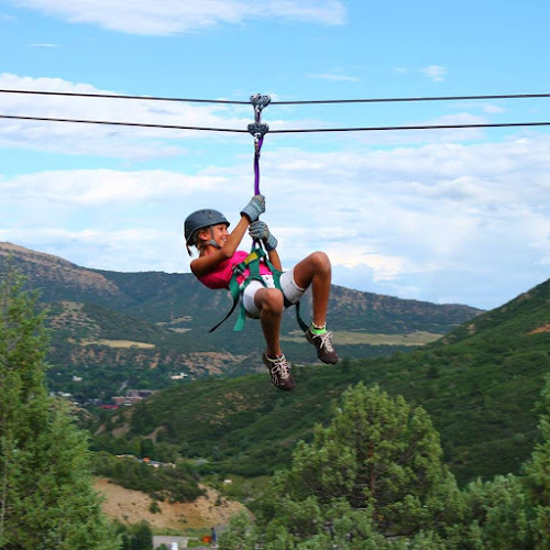
Durango Adventures and Zipline Tours

Hesperus Peace Park
Find Accommodations Nearby
Recommended Tours & Activities
Visitor Reviews
There are no reviews yet. Be the first one to write one.
Share Your Experience
Have you visited Perins Peak State Wildlife Area? Help other travelers by leaving a review.