Green Road
About Green Road
Key Features
More Details
Updated April 15, 2024
## Green Road (Kodaira Green Road), Tokyo: What It Is + How to Walk It
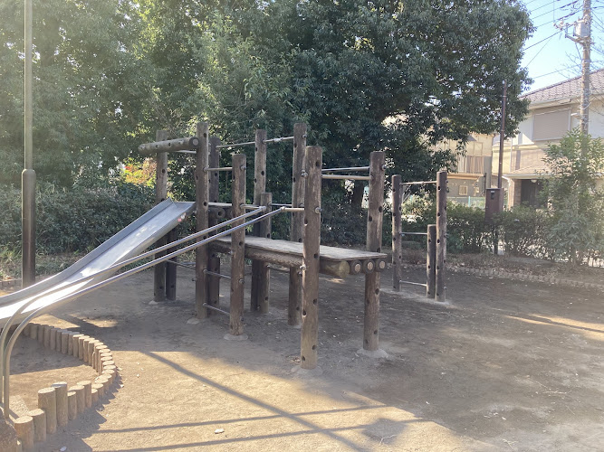
Green Road (often referred to in English as the Kodaira Green Road) is a long, continuous walking route in Kodaira City (western Tokyo Prefecture). Multiple official tourism sources describe it as an approximately 21 km trail that loops around Kodaira and connects/threads alongside several green-and-water corridors, including the Tamagawa Aqueduct (Tamagawa Josui), the Nobidome Irrigation Channel, the Sayama–Sakai Green Way, and Metropolitan Koganei Park. Tokyo
Your provided point—6 Chome-37 Hanakoganei, Kodaira, Tokyo 187-0002 (35.7276836, 139.5079793)—sits in the Hanakoganei area, which is one of the common access zones referenced in local materials about the route. WALKING MAP
—
## Why people come here (what’s verifiable)
### A “walkable Tokyo” route built around waterways + parkland
Official descriptions emphasize that the route is a nature-focused walking path designed to be entered from many stations along the loop, making it easy to do shorter sections rather than committing to the full distance. Tama
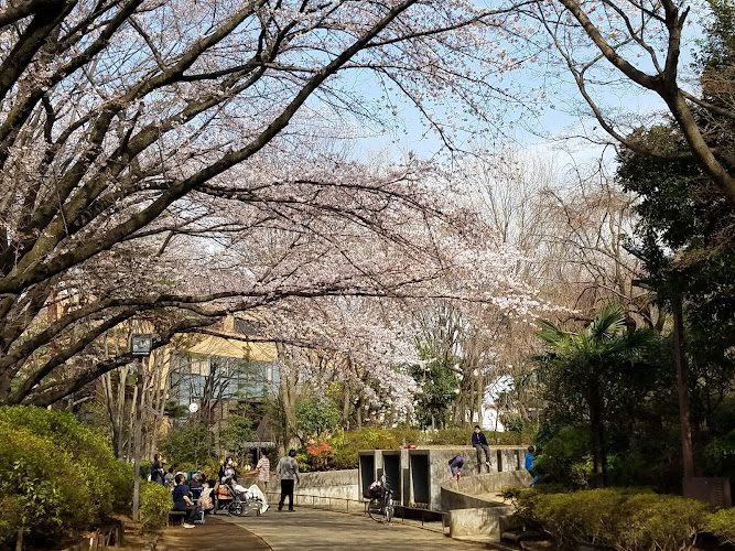
### Cherry blossom season is a headline draw
Japan National Tourism Organization (JNTO) highlights the Green Road area (paired with nearby Koganei Park) as a less-famous sakura viewing option. Their page states that the best time is typically late March to early April. Travel
### Recognitions (as stated by the Tokyo tourism publisher)
A Tokyo tourism publication notes the route was selected as one of the “top 500 beautiful roads that you should walk in Japan” (2004) and later as one of Japan’s walking-route selections for “Waterfront Roads” (2015). Those are historical designations, but they’re presented as part of the route’s established reputation. Tokyo
—
## How to get there (one confirmed public-transit routing)
JNTO gives a straightforward rail approach to the area:
– From Tokyo Station → Yamanote Line to Takadanobaba Station → Seibu Line to Hana-Koganei Station, with the full journey described as about 45 minutes (timing will vary by exact transfer/wait times). Travel
From Hana-Koganei Station, you can connect into Green Road sections around Hanakoganei / Koganei Park. Travel
—
## Practical ways to visit (grounded, no guesswork)
### Option 1: Do a sakura-focused out-and-back (late March–early April)
If your goal is cherry blossoms, plan around the late March–early April window cited by JNTO and use stations like Hana-Koganei as a convenient access point. Travel
Accuracy note: bloom timing can shift year to year based on weather; the “best time” window above is a typical range rather than a guarantee. Travel
### Option 2: Combine Green Road with Koganei Park
JNTO explicitly pairs the two: walk a Green Road stretch and then head to Koganei Park, which they describe as having 1,700+ cherry trees. Travel
### Option 3: Treat it like a “station-to-station” urban nature walk
Local tourism descriptions say you can start from any of the stations dotted along the route and walk a segment, rather than tackling the whole loop. Tama
—
## What the route follows (details you can rely on)
– Length: ~21 km walking trail around Kodaira City Tokyo
– Connected corridors: Tamagawa Aqueduct, Nobidome Irrigation Channel, Sayama–Sakai Green Way, Koganei Park Tokyo
– Tamagawa Josui historical note (route-adjacent): Kodaira tourism mapping materials state the Tamagawa Josui Aqueduct is ~43 km long, with ~8 km running along the Kodaira Green Road, and that the aqueduct was designated a National Historic Site in August 2003.
—
## Accessibility + inclusivity (what I can and can’t confirm)
I did not find a single authoritative, route-wide statement in the sources above that confirms:
– step-free continuity for the full 21 km,
– surface type/grade for wheelchairs,
– tactile paving coverage,
– dedicated cycling separation rules across all segments.
So I’m not going to claim accessibility features that may vary block by block. If accessibility specifics matter for your visit, the most reliable approach is to use the official route map PDFs (Kodaira Tourism / Tokyo Walking Map) to plan a specific start–finish segment and validate surfaces and crossings. WALKING MAP
—
## Outdated-data flags (so you don’t over-trust old claims)
– The “top 500 beautiful roads” (2004) and “waterfront roads” (2015) recognitions are older designations, not necessarily indicators of current maintenance conditions. They’re still useful context, but not a live status report. Tokyo
– The sakura timing (late March–early April) is presented as a typical window; bloom dates can vary year to year. Travel
—
## Internal links (requested) — not included for accuracy
You asked for two contextual internal links, but you didn’t provide RealJourneyTravels.com’s actual Tokyo/Japan URL structure, and I can’t verify what pages exist on your site from the information in this chat. To stay within your “only 100% known factual info” rule, I’m leaving internal links out rather than inventing URLs.
If you paste two existing slugs (e.g., your Tokyo hub + your Japan hub), I’ll integrate them cleanly into the copy in one pass.
Table of Contents
Key Highlights
Green Road
Location
Places to Stay Near Green Road
Find and Book a Tour
Explore More Travel Guides
No reviews found! Be the first to review!
Traveler Reviews for Green Road
There are no reviews yet. Be the first one to write one.
Have you visited Green Road? Help other travelers by sharing your review.
You Might Also Like
Suzuki-kaido Park
Sewerage Museum
Keyaki Park
Find Accommodations Nearby
Recommended Tours & Activities
Visitor Reviews
There are no reviews yet. Be the first one to write one.
Share Your Experience
Have you visited Green Road? Help other travelers by leaving a review.