Google Maps vs Maps.me: 2026 Comparison for Navigation Excellence
Updated February 6, 2026
Picking the right map app can seriously change your travel experience, especially if you’re wandering around somewhere new and the internet is spotty or just nonexistent. Google Maps and Maps.me both let you use maps offline, but honestly, they feel pretty different in practice.
Google Maps really shines when you have internet—it’s great for finding places and all those details you sometimes need. Maps.me, though, is a lifesaver for walking and cycling directions that work totally offline.
It mostly comes down to your travel style. If you’re driving and want all the business info, Google Maps is probably your go-to.
But if you’re exploring cities on foot or hiking off the grid, Maps.me gives you more freedom. Just remember, both apps make you download maps ahead of time while you still have internet, so don’t forget to prep.
Key Takeaways
- Google Maps is best for discovering places and business details, but only gives you offline driving directions
- Maps.me lets you walk or bike offline and takes up less space on your phone for map downloads
- Your travel style should guide your choice: Google Maps for drivers, Maps.me for walkers and hikers
Table of Contents
- Core Differences Between Google Maps and Maps.me
- Overview of Key Features
- Target Users and Use Cases
- Data Sources and Map Updates
- Offline Capabilities and Usage
- Offline Map Availability
- Offline Navigation and Search
- Data Storage and Download Limitations
- Navigation and Routing Performance
- Turn-by-Turn Navigation
- Route Options and Customization
- Public Transit and Multi-Modal Support
- Hiking Trails and Special Routes
- Points of Interest and Discoverability
- Search and Find Nearby Locations
- Information on Points of Interest
- Bookmarking and Saving Places
- Technology Stack and Platform Support
- Mobile and Desktop Compatibility
- Share and Compare Technology Stacks
- Map Coverage, Accuracy, and Real-Time Data
- Global Map Detail and Updates
- Satellite Imagery and Street View
- Real-Time Traffic Information
- Frequently Asked Questions
- What are the main differences between Google Maps and Maps.me in terms of features?
- How do both apps compare in terms of offline map accessibility?
- Can you use Maps.me for navigating without an internet connection?
- Which app offers better route planning options for various modes of transportation?
- How do user reviews compare for Google Maps and Maps.me regarding accuracy and overall satisfaction?
- Does Maps.me provide the same level of detail and points of interest as Google Maps?
- Book Your Dream Experience
- More Travel Guides
Core Differences Between Google Maps and Maps.me
Google Maps builds on its own data and resources. Maps.me, on the other hand, stands on the shoulders of community contributors. The way each app handles offline maps and travel modes makes them fit different types of travelers.
Overview of Key Features

Both navigation apps let you download maps for offline use, but they handle offline directions differently. Google Maps only gives you driving routes offline—no walking, biking, or public transport unless you’re online.
Maps.me does this better. You get full access to driving, walking, and cycling directions, even if you’re totally offline. The app also overlays metro routes in a bunch of cities, so you can plan public transport trips without wifi.
Here’s something else to consider: Google Maps lets you pick the exact area you want to download, so you can save space on your phone. Maps.me makes you download whole regions or countries, but the files are smaller and there’s no limit to how many you can grab.
| Feature | Google Maps | Maps.me |
|---|---|---|
| Offline driving directions | Yes | Yes |
| Offline walking directions | No | Yes |
| Offline cycling directions | No | Yes |
| Offline public transport | No | Limited (metro overlay) |
| Custom download areas | Yes | No |
| Download limits | Yes (storage-based) | No |
Target Users and Use Cases

Google Maps works best for drivers who want business info. The app pulls in millions of businesses, showing you reviews, opening hours, photos, and even menu items. You can even search reviews for things like “wifi” before you visit a café.
Maps.me really suits backpackers and hikers who spend time off the grid. Since you can search the whole downloaded map offline, you don’t have to plan every stop in advance. Just get the region and wander.
Because Maps.me is user-generated, you’ll discover hidden hiking trails, outdoor gyms, or street food stands that Google just doesn’t show. In big cities, though, Google Maps still has more restaurant and shop info.
Data Sources and Map Updates
This is probably the biggest difference. Google Maps relies on its own data and third-party partners. People can suggest edits, but Google gets the final say on what appears.
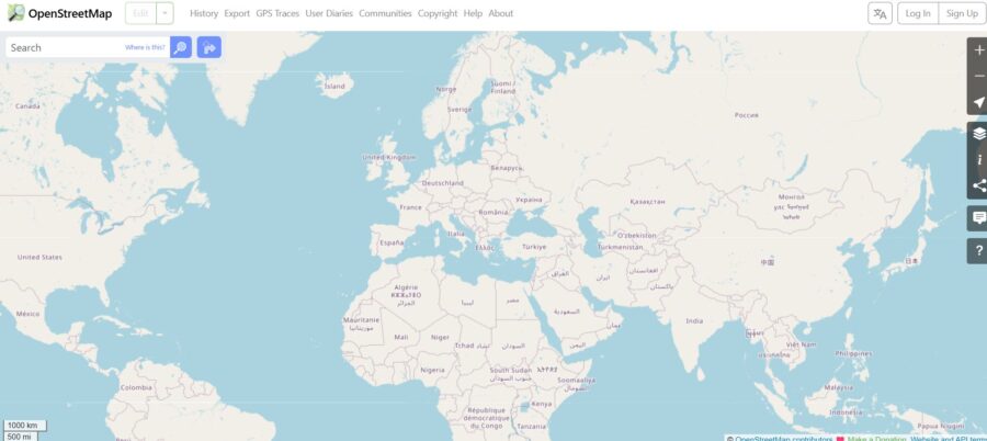
Maps.me uses OpenStreetMap, so anyone can edit and improve the maps directly. Millions of users pitch in, kind of like Wikipedia. It’s a mixed bag.
OpenStreetMap data can be more up-to-date in developing countries or rural spots where Google doesn’t focus much. Locals can add new roads or points of interest right away. In cities, though, Google’s professional data is usually more accurate and detailed.
Offline Capabilities and Usage

Both apps let you download maps for offline use, but they go about it in pretty different ways. Maps.me gives you full offline features with no real restrictions. Google Maps, though, puts some limits on what you can do without internet.
Offline Map Availability
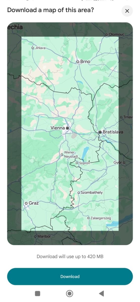
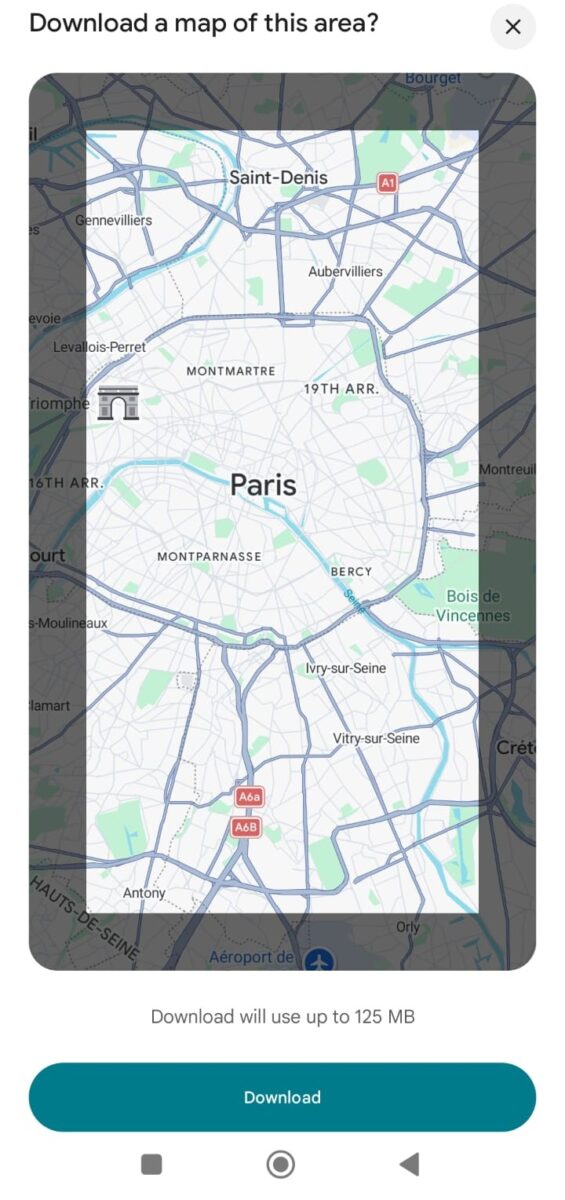
Google Maps lets you draw a custom box on the map to download a specific area. This is handy if you only need a small neighborhood or a particular route. But there’s a catch—Google limits how much you can download at once, and your offline maps expire after 30 days unless you update them.
Maps.me takes a different route. You can download entire cities, regions, or even countries with no size limits, and the maps never expire. This makes Maps.me a better pick for long trips or if you’re hitting up multiple places.
The download process feels easier with Maps.me. When you zoom in on an area, the app just asks if you want to download that map. Google Maps makes you dig through your profile or use the search bar to find the download option.
Here’s where you’ll notice the biggest difference. Google Maps only gives you driving directions offline—no walking, biking, or public transport. That’s a pain if you’re exploring on foot or using buses and trains.
Maps.me lets you navigate offline for driving, walking, and cycling. You can search for places, get turn-by-turn directions, and see travel times for each mode, all without internet. In many cities, metro and public transport overlays work offline too.
Searching works differently. Google Maps only lets you look up places you saved before downloading the map. Maps.me lets you search the whole downloaded map, even if you didn’t bookmark anything. That flexibility makes it easier to stumble onto cool places while you’re out.
Data Storage and Download Limitations
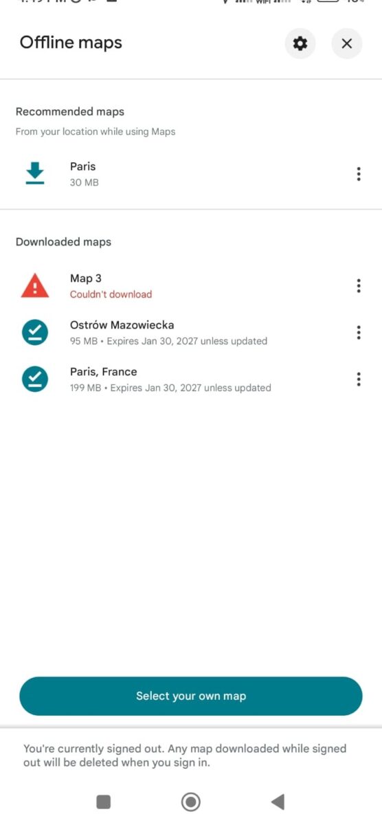
Google Maps files are usually bigger for the same area, and you can’t download as much at once. You also have to be signed into your Google account to use offline maps.
Maps.me maps use less storage and don’t have download caps. You can fill your phone with as many maps as you want. The trade-off? Maps.me doesn’t have a web version, so all your planning happens on your phone. Google Maps syncs your saved places across devices, which is handy if you like planning on your laptop.
See Related: How to Use Google Maps Offline Abroad: Insider Tricks Every Traveler Needs Now
Google Maps gives you advanced routing with live traffic data, while Maps.me sticks to basic, reliable navigation that works offline. Google Maps handles public transit and multiple routes, but Maps.me is way better for hiking trails and remote areas.

Google Maps delivers turn-by-turn directions with voice prompts that update based on current traffic. If you miss a turn, the app quickly recalculates and gets you back on track. It’s smooth and rarely lets you down.
Maps.me offers turn-by-turn navigation too, but it’s simpler. You won’t get real-time traffic updates since it’s offline. The voice guidance is basic, but it works for most routes. You need to download the map area first before creating a route, so planning ahead matters.
Both apps will get you where you need to go, but Google Maps just feels a bit more responsive when things go sideways.
Route Options and Customization

Google Maps shows you multiple routes right away. You’ll see different options with estimated times, and you can avoid tolls, highways, or ferries. If you want, you can even drag the route to change it manually.
Maps.me keeps it simple. You get a route, but not as many alternatives or customization options. The app doesn’t let you avoid certain road types like Google does.
Public Transit and Multi-Modal Support

Google Maps is the go-to for public transit. You’ll get detailed info for buses, trains, and subways, including schedules and platform numbers. The app combines walking, buses, and trains into one trip if needed.
Maps.me doesn’t really do public transit. You’ll see train stations on the map, but you won’t get step-by-step transit directions. If you rely on buses or trains, this can be a dealbreaker.
Hiking Trails and Special Routes

Maps.me actually outperforms Google Maps for hiking and outdoor adventures. Thanks to OpenStreetMap, you’ll get detailed trails, difficulty levels, and routes through remote areas that Google might miss.
Google Maps has gotten better with hiking trails, but it’s still mostly focused on streets. You might see major trails, but the details just aren’t as deep as you’ll find on Maps.me. For backcountry trips, Maps.me is the clear winner.
Points of Interest and Discoverability
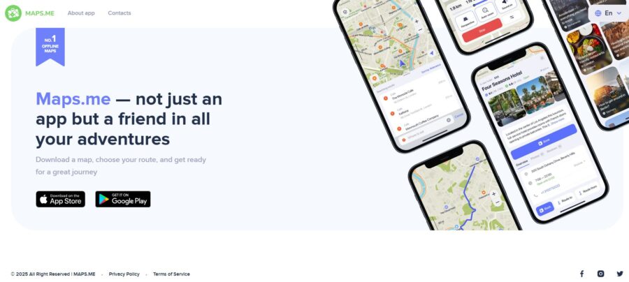
Google Maps makes it easy to find detailed information about businesses and attractions. Maps.me keeps things simpler, with user-generated points of interest you can access offline.
Search and Find Nearby Locations

Google Maps gives you quick shortcuts to restaurants, cafes, gas stations, and attractions right under the search bar. You can scroll through more categories or use the Explore tab to find places based on recent reviews and photos.
Maps.me is more straightforward. Since you download big regions or whole countries, you can search for places offline. The catch? You need to know what you’re looking for. The app won’t suggest trending spots or show you what’s popular nearby unless someone already marked it.
If you’re in a new city without internet, Maps.me lets you type “coffee” or “hotel” and see what’s around. Google Maps won’t let you search offline unless you saved those places ahead of time.
Information on Points of Interest
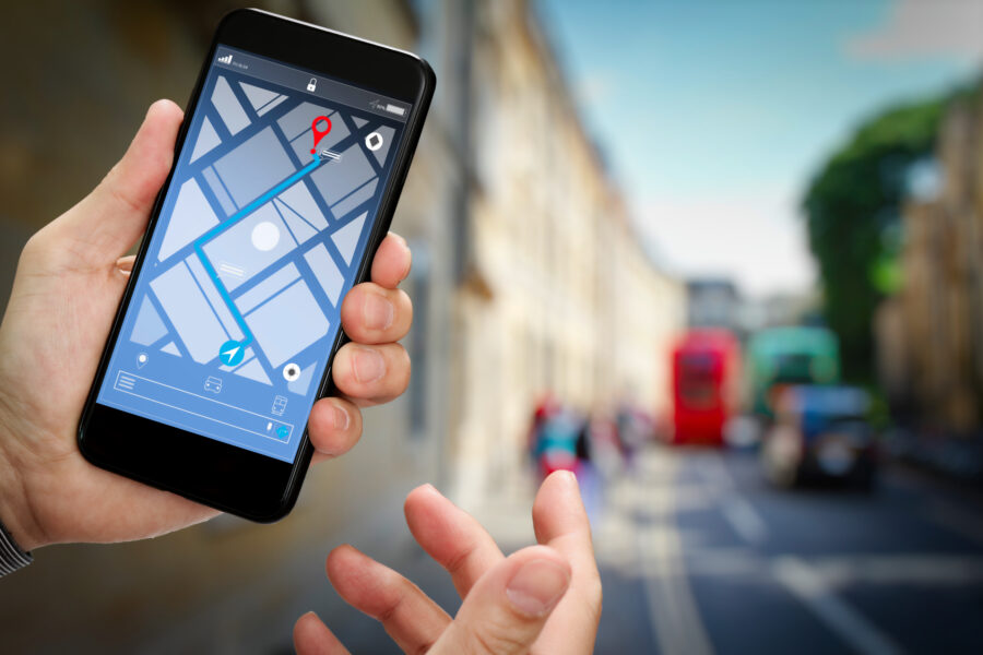
This is where the apps really split. Google Maps shows you everything—hours, busy times, phone numbers, websites, and loads of reviews. You can even search reviews for “wifi” to check if a café has good internet before heading out.
Maps.me sticks to basics: address, maybe a phone number, and whatever info OpenStreetMap users added. In popular cities, coverage is decent. Out in the wild, Maps.me sometimes has more info than Google, since local hikers add spots commercial databases miss.
Still, if you want to know if a restaurant serves vegetarian food or closes early, Google Maps is the clear winner.
Bookmarking and Saving Places
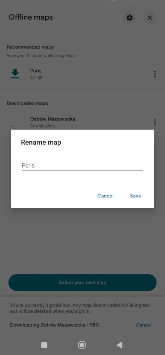
You’ll need a Google account to save places in Google Maps, but once you’re signed in, you can make custom lists that sync between phone and computer. The default lists are fine, but making your own helps keep trip planning organized.
Maps.me uses “Bookmarks.” Just tap the star, name it, and pick a category. It’s simple and works offline. The downside? No web version, so you’re stuck planning on your phone.
See Related: Savvy Luggage Handling Hacks That Will Transform Your Travel Experience
Technology Stack and Platform Support

Both navigation apps cover the major mobile platforms, but they take different approaches under the hood. Google Maps is proprietary, while Maps.me relies on open-source tech.
Mobile and Desktop Compatibility
Google Maps works smoothly on iOS, Android, and any web browser. Your saved places and searches sync across devices if you’re logged into Google.
Maps.me sticks to mobile—iOS and Android only, no web version. That fits its offline-first design, since you’re usually using it while out exploring. It even runs well on older phones, since it doesn’t need a constant data connection.
Both apps get regular updates through the app stores. Google Maps adds new features more often, while Maps.me’s updates usually focus on map accuracy and bug fixes.

If you’re a developer—or just nosy about what powers your favorite apps—StackShare lets you peek under the hood and compare the tech stacks behind Google Maps and Maps.me. Google Maps runs on Google’s own mapping platform, using some pretty advanced data processing and real-time traffic analysis.
Maps.me does things differently. It builds everything on top of OpenStreetMap, which is open source and maintained by a global community.
Anyone can jump in and improve the maps, kind of like editing Wikipedia. Sometimes you’ll spot odd little local details that Google Maps hasn’t picked up yet.
Developers like the open-source vibe of Maps.me. You can actually dig into the code, see how the app handles offline map data, and even tweak it if you’re feeling adventurous.
Map Coverage, Accuracy, and Real-Time Data
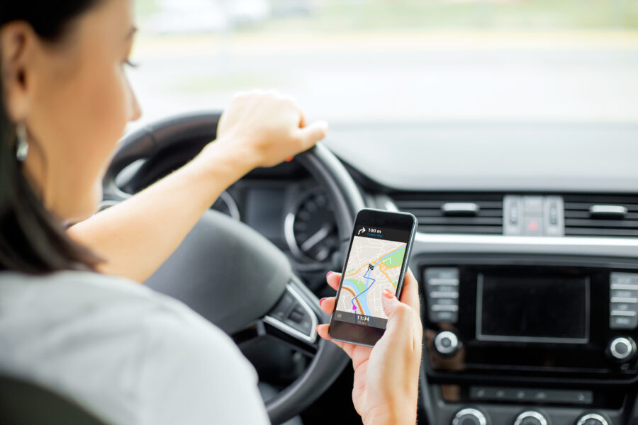
Google Maps usually takes the lead here, thanks to its huge database and live updates from over a billion users every month. Maps.me, on the other hand, sticks to offline maps you download to your phone, so you can navigate without internet—but you’ll miss the real-time stuff most travelers expect.
Global Map Detail and Updates
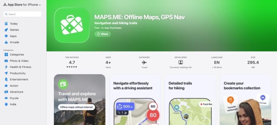
Google Maps covers almost every country in impressive detail. It pulls data from satellites, government sources, street-level photos, and millions of users. Updates happen constantly—sometimes several times a day in busy spots—since the platform processes info from all those users.
Maps.me leans on OpenStreetMap, so the quality depends a lot on how active the local mapping community is. You might get amazing detail in a city with lots of contributors, but in quieter or remote regions, the info can be spotty or out of date.
When you’re looking for new businesses or recently changed roads, the difference gets obvious. Google Maps usually adds these updates within days or weeks. Maps.me can lag behind by months, or even longer, if nobody’s updated OpenStreetMap in that area.
Satellite Imagery and Street View
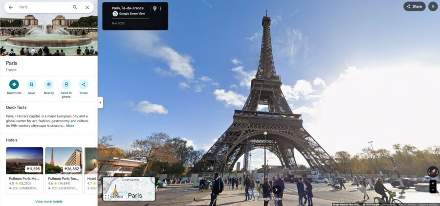
Google’s Street View gives you real photos of places—super handy when you’re trying to spot a tricky entrance or just want to see what a neighborhood looks like before you get there. The satellite images get refreshed fairly often, though some rural spots still show older pictures.
Maps.me skips Street View entirely. You just get the map, nothing more. For some folks, that’s fine, but you won’t be able to virtually scout out your hotel or check out a street corner in advance.
Google pulls satellite images from a bunch of sources and runs them through AI that spots new buildings, road changes, and more. That’s why its maps usually feel fresher than the competition.
Real-Time Traffic Information

Here’s where Google Maps really shines. It gets real-time traffic updates from GPS data shared by millions of Android phones and Google Maps users on the road. The app notices when traffic slows down and can reroute you before you hit a jam or accident.
Maps.me just doesn’t do real-time traffic. When you download a map, you get the roads as they are, but no info about current delays or closures. If something changes after your download, you’re out of luck.
Google’s traffic predictions are surprisingly good. The system learns patterns—like which highways always clog up at rush hour—and can suggest faster routes on the fly. Maps.me can’t warn you about anything like that, since it’s not connected to live data once you’re offline.
See Related: Solo Travel Hacks for the Best Winter Escapades
Frequently Asked Questions
Both apps handle navigation in their own way. Google Maps thrives on real-time updates, while Maps.me is all about working offline. Knowing these differences helps you pick the better tool for your next trip.
What are the main differences between Google Maps and Maps.me in terms of features?
Google Maps gives you real-time traffic, public transit schedules, and tons of user reviews for businesses everywhere. You get street views, satellite images, and always-fresh info about restaurants, shops, and attractions.
Maps.me goes another direction. It uses OpenStreetMap and sticks to offline features instead of live updates. You won’t see traffic or changing business hours, but you will find hiking trails and outdoor spots that Google sometimes leaves out.
The biggest divide is connectivity. Google Maps needs the internet to do its best work, while Maps.me lets you download whole regions and use them with zero data connection.
How do both apps compare in terms of offline map accessibility?
Google Maps lets you save certain areas for offline use, but there are limits. You can only download specific regions, and the maps expire after about 30 days unless you refresh them. Offline mode also drops features like transit directions.
Maps.me was built for offline from the start. You can download entire countries or regions, and they stay on your device until you get rid of them. Everything—navigation, search, bookmarks—works without internet.
If you’re heading somewhere with spotty service or want to avoid roaming charges, Maps.me is easier to rely on. But if you’ve got a solid connection and want up-to-the-minute info, Google Maps has the edge.
Absolutely, and that’s kind of Maps.me’s whole thing. Once you’ve downloaded the maps you need, turn-by-turn navigation works even with no signal.
You can search addresses, find points of interest, and get directions for walking, driving, or cycling—all offline. I’ve used it in places where my phone had no bars, and it just kept working.
You can also bookmark spots and plan routes ahead of time. Just remember to grab the maps before you go off the grid.
Which app offers better route planning options for various modes of transportation?
Google Maps covers more ground here. It gives you driving, walking, cycling, and full public transit directions, with real-time schedules for buses, trains, and subways in tons of cities.
You’ll also see ride-sharing options and get route comparisons based on current traffic. If you’re in a big city and need to know if the subway or a taxi is faster right now, Google Maps will tell you.
Maps.me does a good job with driving, walking, and cycling, but it skips public transit routing. You’ll see bus stops and train stations, but the app won’t plan a transit trip or show you when the next bus arrives.
For hikers and outdoor types, though, Maps.me includes trails and paths that Google often misses. So, which app is “best” really depends on where you’re going and how you want to get there.
How do user reviews compare for Google Maps and Maps.me regarding accuracy and overall satisfaction?
Google Maps usually scores higher in satisfaction surveys. People like the business info, frequent updates, and accurate arrival times. The Slant community ranks Google Maps 2nd among Android apps, while Maps.me sits at 11th.
But Maps.me has die-hard fans who love its offline powers and simple interface. Users praise it for working in places where Google Maps is useless without data.
Some folks worry about Google Maps and privacy, or complain about how much location data it collects. Maps.me users sometimes get frustrated by less frequent updates or missing info, since it depends on volunteers to keep OpenStreetMap fresh.
Does Maps.me provide the same level of detail and points of interest as Google Maps?
Not really. Google Maps just packs in way more business listings, customer reviews, photos, and opening hours. If you want the nitty-gritty on restaurants, hotels, or shops, Maps.me just can’t match that.
Maps.me covers the basics—like restaurants and gas stations—but forget about star ratings, recent reviews, or user photos. The info feels pretty bare, honestly.
On the flip side, Maps.me sometimes surprises you with hiking trails, campgrounds, or natural features that Google Maps either skips or buries somewhere. And yeah, one thing that bugs a lot of people: Maps.me doesn’t have satellite imagery at all. For some, that’s a dealbreaker when they’re trying to get a feel for a new place.