
Bod Bongao Tawi-Tawi
About Bod Bongao Tawi-Tawi
Key Features
More Details
Updated April 16, 2024
## Bod/Bud Bongao, Tawi-Tawi: Sacred Peak of the Southern Philippines
Bud (often spelled “Bod”) Bongao is the landmark peak that dominates the skyline of Bongao, the capital of Tawi-Tawi in the far south of the Philippines. Rising to around 342 meters above sea level and formed by six limestone pillars, it’s recognized as the country’s southernmost peak and a powerful cultural and spiritual symbol for local communities.
Today, Bud Bongao sits inside the Bongao Peak Eco-Tourism Park, a protected forest that has become a signature stop on any Tawi-Tawi itinerary thanks to its combination of sacred shrines, rich biodiversity, and sweeping views over the Celebes Sea.
—
## Why Bud Bongao Matters
### A sacred mountain with centuries of stories
For the indigenous Sama Dilaut and other Muslim communities in Tawi-Tawi, Bud Bongao is not just a viewpoint, but a pilgrimage site. The mountain is believed to be the burial place of two Islamic preachers who were followers of Sheikh Karim ul-Makhdum, the Arab missionary credited with bringing Islam to the Philippines in 1380.
Along the trail, you’ll encounter tampat – small white-draped grave-shrines where pilgrims stop to pray, reflect, and make supplications. Many locals grow up with the saying that you haven’t truly been to Tawi-Tawi until you’ve climbed Bud Bongao at least once in your life. Philippines
Because of this, the mountain is both a religious space and a public hiking trail. Expect families, elders, and children making the climb, often carrying offerings and wearing modest clothing appropriate for prayer.
> Inclusivity note: Visitors of any background are welcome, but you are entering a living spiritual landscape. Dress modestly, keep voices low near tampat, and avoid photographing people who are praying without explicit permission.
### One of the last moist forests of the Sulu Archipelago
Bud Bongao’s forest is not just scenic; it’s ecologically important. The mountain protects one of the last remaining “moist forests” in the Sulu Archipelago, and the Bongao Peak Eco-Tourism Park covers roughly 250 hectares of this habitat.
Researchers and conservation projects have documented Bud Bongao as a biodiversity hotspot, home to threatened plant and animal species including:
– Long-tailed macaques (Philippine macaque), considered “near threatened” by the IUCN.
– Forest species such as pitogo and molave, plus reptiles like monitor lizards and various bird and insect species. the Explorer
In 2017, the site was formally developed as an eco-tourism park, with visitor facilities, view decks, steps, and lighting funded as part of regional conservation and tourism projects.
> Outdated info to flag:
> – Older articles (pre-2017) describe a rough, partially muddy trail without developed facilities. Infrastructure has since been significantly improved.
> – Early reports mentioned smaller forest coverage (around 50 hectares), but newer conservation sources and recent summaries consistently cite about 250 hectares for the eco-park area.
—
## Planning Your Bud Bongao Hike
### Location, height, and trail basics
– Location: Bongao Island, province of Tawi-Tawi, Bangsamoro Autonomous Region in Muslim Mindanao (BARMM), Philippines.
– Elevation: ~342 m (1,122 ft) above sea level, with all of its prominence rising from near sea level.
– Peaks: The massif is composed of six limestone summits: Bongao, Sibutu, Simunul, Tambisan, Tinondakan, and Pajar.
– Eco-park: Bud Bongao lies within the Bongao Peak Eco-Tourism Park, inaugurated in July 2017.
The main hiking trail starts near sea level on the southern side of the mountain (Barangay Pasiagan/Simandagit area, depending on the source) and follows a constructed path and stairs to the viewpoint at Tambisan Peak and onward to other summits.
Recent guide data and local mapping efforts agree that:
– The trail consists of around 3,600+ concrete or cobblestone steps (commonly cited figure: 3,608 steps) from trailhead to Tambisan Peak. trips and travel notes
– Most hikers complete the out-and-back hike in 1–2 hours, depending on fitness level and stops.
The climb is physically demanding mainly because of the step count, but technically straightforward. There is no scrambling, and the path is obvious the entire way.
### Park hours, fees, and registration
As of early–mid 2025, the most recent tourism and guide sources report: Beach Guide
– Opening hours: commonly 6:00 a.m. to 3:00 p.m. for hikers.
– Entrance fee: recent independent guides and blogs report an entrance fee in the ₱20–₱50 range per person, with higher rates typically for non-Bongao residents. A detailed 2025 guide notes that the fee recently increased to about ₱50 for visitors. Beach Guide
– Before 2017, provincial tourism officials stated that entry to parks was free of charge. News Agency This is no longer accurate given current fee reports.
There is a simple registration area at the jump-off where staff record visitors, collect the fee, and inspect bags to enforce a strict leave-no-trash policy. Beach Guide
> Important: Fees and opening times change over time. Always check the latest information from the Bongao Tourism Office or the official municipal Facebook page before your visit.
### How to get to Bongao and the trailhead
Travel logistics in this part of the Philippines change periodically (airline routes, ferry schedules, and security procedures), so treat any specifics as a starting point, not a guarantee.
Historic and recent patterns:
– Past and recent travel reports describe flying first to Zamboanga City, then taking a 45-minute flight onward to Sanga-Sanga Airport (Bongao).
– Alternative routes involve ferries from Zamboanga to Bongao several times a week, but exact sailing days and operators are subject to change.
– From Bongao town proper, most visitors hire a tricycle to the Bud Bongao registration area; multiple sources reference typical tricycle hires from town to areas near the jump-off, with fares negotiated on the spot.
Because current operators and schedules can change quickly, especially in far-flung provinces, check:
– The latest schedules from airlines currently serving Zamboanga–Tawi-Tawi.
– Recent posts from the Provincial or Bongao Tourism Office.
– Current travel advisories from your country’s foreign office for the wider Mindanao/Sulu region.
—
## On the Trail: What to Expect
### Forest, views, and the “guardians” of Bud Bongao
From the first steps in the eco-park, you’re inside one of Tawi-Tawi’s last moist forests – a dense, green canopy that stays humid even when the lowlands are dry.
Along the way you’ll usually experience:
– Shaded forest sections with limestone outcrops and rich undergrowth. Junctures
– Long-tailed macaques, widely regarded as the “guardians” of Bud Bongao, appearing near the trail, especially near rest stops. Experiences
– Viewpoints offering panoramas over Bongao town, the runway of Sanga-Sanga Airport, and surrounding islands on clear days. Some descriptions mention being able to see as far as Sabah from certain peaks in ideal weather. the Explorer
At or near the top, the view decks at Tambisan and other peaks frame the town, the port, and the blue expanse of the Celebes Sea.
### Monkeys, feeding, and current ethics
Older travel blogs frequently encouraged hikers to bring bananas and “feed the monkeys,” describing them as friendly and accustomed to food from visitors.
This guidance is now problematic and partially outdated:
– In 2025, the Tawi-Tawi tourism office publicly condemned tourists who used bananas to bait and then harm monkeys at Bud Bongao, highlighting both animal-welfare and ethical concerns.
– Conservation articles emphasize that these macaques are a near-threatened species, and that human feeding encourages dependency and aggressive behavior.
Given this, the most responsible approach today is:
– Do not lure or touch the monkeys.
– If local authorities still allow limited feeding, avoid plastic bags, keep a distance, and follow any explicit guidelines posted at the eco-park.
– Never tease, corner, or provoke the animals for photos or videos.
This shift from casual feeding to stricter, welfare-focused behavior is one of the most important updates compared with older travel accounts.
—
## Culture, Rituals, and Respect
### Tampat shrines and wishes
Multiple recent sources describe two tampat shrines near the summit, believed to be the burial sites of Makhdum’s followers.
Common practices observed here include:
– Pilgrims pausing to pray at the tampat.
– Visitors tying colored ribbons or knots (baggut) at designated trees, each color representing a specific wish such as health, peace, love, or prosperity. Narvas
– Families taking children up the mountain to pray for healing and protection, a tradition noted in ethnographic and travel accounts. Narvas
Even if you’re not participating in these rituals, it’s crucial to move quietly and avoid blocking access to the shrines.
### Everyday coexistence and safety context
Recent narrative and guide pieces highlight a key point: despite long-standing negative stereotypes about the wider region, Bongao and much of Tawi-Tawi are currently described as relatively peaceful compared with some neighboring provinces, and daily life is marked by coexistence among Sama, Tausug, and Christian communities.
Local residents, expats, and regional travelers frequently note that:
– Tawi-Tawi feels safer than other parts of the Zamboanga–Basilan–Sulu–Tawi-Tawi (ZamBaSulTa) corridor, though it remains important to stay informed.
– Tourism arrivals increased several-fold after 2012 as peace and infrastructure improved, with Bud Bongao among the province’s most visited sites. News Agency
Table of Contents
Key Highlights
Bod Bongao Tawi-Tawi
Location
Places to Stay Near Bod Bongao Tawi-Tawi
Find and Book a Tour
Explore More Travel Guides
No reviews found! Be the first to review!
Traveler Reviews for Bod Bongao Tawi-Tawi
There are no reviews yet. Be the first one to write one.
Have you visited Bod Bongao Tawi-Tawi? Help other travelers by sharing your review.
You Might Also Like
Bohey Dulang Hike Overlook
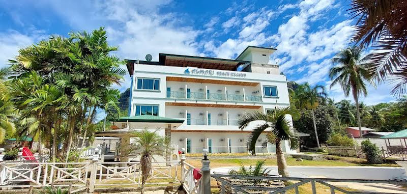
Almari Beach Resort
Bud Bongao Peak
Find Accommodations Nearby
Recommended Tours & Activities
Visitor Reviews
There are no reviews yet. Be the first one to write one.
Share Your Experience
Have you visited Bod Bongao Tawi-Tawi? Help other travelers by leaving a review.