Gunung Lambak
About Gunung Lambak
Key Features
More Details
Updated April 15, 2024
Gunung Lambak Kluang Hiking Guide • The Gees Travel
## Gunung Lambak (Mount Lambak): the go-to “after work” mountain in Kluang, Johor
Gunung Lambak—also written as Mount Lambak—is a 510 m inselberg in Kluang District, Johor, Malaysia.
What makes it useful for travelers (and locals) is that it’s been developed as a recreational forest: established paths, basic facilities at the base, and a straightforward “up-and-down” hike that fits into a half-day.
If you’re looking for a leg-burner that doesn’t require logistics gymnastics—no permits, no guide requirement in the common references—Gunung Lambak is frequently described as free to hike and doable in roughly 2–3 hours for many people, depending on pace and route. Traveller
—
## Quick facts you can plan with
– Name: Gunung Lambak / Mount Lambak
– Location: Kluang District, Johor, Malaysia
– Elevation: 510 m above sea level
– Type: Inselberg (a steep, isolated hill/mountain rising from flatter land)
– Typical hike duration (commonly cited): ~2–3 hours for an up-and-down for many hikers Traveller
– Trail stats vary by route/platform: For example, one AllTrails listing describes ~3.9 miles with substantial elevation gain and ~4–4.5 hours. Treat this as route-specific rather than universal.
—
## What the hike is actually like
Gunung Lambak is often treated as a “training mountain”: short enough to slot into a morning, steep enough to feel like you earned lunch. The recreational-forest development matters here—Wikipedia notes pathways/wooden bridges that make the climb “relatively easy,” plus base-area features like parking and toilets.
At the summit, a broadcasting mast is a notable landmark. Wikipedia reports RTM completed a transmitter on Gunung Lambak in 1969; it later closed (superseded by another transmitter), but the mast still stands at the top.
—
## Trails, difficulty, and why your “time to summit” will differ from someone else’s
Two things can be true at once:
1) Many guides say 2–3 hours is enough for most people to go up and down. Traveller
2) Some route listings (like AllTrails) show a longer, harder outing depending on which approach you take and how the platform defines the route.
Practical takeaway: plan a half-day window the first time. If you finish early, you’re not stressed. If your route is longer than expected, you’re not racing daylight.
—
## Facilities at the base: what’s confirmed vs what might have changed
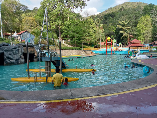
Wikipedia describes a base picnic area with car parking, benches, a small children’s playground, and toilets, and also mentions chalet accommodation, camping facilities, and a swimming pool as part of the recreational-forest development.
### Outdated-data flag (read this)
Those facility details can change over time (maintenance cycles, closures, management changes). Wikipedia is not a live operations feed. Consider the “what exists” list reliable as a concept, but verify specifics (e.g., pool open/closed, campsite booking process) close to your visit.
—
## Getting there without navigation fails
A recurring issue in traveler reviews is Google Maps ambiguity if you type “Gunung Lambak” without the right pin. One Tripadvisor review suggests using “Gunung Lambak Water Park” as a better navigation target.
I’d treat that as a useful, real-world workaround—just confirm you’re being routed to the intended base area before you leave Kluang.
—
## What to pack (optimized for a short, steep, humid hike)
This section is general hiking best practice, not a claim about current conditions.
– Footwear: trail shoes with grip (rock + roots get slick after rain)
– Water: enough for humid climbing; bring more than you think for a short hike
– Electrolytes/salty snack: helps if you sweat heavily
– Sun + bug protection: especially at exposed viewpoints and rest areas
– Small first-aid basics: blister care + a couple of plasters
– Light layer / poncho: tropical downpours are real, even if the morning looks clear
—
## Inclusivity and safety notes that actually matter
– Pace is personal. A “short” mountain can still be intense for beginners, larger-bodied hikers, people returning from injury, or anyone not acclimated to heat/humidity. Build in time buffers and choose the easiest route you can identify on arrival.
– Kid-friendliness depends on the child and the route. The base area is described as having a playground and picnic setup, which can work well for mixed groups where not everyone wants to summit.
– Wildlife: Wikipedia lists macaques and dusky leaf monkeys among mammals found on Gunung Lambak. Give them space and don’t feed them—this is safer for you and healthier for the animals.
—
## When to go
I can’t state “best season” or “best hours” with certainty from the provided sources. What I can say is that Gunung Lambak is positioned as a local, repeatable hike—so early starts are common in practice, and heat management should be part of your plan.
If you need a hard operational answer (current opening hours, closures), that should be checked on a fresh local source right before your visit, because it’s inherently changeable.
—
## Suggested internal links to add (editorial, not factual claims)
If you have relevant pages on RealJourneyTravels.com, these two spots usually lift dwell time and reduce pogo-sticking:
– Internal link #1 (context: logistics): “Kluang Travel Guide: What to Do + Where to Eat”
– Internal link #2 (context: nearby nature): “Best Hikes in Johor for a Weekend Outdoors”
—
## Bottom line
Gunung Lambak is a 510 m landmark mountain in Kluang, Johor that’s been shaped into a recreational-forest hike with base facilities and a clear summit goal—often completed as a short half-day outing.
Expect route-dependent stats, verify navigation carefully (Tripadvisor’s “Water Park” tip is worth testing), and treat any facility specifics as potentially time-sensitive.
Table of Contents
Key Highlights
Gunung Lambak
Location
Places to Stay Near Gunung Lambak
Find and Book a Tour
Explore More Travel Guides
No reviews found! Be the first to review!
Traveler Reviews for Gunung Lambak
There are no reviews yet. Be the first one to write one.
Have you visited Gunung Lambak? Help other travelers by sharing your review.
You Might Also Like
Laman Kreatif Kluang
Gunung Lambak Recreational Forest
Gunung Lambak Water Park
Find Accommodations Nearby
Recommended Tours & Activities
Visitor Reviews
There are no reviews yet. Be the first one to write one.
Share Your Experience
Have you visited Gunung Lambak? Help other travelers by leaving a review.