
Georgenberg”Sport, fitness and fun
About Georgenberg”Sport, fitness and fun
Key Features
More Details
Updated June 11, 2025
Die Schwäbische Alb und ihre Natur: Aussicht vom Georgenberg bei Reutlingen
## Georgenberg (“Sport, fitness and fun”): a local Reutlingen viewpoint with real payoff
Georgenberg sits on the edge between Reutlingen and Pfullingen in Baden-Württemberg, and it’s one of those places locals treat like an outdoor gym and a reset button in the same trip. It’s a volcanic cone (not just “a hill”), with a summit around 602 m and an open top that makes the view the headline.
Your coordinates (48.4715963, 9.2114552) align with the Georgenberg high point area shown in standard references.
What makes it worth writing up for RealJourneyTravels readers: the experience is short, close to town, and easy to stack into a half-day plan—yet it still gives you a genuine “Swabian Alb panorama” moment. Reutlingen
—
## What Georgenberg actually is (and why it looks the way it does)
Georgenberg is described as a kegelförmiger (cone-shaped) volcanic mountain. The German Wikipedia entry also characterizes it as a volcanic feature (including a “Schlotfüllung” / volcanic vent fill) and contrasts it with the nearby Achalm, which is a different type of mountain (a Jurassic “Zeugenberg”).
You don’t need to be a geology nerd to feel the difference: Georgenberg’s symmetrical cone and relatively direct climb are part of why it’s used for quick fitness loops and uphill training.
There’s also a historic land-use detail that still shows on the landscape: the English Wikipedia entry notes that slopes were used for wine-growing and that terraced structures can still be seen below the summit.
—
## The “sport, fitness and fun” angle: how locals use it
On review aggregators, the vibe is consistent: people mention a short uphill walk and the summit payoff over Reutlingen and Pfullingen.
From a practical “what do I do there?” standpoint, the Georgenberg pattern usually looks like this:
– Uphill effort (stairs/steeper segments on some approaches)
– Summit pause for the panorama
– Loop back down via an easier grade if you choose a round-trip route
Route platforms like Komoot present the Georgenberg viewpoint as a named highlight with loop options around Pfullingen/Reutlingen, typically rated at moderate difficulty for hikers (their “Mäßig” category for some loops).
—
## The view: what you can expect to see
Georgenberg is repeatedly framed as a viewpoint (“Aussichtspunkt”) by local and tourism sources. Visit Reutlingen even calls it a “traumhafter Aussichtspunkt” and explicitly promises great views. Reutlingen
Photographic write-ups show the summit looking out over:
– Reutlingen (northward views)
– Pfullingen and the Echaz valley area (multiple directions)
– Nearby ridgelines such as the Albtrauf and recognizable local peaks in the wider frame (as labeled in the photo post)
If you’re chasing light, this is the kind of summit where “golden hour” matters because there’s less visual clutter—more sky, more horizon.
—
## Hike logistics: distance, time, and trail reality
Because Georgenberg is close to town, you’ll see lots of “quick loop” options published. A few grounded, source-based notes:
– The German Wikipedia entry says the ascent from the valley takes about half an hour, and mentions access via a narrow path on the south side.
– AllTrails lists a short ~2.6 km loop (“Um den Georgenberg”) with ~97 m elevation difference, estimating 0.5–1 hour.
– Bergfex publishes a 2.63 km hike with 117 m ascent and a stated duration of 00:46 h (classified “mittel”).
– Outdooractive describes a route segment involving stairs and references a footpath connection up the hill in a residential context.
What this means in real terms: this is not an alpine objective; it’s a short climb where footwear and traction still matter—especially if it’s wet, leaf-covered, or icy.
### What to bring (based on the terrain profile)
– Shoes with grip (the “narrow path” + stairs combo is where slips happen)
– A light layer (it’s exposed at the top; wind can change the feel fast)
– Water if you’re doing repeats or stacking loops
—
## Pair it with nearby Reutlingen/Pfullingen stops (low-friction itinerary)
To turn a quick hike into a fuller plan, keep it simple and stay close:
– Reutlingen city parks: “Pomologie” is documented as a Reutlingen park attraction on TripAdvisor (useful as a gentle add-on if someone in your group wants a flat walk after the climb).
– Pfullingen walking themes: the Schwäbische Alb tourism site lists the Pfullinger Sagenweg (a folklore-themed route), which can fit the same “local outdoors” day. Alb
– More hiking/cycling: Pfullingen’s official site has a “Wandern und Radfahren” page that positions the area as set up for walking and cycling routes.
(Internal link ideas for your site, if you have them: “Best Things to Do in Reutlingen” and “Short Hikes on the Schwäbische Alb”.)
—
## Inclusivity, safety, and responsible use
Because Georgenberg is used heavily for fitness and casual outings, it’s the kind of place where different speeds and abilities mix on the same path.
– If you’re moving fast (running repeats), yield predictably and pass with space.
– If you’re hiking with kids or anyone less steady, stick to the most straightforward loop tracks shown on mainstream route platforms (Komoot/AllTrails/Bergfex) and avoid “shortcut” footpaths in wet conditions.
—
## Outdated-data flags (things worth verifying before you publish evergreen claims)
A few commonly repeated details appear in review-type sources that can change over time and should be treated carefully:
– Mentions of a kiosk and specifics like “20 minutes uphill” show up in aggregator review excerpts; these are not stable facts and can become wrong quickly.
– Trail access notes (which side is easiest, which paths are “the” route) can change with maintenance, signage, or erosion. Even Wikipedia’s “narrow path on the south side” is a useful reference point, but it’s still smart to avoid absolute wording like “only.”
If you want this post to stay accurate, phrase operational details as source-attributed guidance (“Komoot lists…”, “AllTrails describes…”) rather than timeless certainty.
—
## Quick summary for readers
– Best for: a short, satisfying uphill + viewpoint session near Reutlingen/Pfullingen
– What makes it different: a volcanic cone with ~602 m elevation and a clean summit panorama
– Doable time: many popular loops land around under an hour on route platforms
If you want, I can also generate an SEO title set (5–10 options), meta description, and FAQ schema questions for this exact post using only what’s supported by the cited sources.
Table of Contents
Key Highlights
Georgenberg”Sport, fitness and fun
Location
Places to Stay Near Georgenberg"Sport, fitness and fun "
Find and Book a Tour
Explore More Travel Guides
No reviews found! Be the first to review!
Traveler Reviews for Georgenberg”Sport, fitness and fun
There are no reviews yet. Be the first one to write one.
Have you visited Georgenberg”Sport, fitness and fun? Help other travelers by sharing your review.
You Might Also Like
Friedrich List Denkmal
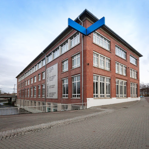
Kunstmuseum Reutlingen
Alte Stadtmauer
Find Accommodations Nearby
Recommended Tours & Activities
Visitor Reviews
There are no reviews yet. Be the first one to write one.
Share Your Experience
Have you visited Georgenberg”Sport, fitness and fun? Help other travelers by leaving a review.