
General W.K. Wilson Jr. Bridge
About General W.K. Wilson Jr. Bridge
Key Features
More Details
Updated April 16, 2024
## General W.K. Wilson Jr. Bridge (I-65, near Creola, Alabama): what it is and why it matters
The General W.K. Wilson Jr. Bridge is a long Interstate bridge that carries I-65 across the Mobile–Tensaw River Delta northeast of Mobile, Alabama, between Mobile County and Baldwin County.
It’s widely recognized for its twin steel through-arch spans (paired arches you drive “through”), which stand out from the lower, flatter viaduct sections that extend across the delta.
### Quick facts (from published sources)
– Function: Carries Interstate 65 traffic across the Mobile–Tensaw Delta.
– Design (as described in sources): “Dual tied through-arch” spans plus beam/viaduct approaches.
– Length: Reported as 6.08 miles (and also reported as 32,100 feet—these figures are consistent with each other).
– Main span (arch portion): Reported as 800 feet.
– Clearance/height figure reported in sources: 125 feet above the Mobile River (sources describe this as the bridge rising/being above the river).
– Construction period reported: Built from 1978 to 1980 (and an Alabama state archives item shows construction imagery dated April 1978).
– Naming: Named for Walter K. Wilson Jr., described as a Chief Engineer with the U.S. Army Corps of Engineers who lived in Mobile.
– Nickname: Often called the “Dolly Parton Bridge.”
—
## Why people talk about it (beyond “it’s a bridge”)
### 1) It’s an Interstate-scale crossing over a true delta landscape
The bridge crosses the Mobile–Tensaw River Delta, which is not a single channel but a broad mosaic of waterways and wetlands. That’s why this structure reads as “a bridge system”—high arches over deeper navigation/water routes, with long approach spans that keep I-65 continuous across the wider delta.
### 2) The distinctive “twin arches” are the visual signature
Most of the length is viaduct, but the part people remember is the pair of weathering-steel tied through-arch spans.
That architectural silhouette—two tall arches side-by-side—drives the local nickname.
### 3) The “Dolly Parton Bridge” nickname is tied to the arch shape and lights
A commonly repeated explanation (documented in sources) is that the bridge has red warning lights on the arches and, from certain approach angles, the shape + lighting led to the nickname.
—
## Where it is (and the location details you provided)
– Address (as commonly listed): I-65, Creola, AL 36525, United States.
– Coordinates (from your dataset): 30.9143144, -87.9636156 (I-65 corridor north of Mobile).
Because “bridges on interstates” are linear features and not a single front-door entrance, different platforms may pin slightly different points along the span. The best practical interpretation is: your coordinates place the bridge on I-65 in the Creola area.
—
## History and dates (and what looks inconsistent)
This is where you should be careful with “single-date certainty,” because sources don’t align perfectly:
– One source states the bridge opened to traffic on October 2, 1981.
– Another source summarizes it as built 1978–1980 and gives an “Open: 1980” line.
Those statements can’t both be strictly true in the same way without nuance (e.g., phased completion, differing definitions of “open,” or an error on one page). The only fully safe factual statement is: sources disagree on the opening year/date, while they consistently place construction in the late 1970s to around 1980, with archival documentation of construction activity in 1978.
Outdated-data flag: If you’re publishing this as a definitive “opened on X date” claim, verify against an Alabama DOT or similarly authoritative record first; the public web sources above are not internally consistent.
—
## What’s verifiably notable about the structure
### It’s long—long enough to be discussed among “long bridges”
Sources describe it as 6.08 miles across the delta, and note that it’s considered among the longer bridges in the U.S.
(That “among the longest” phrasing is qualitative; the measurable part you can safely publish is the 6.08-mile figure, with citation.)
### It’s a combined “arches + viaduct” design
The bridge is described as a combination of tied through-arch spans and beam viaducts forming one continuous crossing.
### It’s tied to a specific person and institution
Walter K. Wilson Jr. is described as a U.S. Army Corps of Engineers leader/engineer associated with Mobile, and sources credit him with recognizing the need for a high-level bridge on I-65 over the Mobile River that wouldn’t impede waterway development.
—
## Planning notes you can publish without guessing
Because this is an active Interstate 65 bridge, the most accurate “visitor expectation” framing is that it’s primarily experienced as a drive-by/drive-over landmark, not as a walk-up attraction with posted visiting hours or a dedicated on-structure viewing platform (those details are not established in the sources above).
If you want to include a “how to experience it” section while staying factual, you can safely say:
– It is located on I-65 and is encountered while traveling along that Interstate north/south of Mobile.
– The memorable visual element is the paired arches over the delta.
Anything beyond that (best pull-offs, best photo spots, pedestrian access, exact viewing angles, shoulder safety) needs either firsthand verification or a reliable local/official reference.
—
## Two contextual internal link placements (non-assertive, CMS-ready)
If RealJourneyTravels.com has relevant hub pages, these are the most natural spots to link internally (without claiming specific URLs exist):
1) In your “Getting oriented” paragraph: link Mobile, Alabama travel guide (anchor text: “Mobile travel guide”).
2) In your “Landscape context” paragraph: link a guide to the Mobile–Tensaw River Delta (anchor text: “Mobile–Tensaw Delta”).
These keep the bridge post from feeling isolated and let readers branch into (a) city logistics and (b) the delta ecosystem context.
—
## Sources used (for editorial review)
– AARoads / AAroads Interstate 65 pages describing the bridge crossing the Mobile–Tensaw Delta and stating an Oct 2, 1981 opening date
– Wikipedia summary of design, length, nickname, and historical notes (includes an “Open: 1980” line)
– Alabama Digital Archives item showing bridge construction imagery dated 1978 Archives of Alabama
– Bridgehunter entry summarizing year built/design type
If you want, I can rewrite the post to be more “story-led” (still factual) once you tell me whether RealJourneyTravels wants this positioned as a road-trip waypoint, an engineering/culture oddity (the nickname), or a delta geography explainer that happens to be anchored by the bridge.
Table of Contents
Key Highlights
General W.K. Wilson Jr. Bridge
Location
Places to Stay Near General W.K. Wilson Jr. Bridge
Find and Book a Tour
Explore More Travel Guides
No reviews found! Be the first to review!
Traveler Reviews for General W.K. Wilson Jr. Bridge
There are no reviews yet. Be the first one to write one.
Have you visited General W.K. Wilson Jr. Bridge? Help other travelers by sharing your review.
You Might Also Like
De Soto
Dr. Jeremy W. Szeto, DO
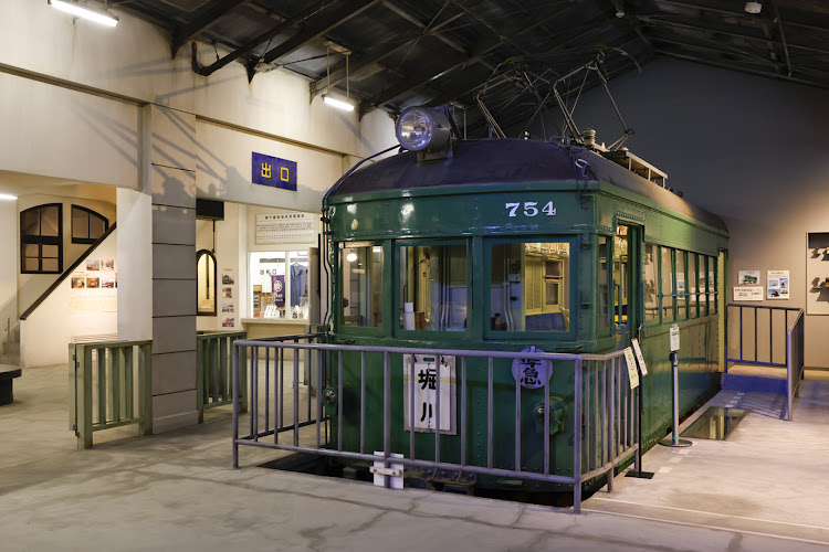
Setogura Museum
Find Accommodations Nearby
Recommended Tours & Activities
Visitor Reviews
There are no reviews yet. Be the first one to write one.
Share Your Experience
Have you visited General W.K. Wilson Jr. Bridge? Help other travelers by leaving a review.