Canal de vridi
About Canal de vridi
Key Features
More Details
Updated April 15, 2024
Elargissement / approfondissement du canal de Vridi (Inauguré en …
# Canal de Vridi, Abidjan: The Waterway That Turned a Lagoon City into West Africa’s Gateway
## Canal de Vridi at a Glance
– Location: Southern Abidjan, Côte d’Ivoire, cutting through the Vridi sandbar between the Ébrié Lagoon and the Atlantic Ocean near Port-Bouët
– Coordinates: Approx. 5.34° N, –3.97° W
– Type: Navigable shipping canal / major port access channel
– Primary role: Connects the Port of Abidjan directly to the Atlantic, allowing deep-sea vessels to enter the lagoon port safely
– Character: Heavy industrial and maritime zone first, “tourist attraction” second – expect ships, cranes and breakwaters more than a classic promenade
—
## Where Is Canal de Vridi and Why Is It So Strategic?
Abidjan sits along the Ébrié Lagoon, separated from the Gulf of Guinea by a long sandbar historically known as Vridi Plage. Britannica For decades this sandbar made direct access from the ocean extremely difficult: powerful surf along this stretch of the West African coast created a dangerous “bar” that limited safe landings and forced cargo onto exposed offshore wharves.
The Canal de Vridi was the engineering answer. Completed in 1950, it literally cuts through that sandbar to link the lagoon with the Atlantic Ocean, creating a deep-water passage for ocean-going ships into what is now the Autonomous Port of Abidjan.
Today, the canal is the main seaward approach to a port widely cited as:
– One of the most important ports in West Africa, and
– A key maritime gateway for landlocked neighbours such as Burkina Faso, Mali and Niger, whose external trade often transits via Abidjan.
For travellers, that means Canal de Vridi isn’t just another body of water: it’s the artery that explains why Abidjan became a major West African coastal hub, not just a lagoon town.
> Internal link idea: When you publish, you can naturally link this section to your broader Attractions hub to help readers discover similar infrastructure-driven sights around the world. Journey Travels
—
## How the Canal de Vridi Changed Abidjan
### From difficult coastline to deep-water port
Late-19th and early-20th-century surveys saw the potential of Abidjan’s lagoon: calm, deep, and ideal for connecting maritime trade with the inland rail network. But repeated early attempts (from 1903 to 1907) to open an ocean passage were defeated by shifting sands and strong coastal currents, which repeatedly re-sealed the cuts through the barrier beach.
After more extensive hydrological studies, engineers finally identified a workable design, and the Vridi Canal was dug during the 1930s–1940s and completed in 1950. The canal:
– Cut directly through the Vridi sandbar
– Linked the lagoon to deep Atlantic water
– Allowed the closure of older, less efficient surf-side wharves like those at Grand-Bassam once the new port was fully operational
The Port of Abidjan was officially inaugurated on 5 February 1951, with the Vridi Canal as its essential access channel.
### Economic pivot for Côte d’Ivoire and the region
By enabling large ships to enter the sheltered lagoon, the Canal de Vridi helped transform Abidjan from a modest coastal settlement into a regional shipping, industrial and financial centre. Abidjan is now frequently described as a major economic hub of Côte d’Ivoire and a key node in West African trade networks.
For context:
– The canal made it possible to handle large volumes of exports (cocoa, coffee, timber and other commodities).
– Industrial facilities – refineries, processing plants and logistics bases – clustered around the canal and port.
– The lagoon-side location allowed direct integration with roads and rail lines serving the interior.
Even if you’re simply in Abidjan on a stopover, standing near the Canal de Vridi connects you to the infrastructure that underpins the modern Ivorian economy.
—
## A Living Infrastructure Project: Enlargement and Deepening
The canal isn’t a frozen mid-century relic. It has been substantially upgraded to keep up with changing maritime logistics.
Between the 2010s and February 2019, a large-scale project widened and deepened the Canal de Vridi. Official port documentation explains that the pre-project canal couldn’t safely accept vessels longer than about 260 m with more than 11.5 m draft, which limited its competitiveness.
The upgrade, inaugurated in 2019, was designed to:
– Allow much larger container and bulk ships, with drafts up to around 16 m,
– Reduce average vessel waiting times (previously reported around 10 hours per day), and
– Position Abidjan as a serious contender for the newest generation of West African shipping routes.
Important note on data: earlier technical descriptions (e.g., from 1951) give the canal as roughly 2.7 km long, ~350 m wide and about 15 m deep; these are now historical figures, because the recent enlargement has modified the cross-section and depths. For current nautical specifications, mariners should always consult the latest official notices and charts from the Port Autonome d’Abidjan.
There has also been social and environmental discussion around these upgrades. Some small-scale fishers interviewed near the canal report that stronger, higher waves after enlargement have made traditional fishing riskier and more destructive for equipment. Network That tension – between growth in container shipping and the realities of coastal livelihoods – is part of the canal’s contemporary story.
—
## What You’ll Actually See When You Visit
### Expect a working ship channel, not a manicured waterfront
On the ground, Canal de Vridi looks like a straight, engineered cut between lagoon and ocean, flanked by breakwaters, industrial land, and the broader port area. Aerial images from the port authority show:
– A long, straight waterway with ships transiting between sea and lagoon
– Rock-armoured embankments and jetties absorbing heavy Atlantic swells
– Industrial zones on the port side and more open land on the opposite bank
You’re in the middle of a heavy-duty logistics environment: tugs, container ships, bulk carriers, port service craft and occasionally cruise ships all use this route.
### Viewing the canal
Because this is vital infrastructure, access is controlled. Some practical, high-level points:
– Do use only public roads and clearly permitted viewing points. Sections of the canal banks fall inside secured port zones with restricted entry.
– Port-side security can be strict, especially around operational quays, refineries and container terminals – photography may be limited in some areas.
– From public vantage points in the broader Vridi / Port-Bouët area, you can often see:
– Ships lining up or exiting the canal
– The intersection where the canal meets the Atlantic surf
– The contrast between the lagoon’s calmer waters and open-ocean conditions
There have been rare operational incidents, such as a 2022 episode where a high-voltage power cable temporarily sagged across the canal and halted navigation until it was cleared. That reinforces that this is an active, high-risk industrial corridor; always respect barriers, signage and staff instructions.
—
## Nearby: Vridi Plage and the Atlantic Coast
If you want to combine infrastructure sightseeing with a more classic coastal experience, the canal sits adjacent to Vridi Plage and other shoreline stretches in Port-Bouët, where the lagoon and ocean meet.
Travel and restaurant sources highlight that:
– Vridi Plage is recognised as a beachfront area of Abidjan, offering sea views and seafood-focused eateries.
– Some long-running restaurants operate directly by the ocean, with views of waves and small fishing boats.
That makes a logical pairing: watch the big ships in the canal, then head along the coast for fresh seafood and a look at everyday beach life.
Safety and inclusivity notes:
– The Atlantic surf here can be powerful; conditions vary and lifeguard coverage is not guaranteed everywhere. General best practice is to follow local advice about swimming and currents, or simply enjoy the shoreline from a safe distance.
– Accessibility can be mixed: some beachfront and canal-view areas have uneven surfaces, sand, or informal paths that are not ideal for wheelchairs or mobility aids. Where step-free access is essential, it’s worth asking your hotel or local contacts to confirm specific routes in advance.
—
## Practical Tips for Visiting Canal de Vridi
### How it fits into an Abidjan itinerary
Canal de Vridi works best as a context stop rather than a half-day destination on its own:
– Tie it into a Port-Bouët / Vridi Plage run if you’re already staying near the airport (Abidjan’s Félix-Houphouët-Boigny International Airport is itself located in Port-Bouët).
– Combine it with broader Abidjan highlights – for example the Plateau business district, St. Paul’s Cathedral and Banco National Park – to show how the lagoon, the port and the forest all coexist in one metropolitan area. Britannica
### When to go
There isn’t a classic “best time of day” in the same way as a viewpoint or sunset beach, but you’ll typically find:
– Daylight hours are best for seeing ship movements and getting a sense of the scale of the canal and port.
– Weather in coastal Côte d’Ivoire follows a pattern of wet and dry seasons; heavy rain can reduce visibility and make some unpaved access routes muddy or potholed.
### Traveller expectations to set
Because mapping apps sometimes label Canal de Vridi as a “tourist attraction”, it’s easy to over-imagine what’s on site. In reality, you should plan for:
Table of Contents
Key Highlights
Canal de vridi
Location
Places to Stay Near Canal de vridi
Find and Book a Tour
Explore More Travel Guides
No reviews found! Be the first to review!
Traveler Reviews for Canal de vridi
There are no reviews yet. Be the first one to write one.
Have you visited Canal de vridi? Help other travelers by sharing your review.
You Might Also Like
La bâche présidentielle mini cave
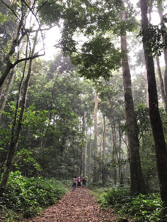
Parc National du Banco
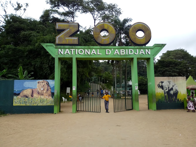
Zoo d
Find Accommodations Nearby
Recommended Tours & Activities
Visitor Reviews
There are no reviews yet. Be the first one to write one.
Share Your Experience
Have you visited Canal de vridi? Help other travelers by leaving a review.