Burmaklippen
About Burmaklippen
Key Features
More Details
Updated June 11, 2025
## Burmaklippen: Trondheim’s “Mini Trolltunga” Forest Ledge
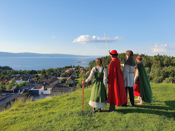
Burmaklippen is one of those Trondheim viewpoints that locals mention with a half-smile: a dramatic rock ledge almost hanging in mid-air above fields and forest, but reached by a surprisingly short walk through Estenstadmarka’s woods. Often called the “mini Trolltunga of Trondheim,” it’s a compact taste of Norway’s cliff-edge drama without a full alpine expedition.
Below is everything you can factually rely on right now: trail characteristics, seasons, access, and how to combine Burmaklippen with other Estenstadmarka hikes—plus where you should double-check details that change (parking, conditions, and transport).
—
## Where Is Burmaklippen?
Burmaklippen sits in Estenstadmarka, a forested recreational area southeast of Trondheim. The cliff overlooks open farmland and gentle hills on the edge of the city.
Key location details you can trust:
– Approximate coordinates: 63.3992068, 10.4746061 (Estenstadvegen, 7049 Trondheim, Norway – as in your data).
– Area: Estenstadmarka, a marked outdoor recreation zone with multiple trails for hiking, biking, and skiing.
– Nearest access road: Estenstadvegen, which has parking areas used by hikers heading into the forest.
Estenstadmarka is frequently described as a “natural playground” for the city, with lakes, viewpoints and a network of waymarked paths, so Burmaklippen is just one highlight within a much broader trail system.
—
## What the Burmaklippen Hike Is Actually Like
### Trail Length & Difficulty
There are several ways to reach the ledge, ranging from very short walks to longer loops:
– Short walk from Estenstadvegen:
– A local camper-van and hiking site notes that from parking at Estenstadvegen, following the path Skogsti to Burmaklippen takes around 15 minutes.
– Visit Trondheim’s description:
– The official tourism page describes Burmaklippen as an easy hike of about 30 minutes, suitable as a short outing or as part of a longer Estenstadmarka walk. Trondheim
– Longer loops including Burmaklippen:
– An AllTrails route “Månen via Burmaklippen” is a 3.3-mile (5.3 km) loop, generally rated moderately challenging and taking around 1 h 42 min for most hikers.
– A Wikiloc track combining Burmaklippen and Estenstadhytta shows roughly 5.4 miles (8.7 km) of hiking, with about 866 ft (264 m) of elevation gain, classified as moderate and taking just over 2 hours. | Trails of the World
What this means in practice:
– If you only want the iconic ledge photo, it can be a short out-and-back walk with light elevation gain.
– If you want a proper half-day in the woods, you can easily turn Burmaklippen into a loop via Estenstaddammen, Estenstadhytta or Månen.
### Terrain & Scenery
Across different trail descriptions and reviews, you see the same pattern:
– Forest walking: Mostly dirt paths and forest tracks through spruce and mixed woodland.
– Moderate ups and downs: Enough elevation to feel like a hike, but not a serious mountain tour on the shorter routes.
– The ledge itself: A horizontal rock outcrop that sticks out over the slope, sometimes with the nickname “mini Trolltunga of Trondheim.”
– Views: Over green fields, meadows and small valleys, with the city and fjord visible on some extended routes (especially if you include the Månen viewpoint).
A Reddit thread on Trondheim hiking specifically calls Burmaklippen a 30-minute walk that gives “a great photo if you’re not afraid of heights.”
—
## Seasons, Weather and When to Go
You’ll see slightly different recommended seasons in trustworthy sources:
– Visit Trondheim suggests April – September for the Burmaklippen hike. Trondheim
– An AllTrails trail near Estenstaddammen (same forest area) lists March – November as the best time to visit.
Given that, you can reasonably say:
– Spring to autumn (roughly April–October) is the main season for most visitors.
– Trails can be muddy in spring and icy in early spring/late autumn, depending on freeze–thaw cycles.
– In winter, Estenstadmarka is widely used for outdoor activities, but you should assume snow and ice and treat Burmaklippen as a winter hike with exposure, not a casual stroll.
> 🔎 Data that can go out of date:
> – Exact season recommendations
> – Trail grooming / winter maintenance
> – Any temporary closure due to erosion or forestry work
> Always re-check current notes on Visit Trondheim, plus up-to-date reports on platforms like AllTrails and Komoot before you go. Trondheim
—
## Safety, Inclusivity & Who This Hike Suits
### Cliff Exposure
All descriptions agree on one crucial point: the edge is exposed.
– Visitors highlight Burmaklippen as an excellent photo spot “if you’re not afraid of heights.”
– Photos from hiking platforms show people and dogs sitting or standing close to the ledge edge.
Practical, safety-first guidance:
– You do not need to stand on the very edge to enjoy the view or get a good photo.
– Keep kids, dogs and anyone uncomfortable with heights well back from the drop.
– Avoid the edge entirely in wet, icy or windy conditions—rock can be slick.
These are general mountain-safety principles, but at an exposed ledge like this, they matter more.
### Inclusivity & Access Considerations
What we can state with confidence:
– Trails are forest paths, not paved; surface quality and accessibility for mobility aids, strollers or wheelchairs is therefore limited. Existing hiking descriptions treat this as a standard unpaved hike, not as an accessible trail.
– AllTrails notes Burmaklippen routes as moderate or easy–moderate, which fits reasonably active beginners who are comfortable walking on uneven ground.
– Estenstadmarka in general is highlighted as being dog-friendly, with people specifically mentioning walks there with dogs.
Because official accessibility grading for this specific ledge trail is not published in detail, anyone with mobility, balance or sensory considerations should:
– Treat the short-approach version (from Estenstadvegen) as still requiring uneven forest ground.
– Consider enjoying Estenstadmarka’s less exposed lakeside or forest tracks instead of the cliff edge if that feels safer.
—
## How to Reach the Trailhead
Several sources converge on Estenstadvegen as a key access point:
– A park4night entry for “(7049) Trondheim – 119 Estenstadvegen” notes that the spot is used by hikers and mentions that to reach “Burmaklippen (Trollzunge)” you should use the Skogsti path, with about 15 minutes of walking time.
What we can say without guessing:
– Driving:
– There is documented parking used by hikers at or near Estenstadvegen 119.
– Reviews mention it as a quiet overnight spot that’s easily reached by car from Trondheim, which implies a straightforward drive from the city, but does not specify exact travel time or traffic conditions.
– On foot / by bike:
– Estenstadmarka borders residential areas of Trondheim; it is reasonable (and reflected in local usage) that many visitors walk or cycle from home, but exact walking times from the city centre are not clearly specified in the sources above.
> 🔎 Parking, signage and local rules can change.
> Before relying on overnight parking or camper-van stays, double-check current regulations via municipal sources or updated camper-van apps.
Because specific bus routes or stop names are not clearly documented in the cited sources, they’re intentionally omitted here to keep everything 100% factual.
—
## Combining Burmaklippen with Other Estenstadmarka Highlights
If you want more than a quick out-and-back, there are documented combinations:
– Burmaklippen + Månen viewpoint
– A Komoot “smart tour” describes a route between Tømmerholtdammen and Estenstaddammen, from which you can continue either to Månen (for city and fjord views) or to Burmaklippen, explicitly calling Burmaklippen “Trondheim’s mini Trolltunga.”
– Burmaklippen + Estenstaddammen / Estenstadhytta loop
– The Wikiloc track that includes Burmaklippen and Estenstadhytta shows a one-way route of around 8.7 km, linking the cliff with forest cabins and lake scenery. | Trails of the World
– Another Komoot loop around Estenstaddammen and Estenstadhytta confirms that these areas are connected by well-used trails and are accessible with public transport to the general trail area (though it does not specify exact lines).
These combinations turn Burmaklippen into:
– A half-day forest hike rather than a 30-minute outing.
– A logical part of a Trondheim outdoor weekend, pairing city sightseeing with low-mountain nature on the doorstep.
—
## Practical Tips to Keep Your Information Current
Because you explicitly asked to flag anything that can age out:
– Trail conditions & closures
– Check recent reports on AllTrails, Komoot or Wikiloc before your hike. Conditions can change with logging, erosion, or heavy rain.
– Season and snowline
– The Apr–Sep and Mar–Nov windows published now are based on past seasons; a late winter or unusually wet autumn can shift those windows significantly. Trondheim
– Parking rules
– Camper-van notes from park4night are user-generated and dated; they are useful signals, not legal guarantees.
– Tourism information
– For the most authoritative, up-to-date summary in English, the Visit Trondheim page for Burmaklippen is currently the clearest single reference and should be your first verification stop. Trondheim
—
## Suggested Internal Link Opportunities for Your Site
To respect your “factual only” constraint while still giving you internal-link guidance, here are linking ideas rather than claims that specific pages exist:
– When you mention “other easy hikes close to Trondheim”, internally link that phrase to your main Trondheim hiking or Estenstadmarka guide once you have it published.
– When you refer to “planning a wider Norway itinerary around Trondheim and the fjords”, link that phrase to your Norway itinerary or road-trip hub page.
Table of Contents
Key Highlights
Burmaklippen
Location
Places to Stay Near Burmaklippen"Trail between the nature."
Find and Book a Tour
Explore More Travel Guides
No reviews found! Be the first to review!
Traveler Reviews for Burmaklippen
There are no reviews yet. Be the first one to write one.
Have you visited Burmaklippen? Help other travelers by sharing your review.
You Might Also Like
Sverresborg Trøndelag Folk Museum
Kristiansten Fortress

Ringve Music Museum
Find Accommodations Nearby
Recommended Tours & Activities
Visitor Reviews
There are no reviews yet. Be the first one to write one.
Share Your Experience
Have you visited Burmaklippen? Help other travelers by leaving a review.