
Bongao Peak
About Bongao Peak
Key Features
More Details
Updated June 11, 2025
## Bongao Peak (Bud Bongao): Sacred Summit of Tawi-Tawi
Rising above the island town of Bongao in Tawi-Tawi, Bongao Peak—better known locally as Bud Bongao—is both a pilgrimage site and one of the most accessible treks in the far south of the Philippines. It’s a place where forest conservation, Islamic history, and everyday island life meet on a single limestone ridge overlooking the Celebes Sea.
This guide walks you through the cultural meaning, hiking route, macaques, and on-the-ground logistics so you can plan a respectful and well-informed visit.
—
## Quick Facts About Bongao Peak
– Local name: Bud Bongao (“bud” = mountain in Tausug/Sinama)
– Location: Bongao Island, Tawi-Tawi Province, southern Philippines
– Coordinates: Approximately 5.0136° N, 119.7422° E
– Elevation: Sources differ slightly, listing around 314–342 meters above sea level (about 1,000–1,120 feet)
– Trailhead: Barangay Pasiagan, near a military outpost at the foot of the mountain
– Trail: Roughly 1.6 km, mostly paved stairs (about 3,608 steps) to the main view deck
– Hiking time: ~1–2 hours up, depending on pace and photo stops
– Best for: First-time hikers, culture-focused travelers, and anyone building a deeper Mindanao or Sulu Archipelago itinerary
> Note on “highest peak” claims: Some travel articles still call Bud Bongao the highest mountain in Tawi-Tawi. Newer mapping-focused sources identify it as the highest peak on Bongao Island but only the second-highest in the province, after Mount Sibankat in Languyan.
—
## Sacred Mountain and Living Pilgrimage Site
Bud Bongao is not just “a viewpoint.” For many people in Tawi-Tawi, it’s a sacred mountain tied to the spread of Islam in the Philippines.
Local tradition holds that two preachers who were direct followers of Karim ul-Makhdum, the Arab missionary credited with introducing Islam to the Philippines in the 14th century, are buried on the mountain at an area known as Tampat Rocks.
Because of that, the peak functions as:
– A place of meditation and prayer, especially for Muslim residents of Tawi-Tawi
– A site where visitors tie written petitions or offerings near the tombs at Tampat Rocks, following local custom
– A symbol of the province—its outline is one of the first things you see when landing at nearby Sanga-Sanga Airport, rising sharply above the surrounding lowlands.
Because of this religious importance, treat Bud Bongao as both a hiking destination and an active spiritual site:
– Dress modestly (shoulders and knees covered is a safe baseline).
– Keep voices low around shrines and tombs.
– Always follow local guidance on where it is and isn’t appropriate to take photos.
—
## Bongao Peak Eco-Tourism Park & Forest Conservation
Bud Bongao sits inside the Bongao Peak Eco-Tourism Park, a protected forest that has been highlighted as one of the last remaining moist forests in the Sulu Archipelago.
Key points:
– The forested area is often cited around 50–250 hectares, depending on how the park boundary is defined in different sources.
– The site was selected as a model area for the New Conservation Areas in the Philippines Project (NEWCAPP), a biodiversity initiative implemented by the Philippines’ Biodiversity Management Bureau in the early 2010s.
– Limestone pillars and six distinct crests—Bongao, Sibutu, Simunul, Tambisan, Tinondakan, and Pajar—give the ridge its dramatic, fortress-like profile.
This conservation focus is one reason the trail is paved and stair-based: it channels foot traffic away from erosion-prone slopes and makes the mountain accessible to a wide range of visitors.
If you’re writing or planning content around sustainable tourism in Mindanao or the Sulu Archipelago, Bud Bongao is a strong case study in:
– Linking heritage tourism and forest protection
– Using simple infrastructure (stairs, railings, view decks) to manage visitor impact
– Keeping a sacred site active and relevant without turning it into a theme park
—
## Hiking the Bongao Peak Trail
You can jump to planning details here: Planning your hike.
### Trail Overview
Most hikers start at the Bud Bongao Forest Park archway in Barangay Pasiagan. From here, the route is straightforward: follow the cobblestone stairway and concrete path through forest and limestone outcrops up to the main view deck on Tambisan Peak.
What to expect:
– Surface: Concrete steps and paved trail almost the entire way
– Gradient: Mostly steady ascent with some steeper sections near the top
– Duration: About 45–60 minutes for fit hikers; 1.5–2 hours with photo and rest stops
– Viewpoints: Small clearings along the way with views over Bongao town, Sanga-Sanga Airport, and the surrounding sea
Although the elevation is modest by mountaineering standards, the heat and humidity in Tawi-Tawi can make the climb feel more demanding. Expect to sweat like it’s a much higher mountain.
### The Macaque “Guardians” and the Banana Tradition
One of the most memorable features of the climb is the large population of long-tailed macaques (Macaca fascicularis) that live in the forest and along the trail. Hikers routinely encounter groups of them near trees and railings, sometimes lounging directly on the steps.
Locally, they’re often described as guardians of the sacred mountain, and a long-running custom encourages visitors to bring bananas—which aligns perfectly with the visitor comment you quoted (“They are friendly only and only if you will bring them bananas…”).
However, there are a few important caveats:
– Feeding wildlife is increasingly discouraged in modern conservation practice, because it can change animal behavior and increase aggressive encounters.
– Some accounts warn that the macaques can scratch or bite, especially if they feel teased or cornered.
A practical middle ground:
– If local guides or rangers still encourage bringing bananas, follow their instructions, give food one piece at a time, and never pull it away once you’ve offered it.
– Keep a safe distance, avoid eye-level staring, and do not hand-feed if you’re uncomfortable—placing bananas on a rock or rail and stepping back is safer.
– Keep loose items secured; the macaques have learned to associate plastic bags with food.
—
## Views From the Top: Limestone, Sea, and Airstrip
From the main view deck on Tambisan Peak, you get a panoramic sweep of the Sulu Archipelago:
– The runway of Sanga-Sanga Airport visible below, with planes arriving against the backdrop of Bud Bongao’s limestone walls
– The patchwork of Bongao town, coastal settlements, and fishing boats
– On clear days, glimpses of nearby islands in the Tawi-Tawi chain and across the sea toward Sabah, Malaysia
If you have time and a local guide, you can explore beyond the main deck toward other peaks in the limestone cluster, each offering slightly different angles over the islands. Not all side trails are equally maintained, so prioritize safety and follow local advice on where it’s appropriate to go.
—
## Planning Your Hike to Bongao Peak
You can hop back to the hiking overview here: Hiking the Bongao Peak trail.
### How to Get to Bongao
1. Reach Zamboanga City
Most routes to Tawi-Tawi start in Zamboanga City in western Mindanao, which is connected by domestic flights and ferries from other parts of the Philippines.
2. Fly to Bongao (Tawi-Tawi)
From Zamboanga, travelers usually:
– Take a domestic flight to Bongao’s Sanga-Sanga Airport, or
– Occasionally travel by boat, depending on seasonal and security conditions
Recent travel guides emphasize the flight option as the standard, quicker route.
3. From the airport or town to the trailhead
Once in Bongao:
– It’s a short drive from town or from the airport to Barangay Pasiagan, where the Bud Bongao Forest Park entrance is located.
– Tricycles or local transport can usually be arranged on the spot or through your accommodation.
### Guides, Fees, and Access
– Local guides: Many trip reports mention arranging a local guide through guesthouses or directly at the trailhead. This is especially valuable for first-time visitors, both for safety and for understanding the religious etiquette on the mountain.
– Entrance/environmental fee: Hikers commonly mention a small fee collected at the start of the trail, but exact amounts and collection systems can change. Confirm on arrival or with your accommodation, rather than relying on older blog posts.
– Opening times: Most visits happen during daylight hours, with many hikers starting around sunrise or late afternoon to avoid midday heat. Check locally if there are specific opening or cut-off times, as park rules can be updated.
Because policies, fees, and access arrangements can change, especially in a province with evolving tourism infrastructure, treat any fixed numbers or “always open” claims in older blogs as potentially outdated and verify them with recent local information.
—
## When to Go & Safety Considerations
### Best Season & Time of Day
Tawi-Tawi experiences tropical weather with no sharply defined dry season, but in practice:
– Many travelers target months with relatively lower rainfall and calmer seas, often the drier windows in the southwest monsoon transition.
– Sunrise or late-afternoon climbs provide cooler temperatures and softer light for photography.
Because specific “best month” recommendations vary between sources and climate patterns are changing, it’s safest to check recent local weather and sea condition updates when planning your trip.
### Security & Local Conditions
Tawi-Tawi is in a region that has historically seen periodic security advisories due to incidents elsewhere in the Sulu Archipelago. Recent travel narratives describe hiking Bud Bongao as a normal, escorted part of Tawi-Tawi tours, but security situations can shift over time.
Practical approach:
Table of Contents
Key Highlights
Bongao Peak
Location
Places to Stay Near Bongao Peak"They are friendly only and only if you will bring them bananas of ..."
Find and Book a Tour
Explore More Travel Guides
No reviews found! Be the first to review!
Traveler Reviews for Bongao Peak
There are no reviews yet. Be the first one to write one.
Have you visited Bongao Peak? Help other travelers by sharing your review.
You Might Also Like
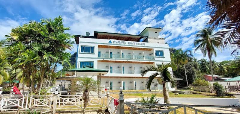
Almari Beach Resort
Bud Bongao Peak
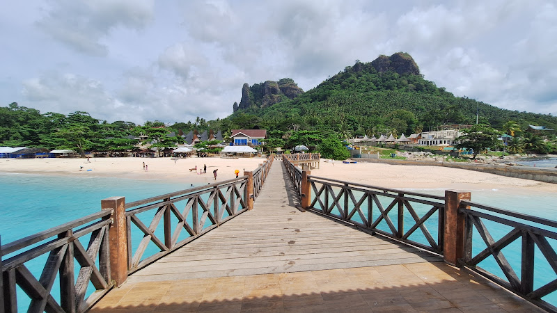
Bihing Tahik Resort
Find Accommodations Nearby
Recommended Tours & Activities
Visitor Reviews
There are no reviews yet. Be the first one to write one.
Share Your Experience
Have you visited Bongao Peak? Help other travelers by leaving a review.