
Barachukki Waterfalls
About Barachukki Waterfalls
Key Features
More Details
Updated June 11, 2025
## Barachukki Waterfalls (Shivanasamudra), Karnataka — A Practical, Insider Guide
Barachukki is one half of the twin Shivanasamudra falls on the Kaveri River; the other half is Gaganachukki. The two lie on opposite banks and are ~15 km apart by road, so plan to see both if you’re making the trip.
Quick facts
– Coordinates: 12.2878258, 77.1836675 (Barachukki viewpoint area)
– District boundary: Falls straddle Mandya (Malavalli taluk) and Chamarajanagar (Kollegala taluk); Barachukki sits on the Chamarajanagar side.
– Hydropower legacy: Shivanasamudra hosts one of Asia’s first hydro-electric stations (1902), originally powering Kolar Gold Fields and later Bengaluru—an important bit of industrial history still referenced by Karnataka Power Corporation.
– Official visiting window: Viewpoints are typically open 8:00–17:00. (Hours can change due to weather/safety; check locally before you go.)
—
### Why Barachukki is worth your day trip
– Massive monsoon spectacle, reliable flows later: The Kaveri splits around an island and drops in segmented curtains—Barachukki (~69 m) flowing wide and photogenic, Gaganachukki taller (up to ~90 m). Peak discharge is during/just after the monsoon; post-monsoon offers clearer skies with steady flow.
– Historic engineering site: Few waterfalls globally are tied so directly to early electrification. Standing at Barachukki, you’re beside the system that lit up Kolar Gold Fields in 1902.
—
### Best time to visit (and what to expect by season)
– Monsoon (July–September): Maximum volume; thunderous flow and mist—dramatic photos but slippery conditions and periodic safety restrictions.
– Post-monsoon (October–February): Most comfortable: greener surrounds, manageable spray, and clearer viewpoints. Several travel authorities place this as the pleasant shoulder after peak flow.
– Dry months (March–May): Reduced volume; plan expectations accordingly.
> Safety note & potential closures: Karnataka authorities have temporarily barred access to certain waterfalls during heavy monsoons on safety grounds in recent seasons. Always verify local advisories just before travel; rules can change week-to-week, especially after cloudbursts. Times of India
—
### Getting there: routes, time, and logistics
– From Bengaluru (Bangalore): Plan ~130–133 km by road (≈3 hours without heavy traffic) via the Bengaluru–Mysuru corridor and Malavalli. Multiple independent sources converge on this distance/time range.
– From Mysuru (Mysore): Roughly 70–80 km; popular as a half-day bolt-on to city sightseeing. with Ecokats
– Public transport: Buses typically run to Malavalli; from there, hire a taxi/auto for the last ~30 km to the viewpoints.
– Parking & amenities: Expect basic facilities at the official viewpoints (kiosks vary by season); options are limited—carry water/snacks.
—
### Barachukki vs. Gaganachukki: how to plan both
– Distance between viewpoints: ~15 km by road; navigation apps sometimes underestimate this because the falls are “as the crow flies” close but on opposite banks.
– View & light: Barachukki often rewards wide-angle compositions; Gaganachukki’s main drop is taller and dramatic in profile. Early morning or late afternoon keeps glare off the spray.
—
### On-site walking & viewpoints
– Viewing decks: Government-maintained platforms give safe perspectives over the gorge. Obey barriers—rocks here get algae-slick and the flow can surge quickly after upstream releases.
– Short trail options: Light walking near the viewpoints is the norm. Some visitors log a short 0.5–1 hour “Barachukki Waterfalls Hike” with modest elevation; treat this as a stroll to multiple vantage points rather than a backcountry trek.
—
### Coracle rides & water access: what’s realistic
– Seasonal & regulated: Coracle boating has historically been seasonal and subject to strict closures, especially during strong currents or after heavy rain. Treat any ride as “maybe” until confirmed on-site; never plan your trip around it. (This variability is due to fluctuating flows and safety directives.) Times of India
—
### Responsible visit checklist
– Footwear: Grippy, closed-toe shoes; paths and rocks can be wet with algae.
– Drones: Assume restrictions near viewpoints and power infrastructure unless you have explicit permits. (Local enforcement varies—ask before flying.)
– Wildlife & waste: Pack out everything. This corridor links forested tracts between Mandya and Chamarajanagar; discard nothing into the gorge.
—
### Nearby add-ons (efficient day planning)
– Talakadu (sand-covered temple town), Bheemeshwari (riverine forests/angling base), and BR Hills can pair well with a Barachukki–Gaganachukki circuit depending on time and season. Distances: Talakadu ~28 km, Bheemeshwari ~55 km, BR Hills ~53 km from the falls region.
—
### Accessibility & inclusivity notes
– Viewing platforms make waterfall viewing feasible for a wide range of visitors; however, surfaces can be uneven with steps. If traveling with a stroller or wheelchair, aim for mid-week, non-monsoon windows when crowds and spray are lower, and request the closest parking bay to the official Barachukki viewpoint deck.
– Facilities availability (toilets, food) fluctuates by season and day; bring essentials, hydration, and sun/rain protection for everyone in your group.
—
### What’s not guaranteed (to keep expectations honest)
– Water volume outside monsoon can be modest; the falls are perennial but not always thunderous.
– Exact opening hours, boating, and access may change at short notice due to rainfall or safety advisories issued by local authorities. Verify same-day conditions before departure from Bengaluru/Mysuru. Times of India
—
### Map & distances you can trust (at a glance)
– Bengaluru → Shivanasamudra (Barachukki side): ~133 km / ≈3 hours under normal conditions via the Bengaluru–Mysuru Expressway → Malavalli.
– Mysuru → Shivanasamudra: ~70–80 km depending on start point within the city. with Ecokats
—
### Final planning notes (accuracy & updates)
– There’s no general entry fee listed on multiple guides for the viewpoints, but minor parking or local maintenance fees can appear; carry small change. Official hours are typically 8:00–17:00. If you’re targeting peak flow, July–September is the safest bet for volume; for calmer visits, aim October–February. Always re-check conditions during active monsoon weeks due to rolling safety closures.
—
Data sources include Karnataka Tourism’s official guidance, historic references to the 1902 hydro-electric station, and distance/time figures corroborated by government/tourism pages and transport guides. Where policies can change rapidly (monsoon safety, boating), this guide flags potential variability so you can verify on the day.
Table of Contents
Key Highlights
Barachukki Waterfalls
Location
Places to Stay Near Barachukki Waterfalls"The falls is a beautiful thing to watch."
Find and Book a Tour
Explore More Travel Guides
No reviews found! Be the first to review!
Traveler Reviews for Barachukki Waterfalls
There are no reviews yet. Be the first one to write one.
Have you visited Barachukki Waterfalls? Help other travelers by sharing your review.
You Might Also Like
Gumbaz-e-Shahi – Srirangapattana
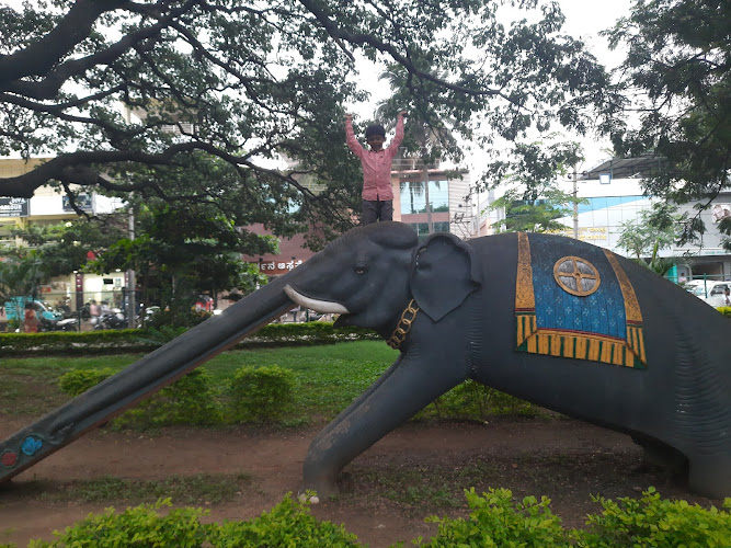
Aane park
Daria Daulat Bagh
Find Accommodations Nearby
Recommended Tours & Activities
Visitor Reviews
There are no reviews yet. Be the first one to write one.
Share Your Experience
Have you visited Barachukki Waterfalls? Help other travelers by leaving a review.