
Anantapur cheruvu
About Anantapur cheruvu
Key Features
More Details
Updated April 15, 2024
# Anantapur Cheruvu (Andhra Pradesh): Practical Visitor Guide
Location: MJFC+RX, Anantapur, Andhra Pradesh 515005
Coordinates: 14.6745724, 77.6224694
Anantapur Cheruvu is one of the city’s central water bodies—what locals refer to as a “cheruvu” (tank/lake)—set within Anantapur’s Old Town/515005 PIN area. The adjacent Cheruvu Katta locality (population ~1,200; ~1.1 km²) frames part of the catchment and access roads, which is useful to know when you’re navigating by address or arranging pickup.
—
## Why this spot matters in Anantapur
– Urban water storage in a dry belt. Anantapur district (Rayalaseema region) is among the driest parts of South India; tanks like this are part of a long-running strategy to store and buffer scarce rainfall.
– Seasonal character. The city has a semi-arid climate with heat peaking around May, limited monsoon rains, and a short cool season. Expect the lake’s appearance to change through the year—fuller after the monsoon, low or patchy in the late dry season.
—
## Getting there (simple, city-center access)
– By rail: Anantapur (Ananthapuramu) railway station is the city’s A-category station and the most straightforward arrival point. From the station, local autos can reach the cheruvu area quickly.
– By road: Anantapur sits on NH-44 (Bengaluru–Hyderabad corridor). City buses and autos run throughout the day. If you’re using a map app, input the Plus Code MJFC+RX or the coordinates above; the Cheruvu Katta label also helps for turn-by-turn driving.
—
## Best time to visit
– After the monsoon (roughly September–November): This window typically offers the most water presence and tolerable heat.
– Morning and late afternoon year-round: You’ll avoid midday heat common to Anantapur’s climate. Shade around the bund may be limited; plan accordingly.
—
## What to expect on site
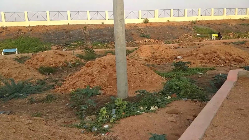
– Urban tank setting. This is a functional city water body, not a gated park. You’ll find local traffic, modest edges of settlement, and practical approaches rather than manicured promenades.
– Variable water levels. In a semi-arid district, tanks can look dramatically different over seasons. Don’t expect year-round boating or standard “lakefront” amenities unless you’ve verified them that week.
– Photography: Sunrise and late-day light work best for reflections when there’s water. If levels are low, switch to textures—bund masonry, sky gradients, and street scenes.
> Note on amenities: Specific facilities (toilets, kiosks, lighting) are not consistently documented by reliable sources; verify day-of if these are essential to your visit. (Avoid relying on unverified listing snippets, which change frequently.)
—
## Simple route planning
– On foot / auto-rickshaw: Use “Cheruvu Katta” as your last-mile landmark when instructing drivers. The name is widely recognized in the area and aligns with the 515005 postal zone.
– From Bengaluru: NH-44 northbound to Anantapur, then local roads to the Plus Code above. Nearest major airport for long-haul travelers is Kempegowda International Airport, Bengaluru; plan ~190 km by road to Anantapur city before a short intra-city hop to the cheruvu.
—
## Safety & accessibility notes
– Heat management: The city’s climate warrants hats, electrolyte water, and breaks. Midday UV can be punishing, particularly March–May.
– Footing: Expect uneven edges around parts of the bund or embankment. Closed footwear is smarter than sandals if you plan to walk the perimeter.
– Inclusivity: Curb-free access points exist in a few places, but continuous step-free paths around the entire tank aren’t reliably documented. If step-free access is critical, scout with a short ride first rather than committing to a full loop.
—
## Trip combinables inside Anantapur
– City orientation: The railway area, Old Town, and arterial roads linked to NH-44 form a straightforward triangle for first-timers; the cheruvu fits neatly into an hour-or-two city circuit between meals or meetings.
– Regional context: If you’re studying Rayalaseema water heritage or dryland agriculture, Anantapur’s network of tanks (and periodic restoration drives reported district-wide) offers on-the-ground examples of how small and mid-sized water bodies support semi-arid urban life.
—
## Practical FAQs
Is there an “official” rating or ticket counter?
No ticketing is documented in trustworthy sources, and user-submitted ratings on aggregator sites vary and change; treat the cheruvu as a free, open urban space unless a local notice states otherwise.
Is it worth a dedicated trip?
Think of Anantapur Cheruvu as a short, context stop: sunrise/sunset photos when water is present, a look at urban tank infrastructure in a dry district, and a useful pin to anchor your mental map of the city.
Any recent policy changes affecting wetlands/tanks?
Andhra Pradesh has been actively mapping and managing wetlands at scale, with ongoing eco-tourism and conservation initiatives state-wide. While these reports aren’t specific to this exact cheruvu, they reflect a statewide trend that can influence maintenance and visibility of urban tanks. For the latest policy context, see recent state coverage. Times of India
—
## What’s likely to be outdated (flagged)
– Amenities & beautification claims: Unless published by the municipal corporation or a government portal, assume kiosk counts, benches, or lighting details in user-generated posts may be out of date.
– Event or boating availability: Not reliably documented for this tank; verify in-city.
– Ride-share pickup points: App pins can drift; trust Plus Code MJFC+RX and confirm with your driver by voice.
—
## Summary
If you’re in Anantapur, the cheruvu is a quick, local stop that illustrates how tanks anchor life in one of India’s driest urban regions. Use the Plus Code (MJFC+RX) or coordinates for precise navigation, time your visit for cooler light and post-monsoon water presence, and keep expectations aligned to a functional city tank rather than a ticketed attraction. For context on the immediate neighborhood, the Cheruvu Katta locality reference is accurate and current; for climate and logistics, rely on Anantapur city data.
—
Sources used for verifiable facts in this guide: district/city references on climate and transport, and locality demographics to confirm on-the-ground naming.
Table of Contents
Key Highlights
Anantapur cheruvu
Location
Places to Stay Near Anantapur cheruvu
Find and Book a Tour
Explore More Travel Guides
No reviews found! Be the first to review!
Traveler Reviews for Anantapur cheruvu
There are no reviews yet. Be the first one to write one.
Have you visited Anantapur cheruvu? Help other travelers by sharing your review.
You Might Also Like
NTR Park
Anantapur Railway Station
Manikanta traders
Find Accommodations Nearby
Recommended Tours & Activities
Visitor Reviews
There are no reviews yet. Be the first one to write one.
Share Your Experience
Have you visited Anantapur cheruvu? Help other travelers by leaving a review.