
Altos de Votorantim
About Altos de Votorantim
Key Features
More Details
Updated April 16, 2024
## Altos de Votorantim, São Paulo — Neighborhood Guide (With Nearby Nature Spots)
Altos de Votorantim is a bairro (neighborhood) within the city of Votorantim, in the Metropolitan Region of Sorocaba, São Paulo state. The point you provided (-23.5406376, -47.4162632) plots to the elevated residential zone on Votorantim’s southwest–west side. The area is formally recognized as a neighborhood with its own range of postal codes (CEPs 18113-810 to 18113-828) across a dozen listed streets, including Rua Américo Barroso and Rua Carlos Alberto Develis. CEP
### Where it sits in the bigger picture
– Votorantim ↔ São Paulo (capital): multiple route planners put the road distance around 100–116 km, depending on the chosen highway (Castelo Branco vs. Raposo Tavares spurs). Estimates include ~103 km, ~107–108 km, and up to ~116 km; all are consistent with a roughly ~2-hour or shorter intercity drive in normal conditions.
– Votorantim ↔ Sorocaba: Votorantim is conurbated with Sorocaba (bordering/continuous urban area), making Sorocaba’s malls, terminals, and hospitals practical reference points for residents and visitors.
> Transit note: Intercity bus services from São Paulo to the Sorocaba terminal (operated by Viação Cometa) are a common leg for reaching Votorantim; from there, local transfers continue into the neighborhoods, including Altos de Votorantim.
—
## What Altos de Votorantim is (and isn’t)
– Residential first. Public sources index Altos de Votorantim as a residential neighborhood with defined CEPs and streets. There’s no official listing of a standalone “Altos de Votorantim” tourist attraction (e.g., park, museum) in city or state tourism pages. If you encounter social posts labeling photos “Altos de Votorantim,” treat those as location tags rather than an attraction brand. CEP
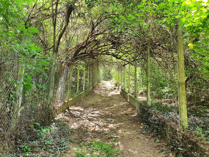
– Nearby leisure is the draw. The nature, trails, and water resources around Votorantim—especially on the Sorocaba River basin and the Itupararanga system—are what most visitors actually come for; Altos is a handy base to reach them.
—
## Quick orientation & practical pointers
### Postal/Address sanity check
If you need to verify a delivery address or confirm street-level details inside the neighborhood, use the official CEP lookup entries for Altos de Votorantim (range 18113-810 … 18113-828 across 12 logradouros). This is the cleanest “ground truth” for addresses in this bairro. CEP
### Getting in and around
– By car: Common approach from São Paulo uses Rodovia Castelo Branco (SP-280) toward Sorocaba and then the local connectors into Votorantim. Distances vary a bit by route planner (roughly 100–116 km).
– By bus: São Paulo → Sorocaba (Cometa) then local transit/ride-hail to Altos de Votorantim.
—
## Outdoors & things to do near Altos de Votorantim
While Altos itself is residential, you’re within short reach of Votorantim’s green areas, waterfalls, and lakeside spots. These recurring names appear in current traveler and official listings:
### Sorocaba River & hill viewpoints (Mirante routes)
– “Votorantim – Mirante” trail: cataloged routes describe winding paths through dense vegetation, narrow sections, and Sorocaba River crossings on a long loop (the platform lists an extended variant at ~26.9 km). Treat it as an endurance outing—plan water, daylight, and exit points.
### Water & cascades
– Cachoeira da Chave: repeatedly listed among Votorantim’s nature attractions and free/low-cost ideas of what to do. Expect natural scenery; conditions and access can vary with recent weather.
### City parks & small reserves
– Parque Ecológico do Matão: an urban/natural park frequently cited in local guides and traveler roundups.
– Parque da Pedreira: noted for walking/hiking listings.
### Reservoir & APA (area of environmental protection)
– Represa de Itupararanga: a major water body serving the region, used for supply and leisure and covered by the APA Itupararanga protective designation. It’s an anchor for boating and lakefront day trips in the broader municipality.
> Housekeeping tip: These spots are distributed across the municipal area; plan rides or a car. Many are not within immediate walking distance from Altos de Votorantim’s residential streets.
—
## Food, shopping, and urban stops (regional context)
– Iguatemi Esplanada (regional shopping center) appears in top-things-to-do lists for Votorantim/Sorocaba; it’s on the Votorantim side of the urban fabric. Use it for ATMs, pharmacies, food courts, and large-format retail.
—
## Safety, inclusivity & on-the-ground realities
– Trail difficulty & inclusivity: The longer Mirante circuits include narrow, uneven terrain and river crossings; these features can be unsuitable for mobility devices or strollers. If your group needs step-free or short, even-surface options, lean toward urban parks (e.g., Parque do Matão) and lakeside promenades where available. Always verify current path conditions locally.
– Water levels/weather: Waterfalls and river fords change with rainfall; surfaces and crossings can shift from easy to unsafe after storms. Check recent conditions before committing to long loops. (This is a general safety note; localized, up-to-the-day advisories are best sourced on the spot.)
– Public listings may be thin: The municipal tourism page currently has very limited details and imagery; assume incomplete coverage rather than absence of attractions. Cross-reference with regional sources or ask locally.
—
## Sample half-day plan using Altos de Votorantim as a base
> This plan keeps to well-documented, publicly listed spots and a conservative pace.
1. Morning: Transfer toward Parque Ecológico do Matão for an easy start in green surroundings.
2. Late morning/early afternoon: Head to Cachoeira da Chave for photo time and a picnic window (pack out all trash; mind footing near wet rock).
3. Backup weather plan: If rain compromises trails, pivot to Iguatemi Esplanada for lunch, errands, or indoor activities.
—
## Practical FAQs
Is Altos de Votorantim itself an attraction?
No official tourism source treats “Altos de Votorantim” as an attraction; it’s a residential neighborhood with documented CEPs/streets. Use it as a lodging base for nearby parks, falls, and reservoir areas. CEP
How do I confirm an address or service coverage inside Altos?
Use the CEP range 18113-810 to 18113-828 to validate streets and deliveries. CEP
What’s the simplest route from São Paulo?
Driver-preferred routes typically involve Rodovia Castelo Branco (SP-280) toward Sorocaba, then local connectors—expect ~100–116 km one-way, route-dependent. Buses run to Sorocaba’s terminal, with onward local transit into Votorantim.
—
## Data freshness & caveats (read this before you go)
– The State tourism page for Votorantim (Dec 2020 posting) and the municipal tourism microsite currently show sparse details; expect outdated or incomplete listings online. Verify operating hours, trail access, and park rules locally before traveling.
– Distances cited are from independent planners and may differ by selected ramp/exits; the range provided reflects that variability (all reputable sources fall near the ~100 km mark, with a high of ~116 km).
—
### Coordinates (for your map/app)
– Altos de Votorantim centerpoint (approx.): -23.5406376, -47.4162632 (as provided)
– Municipal reference: Votorantim sits west of São Paulo, conurbated with Sorocaba, with hydrography dominated by the Sorocaba River and Represa de Itupararanga (APA).
—
#### Suggested internal links (if you have them on your site)
– Sorocaba City Guide — context, transit, and malls (link to your Sorocaba guide).
– Represa de Itupararanga Day Trip — lake access, marinas, and safety notes (link to your Itupararanga article).
(If these pages don’t exist yet, omit these links to avoid dead ends.)
Table of Contents
Key Highlights
Altos de Votorantim
Location
Places to Stay Near Altos de Votorantim
Find and Book a Tour
Explore More Travel Guides
No reviews found! Be the first to review!
Traveler Reviews for Altos de Votorantim
There are no reviews yet. Be the first one to write one.
Have you visited Altos de Votorantim? Help other travelers by sharing your review.
You Might Also Like
Cachoeira da Chave
Ginasio Mirante dos Ovnis
Ecological Park of Matao
Find Accommodations Nearby
Recommended Tours & Activities
Visitor Reviews
There are no reviews yet. Be the first one to write one.
Share Your Experience
Have you visited Altos de Votorantim? Help other travelers by leaving a review.