
Cedar Valley Conservation Area
About Cedar Valley Conservation Area
Key Features
More Details
Updated June 11, 2025
## Cedar Valley Conservation Area, Oshawa: A Quiet Green Corridor Along Oshawa Creek
Cedar Valley Conservation Area in Oshawa, Ontario, is a 41-hectare urban park that protects a wide swath of Oshawa Creek valley — a lowland that once formed the shoreline of glacial Lake Iroquois. It’s managed by the City of Oshawa and combines accessible trails, wilder side paths, and important Indigenous history in one compact conservation area.
Skip ahead to Trail overview and difficulty or Practical tips for visiting.
—
### Where It Is & How the Area Is Laid Out
Cedar Valley Conservation Area sits in north Oshawa, framed by residential neighbourhoods but buffered by forest, meadows, and wetlands along Oshawa Creek. The conservation area has several common access points:
– Canadore Crescent (1655 Canadore Crescent, Oshawa, ON) – frequently referenced as a main access point and parking area.
– Niagara Drive (165 Niagara Dr, Oshawa, ON) – another signed parking area for visitors exploring the valley trails.
– Near Simcoe Street North (around 1510 Simcoe St N.) – used as a reference point in bird-watching guides describing the 1.9 km trail. Coffee Co.
These addresses all refer to entry points into the same green corridor rather than separate parks, which can explain why different guides mention different street names.
—
## Landscape & Ecology
### A Former Lake Shoreline
Geologically, Cedar Valley Conservation Area occupies part of the former shoreline and beach of glacial Lake Iroquois, with Oshawa Creek cutting through this lowland. You’re walking through a landscape shaped by ice-age waters rather than just a standard city ravine.
### Forests, Meadows & Wetlands
A detailed botanical survey describes Cedar Valley as a mosaic of:
– Secondary growth forests in upland areas, dominated by trembling aspen and eastern white cedar, with a sub-canopy that can include buckthorn, green ash, Manitoba maple, and various shrubs.
– Meadows and open fields, where groundcover features species such as goldenrods, cinquefoils, bedstraw, St. John’s wort, and tufted vetch.
– Lowland cedar forests along the Oshawa Creek floodplain, with rich ground vegetation like jewelweed, sensitive fern, Jack-in-the-pulpit, and false Solomon’s seal.
– Pine plantations (white pine and Scots pine) in neat rows; their understories are often dominated by dog-strangling vine, a significant invasive species in southern Ontario.
Because the canopy is not uniformly dense, you’ll see a blend of woodland plants and sun-loving meadow species along a single walk, especially in late spring and summer.
—
## Indigenous History & Cultural Significance
Cedar Valley Conservation Area lies on the western branch of the Scugog Carrying Place, a historic overland route connecting Lake Ontario to Lake Scugog. Indigenous peoples used this route for centuries to move between hunting grounds and villages.
Within roughly a 2 km radius of the conservation area, archaeologists have uncovered artifacts dating back to:
– Paleoindian period (before 8500 BCE)
– Archaic era (8000–1000 BCE)
During the 14th–15th centuries, Huron-Wendat communities established large villages along the Scugog Carrying Place. Two key archaeological sites associated with them — the Grandview and MacLeod villages — were located within a few kilometres of the current conservation area and included multiple longhouses and a wooden palisade at MacLeod.
Later, Mississaugas (ancestors of today’s Mississaugas of Scugog Island First Nation) used the same route, especially during the fur-trade era of the 1700s and early 1800s.
Because of this deep history, Cedar Valley is more than a green space — it’s part of a much older transportation and cultural network. Anyone visiting today is walking through a landscape with many thousands of years of Indigenous presence and stewardship.
—
## Trail Overview and Difficulty
### Main Accessible Trail
According to a Greenbelt Indigenous Botanical Survey, Cedar Valley features about 1.7 km of accessible gravel trails, plus several side trails. These are described as suitable for both walking and biking.
### Loop & Out-and-Back Options
Different trail platforms describe a couple of common ways to experience the valley:
– Cedar Valley Loop – ~1.9 mi / ~3 km
– Generally considered an easy route, taking around 40 minutes on average.
– Frequently described as popular and dog-friendly.
– Shorter out-and-back segment – ~1.1 mi / ~1.8 km
– Rated moderate on some trail listings, with an average completion time of about 22 minutes.
Trail users report that the upper trails are relatively straightforward, while paths close to the creek can be narrower, muddier, and less clearly marked.
Because multiple local guides point out limited signage, downloading a trail map from a hiking app before you arrive is a practical step to avoid confusion. Tourism
—
## Wildlife, Birdwatching & Seasonal Highlights
### Salmon Run & Aquatic Life
Visitor reviews mention seeing salmon moving upstream in Oshawa Creek in early fall. Tourism If you time your visit for the autumn migration, certain creek viewpoints can offer a good chance of witnessing the fish pushing against the current.
### Birds & Biodiversity
A regional bird-watching guide calls out Cedar Valley Conservation Area as a 1.9 km trail well-suited to birding, with free access and on-leash dogs allowed. Coffee Co.
Combined with the botanical survey’s record of diverse forest, meadow, and wetland plant communities, you can reasonably expect:
– Mixed woodland birds in the cedars and hardwoods
– Meadow and edge species in open areas
– Water-associated species along the Oshawa Creek corridor
Exact species vary by season, but the structural diversity of the habitat is well documented.
### Wildflowers, Mushrooms & Insects
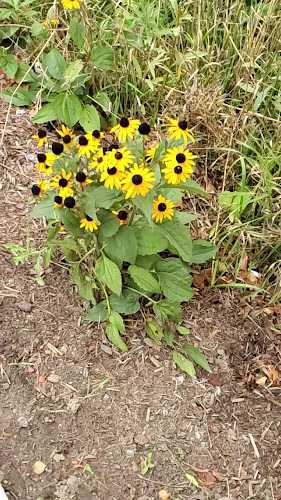
Local hiking and tourism content emphasizes Cedar Valley as a good place to spot wildflowers, mushrooms, butterflies, and other insects, especially in late spring through early fall. Tourism
Because some understory plants include poison ivy, you’ll want to stay on established paths and be cautious about kids or pets straying into dense groundcover.
—
## Dog-Friendly Details (and a Leash Rule Caveat)
Here’s where the information gets a bit mixed, and it’s worth flagging clearly:
– A detailed bird-watching guide and major hiking platform both state that dogs are welcome but should be kept on a leash at Cedar Valley.
– A local dog-walking blog lists Cedar Valley Conservation Area among off-leash parks/trails in Durham Region, which suggests that some dog owners treat parts of the area as off-leash space.
Because these sources conflict and municipal bylaws can change, the safest assumption for visitors who are not local is:
> Treat Cedar Valley Conservation Area as an on-leash, shared-use trail unless you’ve checked the latest rules directly with the City of Oshawa or Central Lake Ontario Conservation Authority and confirmed specific off-leash designations.
This matters both for wildlife protection (especially during the salmon run and nesting seasons) and for the comfort of other visitors.
—
## Mountain Biking & Multi-Use Trails
TrailForks describes Cedar Valley Conservation Area as a “green park just outside of a residential community” with narrow but well-worn paths and many branches. It notes that the area is primarily a place to hike but “very much rideable” for cross-country mountain biking, and that e-bikes are allowed.
If you choose to ride here, be prepared for:
– Rooty sections and occasional stick bridges over muddy pockets
– Narrow singletrack shared with hikers and dog walkers
– Limited trail marking in certain sections
Yielding to pedestrians and controlling speed on corners is essential to keep the experience positive for everyone.
—
## Facilities & Access
Based on currently available information:
– Parking
– Public parking areas are documented on Niagara Drive and near Canadore Crescent.
– A parking-directory site lists “Cedar Valley Conservation Area Parking” at 165 Niagara Dr with a 4.0/5 rating from a small number of Google reviews but does not provide official opening hours.
– Picnic Areas
– The Greenbelt survey explicitly notes several picnic areas in the park, along with the 1.7 km gravel trail.
– Playground
– A travel-planning site describes the area as having a playground and designated picnic area as part of the broader woodland and trail network. Because this is based on user-generated content and not an official city source, playground equipment could change over time.
– Fees & Hours
– Multiple regional sources highlight free access to the trail. Coffee Co.
– No official, up-to-date opening hours for the conservation area or its parking lots are listed in the sources above. In practice, many local conservation areas operate on a dawn-to-dusk expectation, but that’s a general pattern in Ontario, not a published Cedar Valley rule.
– Washrooms & Lighting
– I wasn’t able to find current, official confirmation of washroom facilities or lighting within Cedar Valley Conservation Area. Given that guides focus on the natural trails rather than infrastructure, visitors should plan as though services are limited and verify details with the City of Oshawa if accessible washrooms are essential.
Because planning documents like Oshawa’s Samac Secondary Plan and collaborative notes with the Central Lake Ontario Conservation Authority (CLOCA) indicate that Cedar Valley’s development is ongoing, facilities could change over time. of Oshawa
—
## Practical Tips for Visiting
– Footwear
– Reviews repeatedly mention muddy stretches and wet ground, particularly near the creek. Sturdy, waterproof shoes are more practical than casual sneakers.
– Insects
– Recent visitors call out mosquito season as intense and strongly recommend bringing bug spray.
Table of Contents
Key Highlights
Cedar Valley Conservation Area
Location
Places to Stay Near Cedar Valley Conservation Area"Relaxing walk and great for nature lovers"
Find and Book a Tour
Explore More Travel Guides
No reviews found! Be the first to review!
Traveler Reviews for Cedar Valley Conservation Area
There are no reviews yet. Be the first one to write one.
Have you visited Cedar Valley Conservation Area? Help other travelers by sharing your review.
You Might Also Like
Glen Stewart Park
Lakewoods Park Lookout

Treetop Eco-Adventure Park and iBOUNCE Trampoline Park
Find Accommodations Nearby
Recommended Tours & Activities
Visitor Reviews
There are no reviews yet. Be the first one to write one.
Share Your Experience
Have you visited Cedar Valley Conservation Area? Help other travelers by leaving a review.