
Araçatuba Facts
About Araçatuba Facts
Key Features
More Details
Updated April 15, 2024
## Araçatuba, São Paulo — Fast, Useful Facts for Planning a Visit (and Understanding the City)
Araçatuba sits in the northwest of São Paulo state and serves as a regional hub for services, education, and agribusiness. It was founded in 1908 during the push of the Noroeste do Brasil railway into the interior and became a municipality in 1921.
### Population, Size & Where It Fits in São Paulo
– Population (Census 2022): 200,124 residents
– Population (IBGE 2025 estimate): 208,415 residents
– Area: 1,167.126 km²
– Density (2022): 171.47 people/km²
These are the most recent official figures from IBGE; use them for accurate, current planning or benchmarking.
> Outdated numbers you’ll still see: older English-language summaries and some articles list 2020 or earlier estimates and prior mayors. Prefer IBGE’s 2022 census + 2025 estimate above.
### Why Araçatuba matters
– Railway origins: the city was born from a railway camp at km 280 of the Noroeste line; the line connected Bauru toward the Paraná River and on to Corumbá.
– Regional role today: a services and education hub for the northwest of São Paulo state, with a notable public university presence (UNESP).
—
## Economy Snapshot: From Coffee to “Capital do Boi Gordo”
Araçatuba’s economy transitioned from early coffee cycles to cattle ranching and later sugarcane/ethanol, with services now dominant in the urban core.
– Cattle trade legacy: For decades, cattle buying/selling met at Praça Rui Barbosa, long called “Praça do Boi Gordo,” which helped cement the city’s nickname “Capital do Boi Gordo.”
– Agribusiness mix: Academic and policy literature places the beef cattle and sugar–ethanol (sucroalcooleiro) chains as persistent pillars in the region’s economy.
– State context: São Paulo has seen sustained expansion of sugarcane for ethanol over the past two decades—useful context for understanding surrounding rural landscapes and mill logistics.
> Planning note: When articles or guidebooks call Araçatuba the “Capital do Boi Gordo,” that reflects a historic trading role tied to price-setting meetings at Praça Rui Barbosa; it’s a cultural-economic identity rather than an administrative designation.
—
## Climate & Best Time to Visit
Araçatuba has a tropical savanna (Aw) climate: hot, wet summers and drier, milder winters.
– Köppen type: Aw (tropical with a pronounced dry winter).
– Annual averages: ~24.1 °C and ~1,328 mm of rain.
– Comfort window: weather analysis favors early May to early September for warm-weather activities with lower humidity and rainfall. Data
> Quick month pointers (normals): the heat ramps late winter into spring; September’s average highs are among the year’s peak values before the rainy season intensifies. Always check a short-range forecast before travel. Atlas
—
## Getting There: Airport & Access
– Araçatuba–Dario Guarita State Airport (IATA: ARU, ICAO: SBAU) serves the city.
– Runway: 2,120 m asphalt (05/23).
– Operator: ASP (Aeroportos Paulistas), concession since July 2021.
– Distance to center: ~10 km.
– 2023 throughputs: 93,238 passengers; 10,423 aircraft ops.
Practical tip: ARU has a single runway and limited daily flights; if schedules are tight, compare fares and connections via São José do Rio Preto (SJP) or Londrina (LDB) and drive. (Verify live schedules with carriers.)
—
## Geography & Nature Touchpoints
– River corridor: Araçatuba lies near the Tietê River system, which has long economic and navigational importance across São Paulo; local trails and river crossings appear in community maps and guides.
—
## Education & Research
– UNESP — Araçatuba Campus (FOA): The Faculdade de Odontologia de Araçatuba (FOA-UNESP) is a public state university unit with teaching and research programs and a long-standing local presence (address: Rua José Bonifácio, 1193).
– UNESP’s multi-campus system explicitly lists Araçatuba among its cities, underscoring the city’s role as a university hub in the region.
—
## Governance & Indicators (useful for due diligence)
– Mayor (2025): Lucas Pavan Zanatta (per the IBGE municipal profile).
– PIB per capita (2021): R$ 45,268.6.
– Municipal HDI (2010): 0.788 (high).
– Education (6–14 yrs enrolled): 98.67% (2022).
These headline socio-economic stats are from the IBGE municipal dashboard. If you see older names or figures elsewhere, they’re likely pre-2025 snapshots.
—
## Practical Traveler Intel
– Heat & storm planning: Summer thunderstorms are common; if you’re filming or flying drones, plan morning shoots in the drier months and build weather buffers in the wet season. Aw climates often swing from sunny mornings to stormy afternoons. Data
– Agribusiness seasonality: Harvest and logistics peaks for sugarcane can affect rural road traffic and lodging near mill towns; if you’re combining Araçatuba with nearby countryside, check local calendars. (State-level research chronicles the expansion trend; local patterns vary by mill.)
– Cattle-trade heritage sites: Praça Rui Barbosa is the historic reference point for the “Boi Gordo” identity—useful for cultural context and photography, even if trading now occurs elsewhere.
—
## Quick Answers
– How far is it from São Paulo city? Roughly ~530 km by road, reflecting its inland, northwest position.
– What airport code should I book? ARU (Araçatuba–Dario Guarita). Runway 2,120 m; ~10 km to downtown.
– When’s the best stretch for dry-season city walks and day trips? May–early September based on long-term climate analysis. Spark
—
## Fact Integrity Notes
– Population & indicators: Always treat IBGE as the system of record; it provides the 2022 census counts and 2025 estimates used here. If a source shows different totals or an older mayor’s name, it’s likely not updated post-census.
– Climate: Köppen classification and normals are from climate databases compiling long-term station records; city micro-climates vary with urban growth and arborization. Data
– Economy labels: “Capital do Boi Gordo” is a documented historical moniker tied to cattle price-setting in Praça Rui Barbosa, not an official administrative status.
—
### Source Highlights
– IBGE municipal profile (2025 update) — population, area, density, leadership, fiscal and socio-economic indicators.
– UNESP (FOA Araçatuba) — campus presence and address (education hub context).
– Airport (ARU/SBAU) — runway, operator, distance, 2023 movement.
– Climate normals & visit window — Köppen type, temperature/precipitation and travel-comfort season. Data
– Cattle-trade heritage — Praça Rui Barbosa / “Boi Gordo” documentation via municipal tourism and reference pages.
All figures and claims above are drawn from the cited sources; where multiple values exist online, the newest official data (IBGE; 2022 census & 2025 estimate) is prioritized.
Table of Contents
Key Highlights
Araçatuba Facts
Location
Places to Stay Near Araçatuba Facts
Find and Book a Tour
Explore More Travel Guides
No reviews found! Be the first to review!
Traveler Reviews for Araçatuba Facts
There are no reviews yet. Be the first one to write one.
Have you visited Araçatuba Facts? Help other travelers by sharing your review.
You Might Also Like
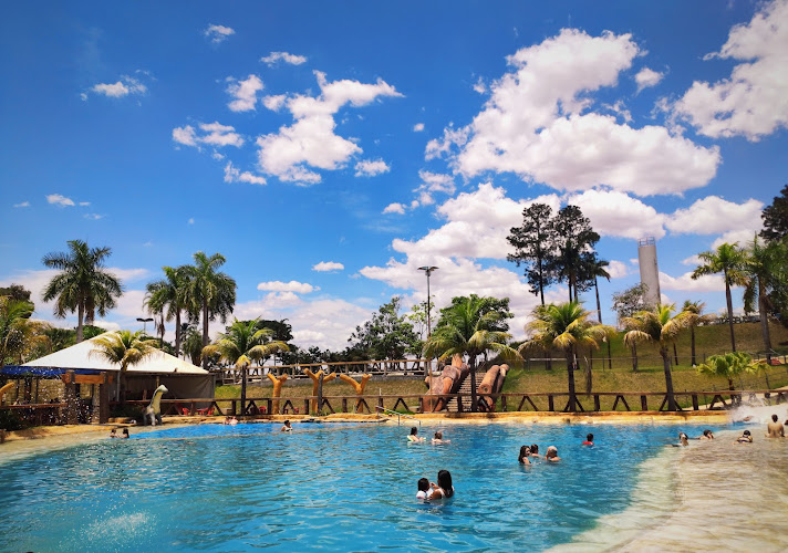
Hot Planet Thermas Park
Araça
BLUMATUR Excursões e Turismo
Find Accommodations Nearby
Recommended Tours & Activities
Visitor Reviews
There are no reviews yet. Be the first one to write one.
Share Your Experience
Have you visited Araçatuba Facts? Help other travelers by leaving a review.