La Aguadita – Parque San Rafael
About La Aguadita – Parque San Rafael
Key Features
More Details
Updated April 15, 2024
Una Reserva Natural de Hadas – Parque san Rafael – La Aguadita Cundinamarca
## La Aguadita – Parque San Rafael (Fusagasugá): what to expect on this short-and-steep nature hike
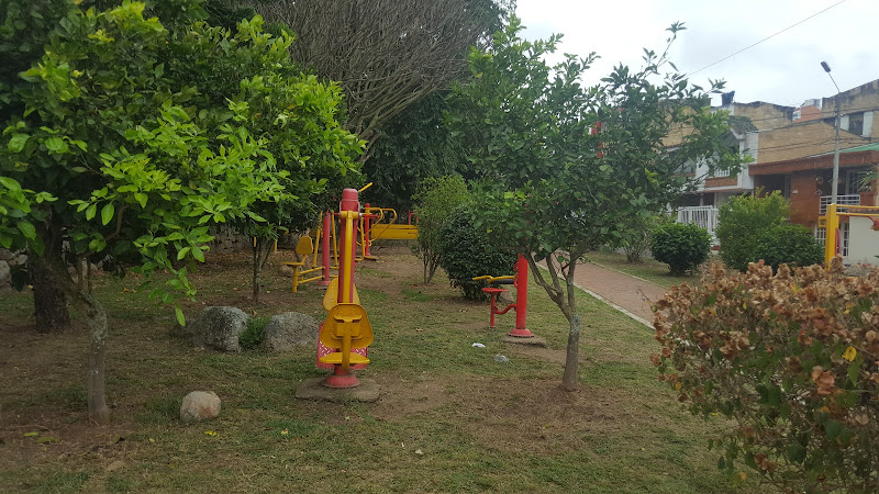
La Aguadita – Parque San Rafael is a hiking area tied to the rural corregimiento of La Aguadita in Fusagasugá, Cundinamarca, Colombia. Your coordinates (4.3766094, -74.3014182) put it in the Andean foothills south of Bogotá, where cloud-forest humidity, water sources, and slick stone are the realities you plan around—not an afterthought.
What makes this walk worth it is simple: you’re heading toward a municipal ecological reserve known for water and forest protection, and the on-the-ground experience tends to revolve around a waterfall/cascade, shaded trails, and thick vegetation.
### Quick facts (from your dataset)
– Name: La Aguadita – Parque San Rafael
– Type: Hiking area
– City/Area: Fusagasugá (La Aguadita), Cundinamarca, Colombia
– Coordinates: 4.3766094, -74.3014182
– Rating: 4.6
## Why locals treat San Rafael as more than “just a hike”
The most useful official framing is that this park was created by municipal agreement (May 28, 2004) as an ecological reserve with landscape value and water richness, connected to the Sumapaz region’s water systems and aquifer recharge. That matters for visitors because it explains why the experience is water-forward: springs, wet ground, mossy rock, and runoff are part of the terrain, especially after rain.
On Cundinamarca’s official tourism listing, the park is positioned as a nature-and-landscape stop with activities/services like:
– Flora & fauna observation
– Trekking
– Rest space
– Meditation
– Pet entry (noted as allowed on the listing)
## What you’ll likely see on the trail
Independent hiking operators and route logs consistently describe this area as a waterfall + pool/pozo style destination, with mossy rock formations and well-preserved native vegetation. Aire Libre
One practical detail that shows up in route descriptions: hikers warn against doing the route in heavy rainy conditions because descents can get sketchy—a common issue on narrow, wet, irregular Andean paths. | Rutas del Mundo
## Getting there: what’s confirmed vs what you should verify
### Confirmed (official contact + municipality channel)
The official DeTour Cundinamarca listing provides the municipality contact point tied to Fusagasugá, including:
– Address: Calle 6 No. 6–24, Fusagasugá
– Phone: (+57)(1) 886 8181
– Email: [email protected]
– Website: fusagasuga-cundinamarca.gov.co
If you want the cleanest “single source of truth” before you go—especially for access conditions after storms—use those channels.
### Needs verification (flagged as potentially outdated or variable)
I did not find a reliable, consistently maintained official page that publishes current entrance rules, trail closures, or day-by-day opening hours for the park itself. Many third-party pages and tour operators exist, but they can drift out of date quickly for parks like this.
Action: confirm same-day access and any restrictions by contacting the municipality using the details above.
## When to go (practical terrain reality, not vibes)
Because the experience is tied to water and shaded rock, your biggest comfort and safety swing factor is rainfall timing. Route notes explicitly advise caution or avoidance in “winter” (rainy season conditions) due to slippery descents. | Rutas del Mundo
If you’re choosing a day:
– Prefer dry morning weather windows (you want traction and visibility).
– If it has rained hard in the previous 24–48 hours, assume mud + higher flow + slick stone and adjust pace and footwear accordingly.
## What to pack (what actually changes outcomes here)
This is where people get it wrong: they pack for “a short hike” and forget they’re walking into a damp microclimate.
Bring:
– Trail shoes with real grip (not flat soles).
– Light rain layer even if the forecast looks calm (humid forests generate their own surprises).
– Water + snacks (multiple tour itineraries mention long stretches without nearby shops on-trail). Natural
– Dry bag / zip bag for phone + documents (spray near cascades is real).
– Basic first aid: blister care + antiseptic wipes.
If you plan to get in the water near a cascade/pool, prioritize traction and stable footing over “swim convenience.” Wet rock turns minor slips into bad days fast.
## Safety and etiquette that people don’t say out loud
– Stay on established paths near water features. Unmarked shortcuts are where ankles go to die.
– Don’t push to the “bigger waterfall” if it requires an unmarked descent unless you’re confident reading terrain and have enough daylight. Some visitor write-ups mention that certain waterfall access is harder and not clearly signposted. (Treat that as a caution, not a guarantee.)
– Leave-no-trace rules apply harder in water reserves. If the point is water protection, your job is to not add soap, food waste, or litter to runoff.
## Inclusivity and access notes (what’s known, what isn’t)
– I did not find official accessibility details (surface type, slope grades, wheelchair suitability, railings) on the official listing.
– Given it’s explicitly categorized as trekking and associated with waterfalls/forest terrain, plan for uneven natural surfaces unless confirmed otherwise by the municipality contact.
If you’re traveling with someone who needs predictable footing or minimal elevation change, confirm route conditions before committing.
## A simple on-site plan (to avoid the classic “we came unprepared” loop)
1. Start early to buffer weather and to leave margin for slow, careful descents.
2. Move steady, not fast—slips happen when pace exceeds traction.
3. Pick a turnaround time (not “when we feel like it”), especially if clouds build.
4. Save time for the waterfall area: even if you don’t swim, it’s usually the highlight.
## Internal links (can’t be added without your site structure)
You asked for two contextual internal links; I can’t add them responsibly without knowing the exact RealJourneyTravels.com URL structure (and you requested only information I’m fully sure about). If you drop your preferred Colombia category URL pattern (even one example slug), I’ll weave in two clean, contextual links in-line without guessing.
Table of Contents
Key Highlights
La Aguadita – Parque San Rafael
Location
Places to Stay Near La Aguadita - Parque San Rafael
Find and Book a Tour
Explore More Travel Guides
No reviews found! Be the first to review!
Traveler Reviews for La Aguadita – Parque San Rafael
There are no reviews yet. Be the first one to write one.
Have you visited La Aguadita – Parque San Rafael? Help other travelers by sharing your review.
You Might Also Like
Finca fusa
Desierto Del Checua (Tatacoita)
Abuelos Fusagasuga Park
Find Accommodations Nearby
Recommended Tours & Activities
Visitor Reviews
There are no reviews yet. Be the first one to write one.
Share Your Experience
Have you visited La Aguadita – Parque San Rafael? Help other travelers by leaving a review.