Chestnut Ridge Trail
About Chestnut Ridge Trail
Key Features
More Details
Updated June 11, 2025
## Hiking the Chestnut Ridge Trail Near Roanoke, Virginia
Chestnut Ridge Trail is one of Roanoke’s classic forest loops: a moderate, mostly shaded path that circles Roanoke Mountain just off the Blue Ridge Parkway. It’s close enough to downtown for a quick half-day outing but long enough to feel like a proper backcountry hike.
The trail is managed by the National Park Service as part of the Blue Ridge Parkway corridor and is widely described as a figure-eight loop encircling the Roanoke Mountain Campground. Park Service
—
## Chestnut Ridge Trail at a Glance
Based on National Park Service, state wildlife, and local trail data, you can expect roughly the following for the main loop:
– Location: Mill Mountain Spur Road off the Blue Ridge Parkway, near Roanoke, Virginia Park Service
– Length: Most official and local sources list the loop around 5.4 miles; some hiking platforms round it to 5.7–6 miles depending on GPS tracks and side spurs. Park Service
– Elevation gain: Approximately 650–800 feet of cumulative ascent, spread across several hills.
– Difficulty: Generally rated moderate (easy–moderate if you’re used to climbing in the Blue Ridge). Park Service
– Surface: Natural dirt path, wide and well-graded for much of the way.
– Use: Hiking and horseback riding; bikes are not allowed on this Parkway trail. Park Service
– Dog policy: Dogs are allowed but must be kept on a leash under local trail rules.
– Trail rating: Hiking platforms such as AllTrails currently show ratings around 4.5/5 from several hundred reviews, reflecting a consistently positive experience for most hikers.
Because the trail is a figure-eight, you can opt for shorter loops of roughly 2.5–3.4 miles if you don’t want to commit to the full circuit.
—
## Where Exactly Is Chestnut Ridge Trail?
Chestnut Ridge Trail runs around Roanoke Mountain, just off the Blue Ridge Parkway southeast of downtown Roanoke. The most commonly cited access is from the Chestnut Ridge Overlook along Mill Mountain Spur Road near Parkway milepost 120.5. Park Service
Official directions typically follow this pattern:
1. From Roanoke, take I-581/US-220 South.
2. Follow signs for the Blue Ridge Parkway and merge onto the Parkway heading north.
3. Continue to approximately milepost 120.5.
4. Turn right on Mill Mountain Spur Road and drive about 1–1.1 miles to the Chestnut Ridge Overlook parking area, where trail access is signed.
There are also connections from the Roanoke Mountain Campground and from city parks like Fern Park, which has a 1.8-mile multiuse connector trail into the Chestnut Ridge system and broader Mill Mountain trail network. Parks And Recreation
—
## Trail Layout: Figure-Eight Loops and Route Options
Trail descriptions from local hiking organizations and outdoor magazines agree that Chestnut Ridge forms a figure-eight loop encircling Roanoke Mountain Campground.
### Main 5.4-Mile Loop
– The “standard” outing follows the full outer loop, roughly 5.4 miles long.
– Expect rolling terrain with multiple short climbs rather than one big ascent.
– The trail crosses Mill Mountain Spur Road twice and intersects several short side paths leading to the campground, which is why distances vary slightly between guidebooks and GPS tracks.
### Shorter Loop Options (2.5–3.4 Miles)
Roanoke Outside and other local resources note that the inner part of the figure-eight can be used to cut the hike down to around 2.5 or 3.4 miles.
These shorter loops are useful if:
– You’re hiking with younger kids or mixed-ability groups.
– You want a trail run in the 30–60 minute range.
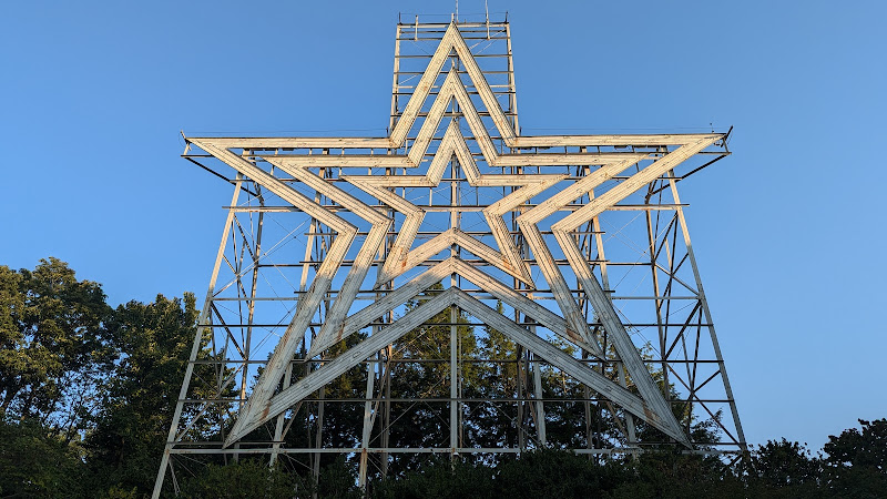
– You’re adding Chestnut Ridge onto a longer day that includes Mill Mountain or the Roanoke Star.
### Connector Routes
Several connectors turn Chestnut Ridge into part of a larger Blue Ridge Parkway outing:
– Fern Park Trail → Chestnut Ridge loop is mapped at roughly 4.2–4.4 miles with about 400–600 feet of gain, giving South Roanoke residents a car-free route into the trail system. Parks And Recreation
– Trails from Mill Mountain and the Ridgeline Trail also tie into Yellow Mountain Road and the Chestnut Ridge network, making it easy to string together a custom loop.
—
## What You’ll Experience on the Trail
### Classic Blue Ridge Forest
Several official and local descriptions converge on the same picture: Chestnut Ridge winds through eastern hardwood forest dominated by large oaks and maples, with an understory of mountain laurel, rhododendron, and galax in places.
That translates, in practice, to:
– Deep shade for much of the hike, especially helpful in summer.
– Seasonal wildflowers and blooming shrubs in late spring.
– Leaf-littered singletrack and a canopy of color during fall foliage season.
Virginia’s wildlife department notes that the 5.4-mile route “meanders” through this forest, with brush piles and understory providing habitat for birds and small mammals. Wildlife Resources
### Views and Vistas
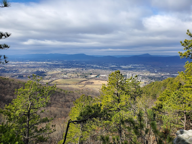
This is primarily a forest loop rather than a big-view summit hike. However:
– There are limited winter views of the Roanoke Valley and nearby communities such as Gum Spring from sections of the ridge, especially when leaves are down.
– Power-line clearings and openings along the ridge provide occasional glimpses of the Blue Ridge Mountains and surrounding hills, as shown in many recent trail photos.
If you want huge vistas, combine Chestnut Ridge with a separate day on nearby McAfee Knob or Dragon’s Tooth; those Appalachian Trail classics deliver the cliff-edge panoramas, while Chestnut Ridge retains a quieter, woods-focused feel.
### Who the Trail Suits
From trail descriptions and user feedback, Chestnut Ridge works especially well for:
– Trail runners looking for a soft-surface loop close to town with manageable elevation.
– Families and newer hikers wanting something more substantial than a city greenway but less committing than a strenuous AT climb. Wildlife Resources
– Dog owners and equestrians, thanks to leash-friendly policies and horse-compatible trail design (wide tread, moderate grade, no tight rock scrambles). Park Service
—
## When to Hike Chestnut Ridge
The trail is generally accessible most of the year, but each season offers a different character:
– Spring:
– Blooming mountain laurel, rhododendron, and understory plants.
– Cooler temperatures and good footing before summer storms create muddier patches.
– Summer:
– The leafy canopy provides strong shade, one reason local wellness guides recommend Chestnut Ridge as a relatively low-impact warm-weather hike.
– Expect humidity and insects; a head net or repellent can make the experience more comfortable.
– Autumn:
– Oaks and maples turn the ridge into a fall-color corridor, with leaf-lined singletrack underfoot. Wildlife Resources
– Winter:
– Leaf-off conditions mean better valley views through the trees and cooler, clearer air, but ice and snow may linger on shaded slopes after storms.
Always check Blue Ridge Parkway and NPS alerts before you go, particularly in winter and early spring when road or trail closures sometimes occur. Park Service
—
## Safety, Regulations & Inclusivity Notes
To give everyone a safe and respectful experience, several agencies and trail groups outline consistent rules for Chestnut Ridge and related Blue Ridge Parkway trails:
– No bicycles on the Chestnut Ridge Trail; it’s designated for hikers and horseback riders.
– Dogs must be on a leash. This is reinforced by Roanoke Outside, Roanoke Valley Greenways, and wellness guidance from Virginia Tech’s medical school newsletter.
– Pack out all waste, including dog waste; leave no trace principles are strongly emphasized.
– No camping or fires directly along this loop; camping options exist at Roanoke Mountain Campground nearby when open. Park Service
### Terrain and Accessibility
– The tread is natural dirt, sometimes rooty or rocky, with multiple short climbs and descents. Wildlife Resources
– Roanoke Valley Greenways notes that the trail is not wheelchair accessible, which is consistent with its surface and grade.
– For hikers with limited mobility, shorter segments from the overlook or campground may be more manageable than committing to the full loop.
If anyone in your group has balance, vision, or stamina considerations, plan for extra time, trekking poles, and frequent rest stops—especially on the hillier stretches highlighted by local running guides. Junkies L.L.C.
—
## How to Combine Chestnut Ridge With a Roanoke Trip
Because the trailhead is roughly a 10-minute drive from downtown Roanoke, it slots neatly into a weekend in the city. Ideas:
– Start the day with an early lap around Chestnut Ridge, then explore more Parkway viewpoints or the Roanoke Star and Mill Mountain Park via nearby trails and overlooks.
– Pair your hike with a downtown walking tour, museums, and breweries featured across Roanoke’s tourism and outdoor-adventure resources.
On RealJourneyTravels.com, Chestnut Ridge would fit naturally into a hub article such as Blue Ridge Parkway hikes near Roanoke and a city guide like things to do in Roanoke, Virginia—ideal internal links for readers planning a broader Virginia Mountains itinerary.
—
## Data Accuracy & What Might Be Outdated
A few important caveats about the information above:
Table of Contents
Key Highlights
Chestnut Ridge Trail
Location
Places to Stay Near Chestnut Ridge Trail"A great hiking trail whether you complete it or do sections."
Find and Book a Tour
Explore More Travel Guides
No reviews found! Be the first to review!
Traveler Reviews for Chestnut Ridge Trail
There are no reviews yet. Be the first one to write one.
Have you visited Chestnut Ridge Trail? Help other travelers by sharing your review.
You Might Also Like
Mill Mountain Park
Read Mountain Preserve
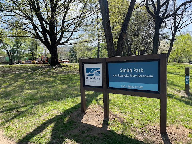
Smith Park
Find Accommodations Nearby
Recommended Tours & Activities
Visitor Reviews
There are no reviews yet. Be the first one to write one.
Share Your Experience
Have you visited Chestnut Ridge Trail? Help other travelers by leaving a review.