Carrollton Blue Trail
About Carrollton Blue Trail
Key Features
- Paved, multi-use trail suitable for walkers, runners, strollers and cyclists
- Follows Furneaux Creek through the Nob Hill Greenbelt with tree canopy and native plants
- Connections to parks, playgrounds, athletic fields and nearby neighborhoods
- Accessible entry points and generally gentle grades (wheelchair-friendly sections)
- Wayfinding and links to Carrollton’s wider trails network and master plan routes
More Details
Updated June 11, 2025
Carrollton Nob Hill Greenbelt: Blue Trail, Texas – 659 Reviews, Map …
## Carrollton Blue Trail Guide: Paved Greenbelt Escape in Carrollton, Texas
The Carrollton Blue Trail is a paved, multi-use greenbelt path that follows Furneaux Creek through the Nob Hill Greenbelt and up toward Hebron Parkway in Carrollton, just north of Dallas. The section around 1971–1979 E Peters Colony Road (33.0069594, -96.8823957) is one of the most popular entry points, and the trail is typically rated around 4.6 out of 5 on major review platforms for its scenery and ease.
Locals use it for sunrise walks, after-work runs, bike rides, and dog-walking along ponds, small lakes, and a tree-lined creek. The route is part of Carrollton’s broader trail network, so you can customize anything from a short stroll to a longer fitness route.
—
## Quick Facts About the Carrollton Blue Trail
– Location: Nob Hill Greenbelt / Furneaux Creek corridor, Carrollton, Texas
– Main mapped access: 1971–1979 E Peters Colony Rd, Carrollton, TX 75007 (Nob Hill Greenbelt area)
– Coordinates: 33.0069594, -96.8823957
– Trail type: Paved, multi-use greenbelt trail following Furneaux Creek with ponds and a small lake.
– Approximate length:
– City and mapping sources describe a continuous Blue Trail corridor of about 5–5.25 miles between the Trinity Mills/Dickerson area in the south and Hebron Parkway/Arbor Creek in the north.
– Common walking and running routes are logged at about 6.8–7.8 miles round-trip with roughly 100–140 ft of elevation gain, and an “easy” difficulty rating.
– Surface: Concrete/cement path, painted with a blue line in many sections.
– Typical use: Walking, running, casual cycling, skating, and family outings.
– Dog policy: Dogs are allowed but must be kept on leash and owners are expected to pick up waste.
– General hours: Nob Hill Greenbelt, which the Blue Trail passes through, is currently posted with park hours of 5:30 a.m. to 10 p.m. daily; individual access points may differ.
Because conditions, signage, and route lengths can change, it’s worth checking recent information from the City of Carrollton or a current trail app before you go.
—
## What the Carrollton Blue Trail Is Like
### Route and scenery
Historically, the Blue Trail was built as a north–south spine through Carrollton’s greenbelt system. It runs along ponds and Furneaux Creek in the Nob Hill Greenbelt, passes under bridges like Josey Lane, and continues past Peters Colony and Rosemeade Parkway before reaching the Hebron area.
Key characteristics:
– Water views: Several stretches follow ponds and a small lake where people frequently report seeing turtles and water birds.
– Gentle terrain: Elevation gain over a full out-and-back is roughly 100 ft, so it feels mostly flat with gradual rises—comfortable for steady walking and beginner runners.
– Suburban greenbelt feel: The trail weaves between residential neighborhoods and green spaces, with occasional street crossings but long off-road sections alongside the creek.
– Multi-use path: The concrete surface and painted blue center line are designed to separate directional traffic, making it practical for walkers, runners, cyclists, and skaters at the same time.
Carrollton’s parks department has specifically mentioned enhancing the Blue Trail corridor with wildflower plantings, natural areas, and even a parallel nature trail along parts of Furneaux Creek, so expect sections where mown parkland shifts into more natural vegetation.
### Atmosphere and crowd patterns
Reviews consistently describe the area as:
– Well-used by runners, cyclists, families having picnics, and people walking dogs.
– Generally peaceful and scenic, especially along pond sections.
Because this is a suburban trail, it doesn’t feel remote. That’s a plus if you prefer seeing other people around, but you’ll still find quieter stretches away from major road crossings.
—
## Best Sections for Different Types of Visitors
### 1. Short, relaxed walks
For a shorter outing, many people enter around Peters Colony Road where the trail passes a lake and several ponds within Nob Hill Greenbelt.
Why this section works well:
– Water views almost immediately.
– Benches and picnic tables nearby for breaks.
– Easy to follow the blue-painted path for a simple out-and-back before turning around.
### 2. Longer runs and fitness walks
If you’re using the Blue Trail as a training route:
– Common route logs show 6.8–7.8 miles for longer out-and-back or loop combinations, still classified as easy with minimal elevation.
– The corridor between the Trinity Mills/Dickerson area in the south and Hebron & Arbor Creek in the north gives you a nearly continuous paved line to work with, plus connectors into the broader Carrollton Greenbelt system.
Because much of the path is away from vehicle traffic, it’s popular for tempo runs, interval workouts, and longer weekend mileage—just keep an eye out for cyclists and families at peak times.
### 3. Casual cycling, skating, and RC hobbies
The Blue Trail is suitable for:
– Casual cycling: Reviews highlight long, uninterrupted stretches ideal for easy rides rather than technical cycling.
– Skating: The smooth concrete surface with gentle grades makes it viable for rollerblades and similar gear in dry weather.
– RC crawling: One niche use here is remote-control car crawling; an RC community site lists “Carrollton Blue Trail” at Peters Colony as an open RC crawling area, again emphasizing the all-day access and paved corridor.
If you’re using wheels of any kind, the blue center line and trail etiquette signs are there to keep speeds reasonable and interactions predictable.
—
## Seasons, Weather, and Best Time to Go
Carrollton has a humid subtropical climate: hot summers, mild winters, and most rainfall in spring.
### Spring (roughly March–April)
– This is often the most comfortable time to walk the Blue Trail, with warm but not extreme temperatures.
– Local sources highlight spring wildflowers, including bluebonnets in the Nob Hill area and wildflower plantings along the trail.
### Summer
– Daytime highs can be intense, so early morning or late evening outings are more comfortable.
– Mosquitos are frequently mentioned at sunset near the water; insect repellent is strongly recommended.
### Fall and winter
– Fall brings slightly cooler air while keeping the trail fully usable.
– Winters are generally mild in this part of Texas, so the paved path remains walkable most of the year unless there’s ice from a rare winter storm.
—
## Access, Parking, and Amenities
### Main entry points
– Nob Hill Greenbelt / Peters Colony:
The widely referenced address for the Blue Trail is around 1971–1979 E Peters Colony Rd, where you can access the paved path along the lake and ponds.
– Crooked Creek Drive trailhead:
Nob Hill Greenbelt also has access around Crooked Creek Dr, with posted hours and park information.
Along the broader Carrollton Greenbelt, trailheads have been developed to provide:
– Parking
– Trail maps and distance markers
– Amenities like water fountains and, at some locations, restrooms and picnic facilities
Because amenities vary by trailhead and are subject to change, it’s best to check the City of Carrollton’s parks and recreation pages or recent user reviews for current details before you go.
—
## Safety, Inclusivity, and Trail Etiquette
### Accessibility considerations
Documented features that help with accessibility:
– Wide concrete surface with relatively gentle grades.
– Clearly marked path with a painted blue line in many sections.
This design is typically more accommodating for strollers and many mobility aids than unpaved or steep terrain. However, curb cuts, crosswalks, and specific access points differ along the corridor, so anyone with specific accessibility needs should start with a short scouting walk from their chosen trailhead.
### Dog-friendly, with rules
– Dogs are welcome on the Blue Trail but must stay on a leash.
– Owners are asked to pick up pet waste and be mindful around other walkers and dogs.
### General trail etiquette and safety
Carrollton’s trail map and safety guidelines emphasize:
– Keep right except when passing.
– Pass on the left with a clear audible warning (for example, announcing that you’re passing).
– Yield to pedestrians and slower users, especially at busy times.
– Avoid blocking the path by stopping in the middle; step off to the side for breaks.
– Obey traffic signals and use caution at street crossings.
The city has also implemented a trail safety marking system with locator posts along the trails. Each marker corresponds to a specific location address so emergency services can quickly find you if you call 911 and provide the marker ID.
As with any urban trail, crime patterns and conditions can change. Checking recent reviews or local community updates before a late-night or very early outing is a sensible extra step.
—
## Pairing the Blue Trail with Other North Texas Experiences
If you’re using Carrollton as a base, the Blue Trail pairs well with other nearby green and cultural stops that Real Journey Travels already covers:
– Texas Discovery Gardens (Dallas):
A historic, 7.5-acre garden in Dallas’ Fair Park, established in 1940, with themed gardens and an indoor butterfly house. It offers a more curated, educational green space to complement the informal ponds and creekside views of the Blue Trail. Journey Tours & Travels
👉 Texas Discovery Gardens
– European-style towns in Texas:
If the Blue Trail whets your appetite for more regional exploring, Real Journey Travels’ guide to European-inspired towns in Texas spotlights places around the state that channel German, Czech, and other European influences—ideal for a weekend beyond Dallas–Fort Worth. Journey Tours & Travels
👉 European Towns in Texas
—
## A Note on Data and Updates
Key details in this guide come from:
Table of Contents
Key Highlights
- Paved, multi-use trail suitable for walkers, runners, strollers and cyclists
- Follows Furneaux Creek through the Nob Hill Greenbelt with tree canopy and native plants
- Connections to parks, playgrounds, athletic fields and nearby neighborhoods
- Accessible entry points and generally gentle grades (wheelchair-friendly sections)
- Wayfinding and links to Carrollton’s wider trails network and master plan routes
Location
Places to Stay Near Carrollton Blue Trail"One of my favorite things to do is get up at sunrise and walk this trail."
Find and Book a Tour
Explore More Travel Guides
No reviews found! Be the first to review!
Traveler Reviews for Carrollton Blue Trail
There are no reviews yet. Be the first one to write one.
Have you visited Carrollton Blue Trail? Help other travelers by sharing your review.
Nearby Attractions
You Might Also Like
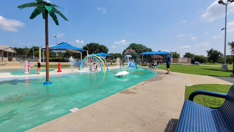
W. J. Thomas Park, Aquatic Complex & Sports Field

Furneaux Lane Park
Clifford E 'Bill' Hall Park
Find Accommodations Nearby
Recommended Tours & Activities
Visitor Reviews
There are no reviews yet. Be the first one to write one.
Share Your Experience
Have you visited Carrollton Blue Trail? Help other travelers by leaving a review.