Bañadero Baywalk
About Bañadero Baywalk
Key Features
More Details
Updated June 11, 2025
## Bañadero Baywalk, Tanauan (Batangas): Quiet Taal Lake Views, Golden-Hour Walks, and Local Eats
Bañadero Baywalk sits on the Tanauan City shoreline of Taal Lake, directly facing the volcano island. It’s a simple, low-key promenade—no theme-park frills—just wide lake views, changing light, and the steady pulse of lakeside life. If you want a calm vantage point on Taal without Tagaytay crowds or price tags, this is it.
– Location: Bañadero, Tanauan City, Batangas
– Map/Plus Code: 33M6+5VW, Tanauan, Batangas (pin typically labeled “Bañadero Baywalk”).
– Coordinates: 14.0829907, 121.0621905 (Tanauan shoreline)
– Good to know: Local pages note boat rides and food stands operate at the baywalk during fair weather/weekends. Operations vary with lake conditions.
—
### Why Go: The Case for Tanauan’s Lakeside Promenade
1) Serious golden-hour payoff. The baywalk faces west across the lake, which means sunset color when conditions cooperate. Field reports in 2024 called out Bañadero Baywalk as a solid spot for golden hour to sunset sequences—muted on hazy days, vivid when the air is clear. Bring a mid-range focal length (35–85mm) for compressed layers of lake–island–sky. Shoestring Diaries
2) Ground-level perspective on Taal. Tagaytay delivers height and drama; Bañadero gives you shore-level intimacy with the waterline, small fishing bancas, and the volcano aligned almost dead center across the bay. Local coverage regularly showcases visitors watching steaming bursts from here (when activity occurs).
3) Low-effort, family-friendly stroll. The promenade is flat and straightforward—easy for mixed-ability groups, strollers, and casual walkers. When vendor stalls are active, you can grab snacks without leaving the path. (Vending is informal; expect variability.)
—
### Situational Awareness: Volcano Status, Air, and Access (Updated November 2025)
Taal is an active volcano. As of early November 2025, PHIVOLCS maintains Alert Level 1 (Low-level unrest). Minor phreatic/phreatomagmatic bursts did occur in late October; advisories emphasize avoiding Taal Volcano Island itself and staying alert to vog/SO₂ exposure when winds carry gas toward lakeside towns. The mainland baywalk area is outside the permanent danger zone, but conditions change—check the latest PHIVOLCS bulletin before you go.
> How to check: PHIVOLCS’ live bulletins list the current alert level and the last 24-hour observations. If you or someone in your group has asthma or respiratory sensitivities, avoid visiting during vog episodes or bring masks.
—
### Getting There
By car from Metro Manila (fastest when traffic is light):
– Take SLEX → STAR Tollway toward Batangas; exit for Tanauan/Laurel, then follow local roads to Bañadero waterfront.
– For precise routing, navigate directly to “Bañadero Baywalk, Tanauan City”; Waze keeps an active pin and live-traffic pathing.
Without a car:
– Bus or van to Tanauan City (Batangas), then a local tricycle to Bañadero Baywalk. Confirm drop-off at the waterfront promenade; drivers know the spot.
—
### On-Site: What to Expect
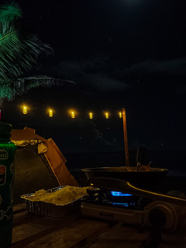
Promenade + lake edge. A concrete/boardwalk-style path (segments may vary by section/maintenance) fronting the lake. You’ll meet walkers, joggers, families, cyclists, and anglers. Weekends are livelier.
Boat rides (weather-dependent). Local operators advertise short lake jaunts. These are not to the volcano island (entry is prohibited at any alert level where PHIVOLCS restricts it). Rates aren’t standardized; ask total price, route, and duration up front and wear a life vest.
Food + kiosks. Expect snack stalls (grilled skewers, cold drinks) when active; options thin out on rainy weekdays. Bring water if you plan a longer stay.
Bathrooms. Public restrooms are limited and sometimes closed; plan ahead (nearby eateries or gas stations before arriving).
Photography notes.
– Sunset window: ~45 minutes before to 15 minutes after official sunset for color shift on the water.
– Wind/vog: If wind carries gas toward Tanauan, visibility and comfort drop. Check advisories; a clear-air morning can also be beautiful when the lake is glassy.
—
### Best Time to Visit
– Late afternoon to sunset for light and temperature. Dry months (roughly Dec–May) trend clearer, but October–January can bring crisp post-rain visibility after squalls.
– Weekdays for a quieter walk; weekends for more vendors and community vibe.
– Rainy/hot tips: Shade is limited—use sun protection; pack a compact umbrella for pop-up showers.
—
### Safety & Inclusivity Checklist
– Volcano island off-limits: Do not attempt any private boat landing on Taal Volcano Island; it’s an enforced no-go when alert levels and regulations restrict access (which is typical). Mainland viewing from the baywalk is fine unless authorities issue specific shoreline advisories.
– Air quality: People with respiratory conditions may be sensitive to vog; carry masks and avoid visiting during advisories. Check same-day bulletins.
– Mobility: The path is largely flat. Some sections can have uneven joints or pooled water after rain—watch footing and roll wheels cautiously.
– Lighting: After dark, stick to lit sections and go with a group if possible.
—
### Nearby Add-Ons (Easy Pairings)
– Apolinario Mabini Shrine (Tanauan City): A compact, meaningful stop for Philippine history on the life and writings of Mabini. Many Tanauan hotel/guide pages suggest pairing this with lake views.
– Tagaytay Ridge (Cavite): Elevated ridge viewpoints across the lake—combine Ridge panoramas by day with Bañadero sunset at ground level for two distinct photo sets. (Multiple reports compare the two vantage types.) Shoestring Diaries
—
### Practical Itinerary (Half-Day)
1) Arrive 90 minutes before sunset to park, scout compositions, and secure snacks.
2) Walk the length of the promenade to find foreground interest (bancas, ripples, railings) for leading lines toward the volcano.
3) Stay 15–20 minutes after sunset for blue hour when water goes slate-blue and city lights glint.
4) Dinner in Tanauan or head toward Tagaytay/Laurel.
—
### Where to Stay
There’s no hotel on the promenade itself. If you’re basing nearby, platforms list stays in Tanauan/Laurel/Tagaytay; check recent reviews and driving times. Big OTAs also reference Bañadero Baywalk when searching Tanauan. (Always verify pin location and parking.)
—
### What’s Changed Recently (and What Might Be Outdated)
– Volcano Activity: Minor eruptions and gas episodes occurred in late October 2025; Alert Level 1 holds as of early November 2025. Expect periodic vog and short-notice advisories; these conditions change—consult PHIVOLCS the morning of your visit.
– On-site Vendors/Boats: Local pages show boat rides and food stalls but do not guarantee daily operation. Treat as seasonal/variable (weather, weekends, holidays).
—
### Bottom Line
If you want a no-nonsense, ground-level view of Taal with room to breathe, Bañadero Baywalk delivers. Time it for golden hour, keep an eye on PHIVOLCS updates, and roll with the informal vendor/boat scene. For photographers and families who prefer calm waterlines over crowded ridges, this promenade is a smart, accessible add to any South Luzon day trip. Shoestring Diaries
Fact-check anchors used in this guide: public listing for the Bañadero Baywalk pin (+Code 33M6+5VW), local page notes on boats/food, on-the-ground sunset reports, major-OTA attraction references, and PHIVOLCS alert-level sources (Nov 2025).
Table of Contents
Key Highlights
Bañadero Baywalk
Location
Places to Stay Near Bañadero Baywalk"Relaxing place to go with great views of Taal lake and volcano."
Find and Book a Tour
Explore More Travel Guides
No reviews found! Be the first to review!
Traveler Reviews for Bañadero Baywalk
There are no reviews yet. Be the first one to write one.
Have you visited Bañadero Baywalk? Help other travelers by sharing your review.
You Might Also Like
Camp Baybayon Beach Resort
boot tanauan viewdeck
Guntian
Find Accommodations Nearby
Recommended Tours & Activities
Visitor Reviews
There are no reviews yet. Be the first one to write one.
Share Your Experience
Have you visited Bañadero Baywalk? Help other travelers by leaving a review.