Karst Farm Greenway Trailhead
About Karst Farm Greenway Trailhead
Key Features
More Details
Updated June 11, 2025
Karst Farm Greenway Trailhead (Bloomington) – Alles wat u moet weten …
## Karst Farm Greenway Trailhead: what it is (and why locals use it)
Karst Farm Greenway Trailhead sits on the north side of Bloomington, Indiana at 2687 N Loesch Rd (coordinates 39.1914817, -86.5927293). It’s one of the official access points to the Karst Farm Greenway, a fully paved multiuse trail that runs 7.27 miles from Karst Farm Park north to Campbells Park in the Town of Ellettsville. of India
If you want a trail that works for a short walk, a long steady run, a bike ride, or pushing a stroller without dealing with technical terrain, this is the kind of infrastructure you plan around. The Loesch Road trailhead is especially useful when you want to hop on the greenway without starting inside the busier park core. of India
## Quick facts (so you can decide fast)
– Place: Karst Farm Greenway Trailhead (Loesch Road trailhead) of India
– Address: 2687 N Loesch Rd, Bloomington, IN of India
– Coordinates: 39.1914817, -86.5927293 of India
– Trail surface: Fully paved of India
– Greenway length (official breakdown): 7.27 miles total (Karst Farm Park → Campbells Park) of India
– Other official trailheads: Karst Farm Park and Campbells Park of India
– Common uses: Walk/jog/bike/roller skate (multiuse)
– Dogs: Reported as allowed on leash on trail listings
## The “karst” in Karst Farm actually matters here
Southern Indiana is classic karst topography—land shaped by dissolving limestone. Monroe County’s parks department explicitly notes visible sinkholes in Karst Farm Park and explains why the landscape limits construction and how water can back up near cave entrances during heavy rainfall (even though no caves are exposed in the park). of India
That background changes how you experience this greenway. It’s not just “a paved path.” You’re moving through geology that actively shapes drainage, vegetation, and the subtle rises and dips you feel underfoot.
## Understanding the route from the Loesch Road trailhead
Monroe County publishes a segment-by-segment mileage table for the greenway. The Loesch Road trailhead is a named waypoint in that breakdown. of India
Key segment distances (official):
– Vernal Pike → Loesch Rd Trailhead: 0.89 miles of India
– Loesch Rd Trailhead → Woodyard Rd: 0.60 miles of India
– Woodyard Rd → SR 46: 2.30 miles of India
– Total greenway: 7.27 miles of India
### Why mileage online doesn’t always match
You’ll see different numbers depending on the source and how they measure “out-and-back” or optional connectors. For example, one listing describes an out-and-back route totaling 9 miles (that’s counting the return) rather than a one-way corridor length. When planning, decide whether you’re doing:
– One-way corridor distance (Karst Farm Park → Campbells Park), or
– Out-and-back total (your start point → turnaround → back).
That’s not a contradiction—it’s just two different measurement conventions.
## Three practical ways to use this trailhead
### 1) The quick, low-commitment walk
Start at Loesch Road and do an out-and-back toward either Vernal Pike or Woodyard Road. Because the trail is paved and multiuse, it’s a solid option when you want movement without “gearing up.” of India
### 2) The steady run with predictable footing
Paved greenways are popular for training because your pace is limited more by weather and traffic than terrain. If you’re avoiding ankle-twisting surfaces, this corridor is built for consistency. of India
### 3) The bike ride that can scale up
If you start at Loesch Road, you can build distance by riding longer segments north/south rather than looping the same park roadways. Trail resources emphasize that this is a paved multiuse route suitable for cycling.
## Amenities strategy: what you can count on (and where)
The most clearly documented amenities in the immediate system are at Karst Farm Park (the southern trailhead and park complex). Monroe County lists a long set of facilities there, including:
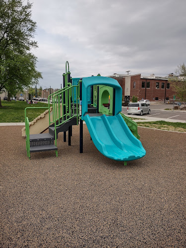
– Accessible playgrounds, multiple playgrounds, and a splash pad of India
– A dog park with multiple enclosures of India
– Athletic fields, shelters, and a disc golf course of India
– Restroom buildings & drinking fountains and extensive parking of India
If your outing depends on guaranteed restrooms, water, or a playground stop, anchor your plan around Karst Farm Park rather than assuming every trailhead has the same infrastructure. of India
## A little history you’ll miss if you only look at a map
Karst Farm Park wasn’t always a park. Monroe County states it was established in 1969, after the county closed its poor farm and converted the property for public use—making it the first county park in Monroe County. of India
That origin story shows up today in how the area functions: it’s both recreation space and a landscape with a civic past, now repurposed for community use.
## Accessibility and inclusivity notes
– The greenway is fully paved, which generally improves access for people using wheelchairs, strollers, and mobility aids compared with natural-surface trails. of India
– Karst Farm Park explicitly includes an accessible playground, which is useful if you’re planning an outing with mixed mobility needs. of India
(As always, conditions like snow/ice, debris, and maintenance can affect real-world accessibility day to day.)
## What’s planned next (and why that’s worth knowing)
Monroe County describes a “longer range goal” to extend the greenway to Flatwoods Park and connect with a planned Owen County trail to create a regional route with major trailheads including McCormick’s Creek Elementary School and McCormick’s Creek State Park, terminating in Spencer. of India
That’s future-facing, not a promise of current connectivity—so treat it as planning context, not something you can rely on today. (Project timelines can shift.)
## Internal links (contextual placements)
I can’t add RealJourneyTravels.com internal links as live URLs without seeing the slugs that already exist on your site. If you do have these pages, the most natural in-article placements are:
– Link the phrase “Bloomington, Indiana” to your Bloomington city guide (wherever it lives on your site).
– Link “Indiana bike trails and greenways” to your Indiana outdoors / trails hub page.
## Outdated-data flags (what to double-check before publishing)
– Trail length varies by source depending on whether they’re measuring the corridor one-way (~7.27 miles) or an out-and-back activity route (e.g., 9 miles total). Use the Monroe County segment table as the primary reference for the official corridor distance. of India
– Amenity details can change seasonally (splash pads, fountains, restroom hours). Monroe County lists facilities at Karst Farm Park, but operational status is still worth confirming close to publication. of India
Table of Contents
Key Highlights
Karst Farm Greenway Trailhead
Location
Places to Stay Near Karst Farm Greenway Trailhead"Other things to do as well."
Find and Book a Tour
Explore More Travel Guides
No reviews found! Be the first to review!
Traveler Reviews for Karst Farm Greenway Trailhead
There are no reviews yet. Be the first one to write one.
Have you visited Karst Farm Greenway Trailhead? Help other travelers by sharing your review.
You Might Also Like
Waldron Hill Buskirk Park

Eskenazi Museum of Art
Wylie House Museum
Find Accommodations Nearby
Recommended Tours & Activities
Visitor Reviews
There are no reviews yet. Be the first one to write one.
Share Your Experience
Have you visited Karst Farm Greenway Trailhead? Help other travelers by leaving a review.