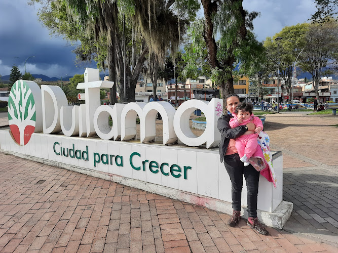
Duitama
About Duitama
Key Features
More Details
Updated April 16, 2024
Pueblito Boyacense: parada imperdible en Duitama | Blogs El Tiempo
## Duitama, Boyacá: a practical base for exploring Colombia’s highland heartland
Duitama is a mid-sized Andean city in Colombia’s Boyacá Department, positioned on the Cordillera Oriental and connected to the Bogotá–Tunja–Duitama corridor. Your coordinates (5.8268951, -73.0329273) place it in the highlands where the air is cooler, the sun is strong, and day trips can be surprisingly varied—heritage towns, independence-history sites, hot springs, and one of Colombia’s most important high-altitude lakes. Britannica
### Quick facts you can plan around (high confidence)
– Elevation: sources vary slightly—around 2,530–2,590 m above sea level depending on reference. Plan for altitude effects either way. Britannica
– Typical temperatures: mild days and cool nights; “average ~15°C” is commonly reported for the city.
– Signature attraction inside the city: Pueblito Boyacense, a purpose-built “mini Boyacá” architectural complex.
– Cycling history: Duitama hosted the 1995 UCI Road World Championships.
> Data-quality flag (conflicting sources): Some local/tourism write-ups describe an early “foundation” in the 1530s, while other references describe the modern city’s establishment in 1819. If you’re publishing a strict historical timeline, treat “founded” claims carefully and cite the specific source you choose.
—
## Why Duitama is worth your time (even if you don’t “do cities”)
Duitama works best as a logistics base: you can sleep at altitude, eat well, and pivot in multiple directions without changing hotels nightly. It’s also a useful contrast to Boyacá’s smaller colonial towns—more services, more transport options, and faster access to practical needs (ATMs, pharmacies, gear, etc.). The payoff is day-tripping out to the places people actually talk about when they say “Boyacá.”
—
## Getting to Duitama without drama
### By road (most common)
Duitama sits on the Bogotá–Tunja–Duitama route corridor, commonly referenced as part of the Troncal Central del Norte / Ruta Nacional 55 network.
A practical way to plan is to treat Tunja as the pivot: Duitama ↔ Tunja is typically listed around an hour by road, depending on traffic and operator.
### What to expect at altitude
At ~2.5 km elevation, visitors who are sensitive to altitude may feel it—especially if arriving straight from low elevations. Keep your first evening light: hydrate, avoid aggressive workouts, and don’t stack alcohol + poor sleep. (That’s physiology, not “travel folklore.”) Britannica
—
## Best things to do in Duitama
### Pueblito Boyacense (the “all-in-one” Boyacá sampler)
If you only do one attraction in the city, make it Pueblito Boyacense. It’s a curated complex designed to evoke Boyacá’s architectural styles in a walkable space—good for photos, a slower coffee stop, and buying regionally themed crafts without committing to multiple towns in a single day.
Planning detail that matters: reporting on its origins is fairly consistent that the concept was proposed in the early 1990s and realized later in that decade. If you reference dates, cite the source you’re using. City Paper Bogotá
Local-feeling tip: Use Pueblito Boyacense as a preview, not a substitute. If one “style” grabs you (Villa de Leyva vibes, Ráquira craft energy, etc.), pick one real town for the next day.
—
### Parque/Plaza de los Libertadores (city center orientation)
Most Colombian cities have a central square that tells you how the place functions day-to-day—Duitama’s is Parque (or Plaza) de los Libertadores. It’s a useful anchor for walking, finding the cathedral, and seeing normal city rhythm rather than curated tourism.
—
### City highlights travelers commonly list
If you’re building a checklist-style itinerary, mainstream listings consistently surface places like:
– Catedral / central church area
– Plaza/Parque central
– Nature walks and ecological trails (the specifics vary by season and trail conditions)
These show up repeatedly in travel directories, though details can be thin—verify on the ground if you’re committing time.
—
## Day trips that make Duitama a smart base
### 1) Pantano de Vargas + Monumento a los Lanceros (independence history)
A short hop from Duitama’s broader area is the Vargas Swamp (Pantano de Vargas) monument complex, commemorating the Battle of Vargas Swamp (1819) and featuring the well-known “Lancers” monument (dated to 1970, per reference summaries).
If you care about Colombia’s independence narrative, this is a high-signal stop: big landscape, big monument, and a story that ties directly into Boyacá’s identity.
### 2) Paipa for thermal waters (hot springs infrastructure)
Nearby Paipa is widely associated with hot springs tourism, including the Parque Termal offerings and “Termales de Paipa” positioning. Use this as a recovery day if you’re road-tripping hard.
### 3) Lake Tota (Colombia’s largest lake)
For a full-day nature reset, Lake Tota is repeatedly described as the largest lake in Colombia, located in Boyacá at high elevation (around 3,015 m in common references).
This isn’t a “quick photo and leave” place. The altitude is higher than Duitama, so bring layers, sunscreen, and patience for weather shifts.
—
## Food + local culture cues (what’s safe to claim)
Rather than pretending one dish “defines” Duitama, a more accurate way to approach Boyacá is: Andean highland comfort food, dairy-forward products, and hearty plates suited to cool weather. If you want to be precise for publication, confirm specific dish names and local specialties with a primary local source at time of writing (menus change, and regional labels can be sloppy online).
—
## Simple, high-conversion itinerary (1–2 days)
### 1 day in Duitama
– Morning: Parque/Plaza de los Libertadores orientation walk
– Midday: Pueblito Boyacense (slow lunch + photo loop)
– Late afternoon: keep it light—altitude + travel fatigue is real at 2,500m+ Britannica
### 2 days using Duitama as a base
– Day 1: Duitama core (above)
– Day 2: choose one:
– Pantano de Vargas (history)
– Paipa hot springs (recovery)
– Lake Tota (full-day nature)
—
## Contextual internal links (if you’re building a Boyacá loop)
– Continue nearby: Paipa travel guide
– Add the departmental capital: Tunja travel guide
—
## Notes on accuracy + what to verify before publishing
– Founding/establishment dates are inconsistent across sources; don’t present a single date as absolute without citing the exact reference.
– Population figures found online are often outdated or truncated in summaries; I’ve intentionally not included a number here. Britannica
If you want, paste your RealJourneyTravels.com internal URL patterns (or two existing Boyacá slugs) and I’ll convert those internal links into your exact house style without guessing.
Table of Contents
Key Highlights
Duitama
Location
Places to Stay Near Duitama
Find and Book a Tour
Explore More Travel Guides
No reviews found! Be the first to review!
Traveler Reviews for Duitama
There are no reviews yet. Be the first one to write one.
Have you visited Duitama? Help other travelers by sharing your review.
You Might Also Like
Casa del Escribano Don Juan de Vargas
Américas Park
FIBAS DESERT GARDEN
Find Accommodations Nearby
Recommended Tours & Activities
Visitor Reviews
There are no reviews yet. Be the first one to write one.
Share Your Experience
Have you visited Duitama? Help other travelers by leaving a review.