Dholawad Dam
About Dholawad Dam
Key Features
More Details
Updated June 11, 2025
Dholawad Dam, Ratlam: How To Reach, Best Time & Tips
# Dholawad Dam (Ratlam, Madhya Pradesh): Practical Visitor Guide
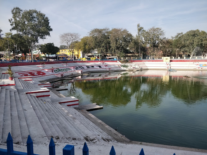
Dholawad Dam is a reservoir and local excursion spot in Ratlam district, Madhya Pradesh, India. It’s officially listed by the Ratlam district administration as a tourist place and described as being in/near Raoti, about 25 km west of Ratlam, and also known as Saroj Sarowar Bandh.
If you’re building a low-effort day trip out of Ratlam—fresh air, big-sky views, and a slower pace—this is one of the district’s most straightforward options.
—
## Quick facts
– Name: Dholawad Dam (also listed as Saroj Sarowar Bandh)
– Type: Reservoir (water storage / dam site)
– City/District hub: Ratlam
– Area mentioned in official listing: Raoti; ~25 km west of Ratlam
– Coordinates (provided): 23.264888, 74.9004158
– Official tourism category (district site): “Adventure” + “Natural / Scenic beauty”
– Rating (provided): 4.2
—
## Where Dholawad Dam is, exactly
On Ratlam district’s official site, Dholawad Dam is presented as a tourist attraction located in Raoti, described as roughly 25 km to the west of Ratlam.
That “Raoti + west of Ratlam” detail matters because it helps you plan the day realistically: it’s close enough for a short out-and-back without needing an overnight, but far enough that you should treat it like a proper half-day outing—especially if you’re relying on local transport.
—
## What you can realistically do there
Because Dholawad Dam is categorized officially under Natural/Scenic beauty (and also tagged Adventure) on the district tourism pages, it’s fair to plan for a “views + outdoors” visit rather than a highly managed attraction.
### 1) Scenic walking and viewpoint-hunting
Most dam visits are about moving slowly: walking the accessible stretches, stopping at safe edges and designated viewpoints, and getting a feel for the scale of the reservoir. Bring a wide-angle lens if you shoot photos—reservoir landscapes look flat on phones unless you include foreground objects (railings, rocks, people) for scale.
### 2) Picnic-style day out (with low expectations)
If your goal is a relaxed outing—snacks, tea, and time outside—dams tend to work well because you can self-direct the experience. The tradeoff: amenities and crowd management can vary by season and day of week.
### 3) Water-level watching (seasonality)
Reservoir scenery can change dramatically with rainfall and water releases. Even when the location is the same, the experience can feel totally different depending on:
– waterline height
– wind conditions (reservoirs can get gusty)
– visibility (dust/haze vs. clear skies)
That’s not a “fun fact”—it’s the difference between a memorable visit and a “why did we come?” visit.
—
## Getting there: how to plan the approach
### From Ratlam (most common base)
The district listing’s ~25 km west of Ratlam is your anchor for planning.
Practical implications:
– If you’re driving: budget extra time for last-mile road variability (rural surfaces, farm traffic, occasional detours).
– If you’re hiring a taxi/auto: confirm the return plan upfront (signal can be inconsistent near open water and rural roads).
– If you’re using map pins: use the coordinates (23.264888, 74.9004158) as your reliable reference, since “Dholawad Dam” can sometimes pull multiple pins or outdated map results.
—
## Safety and accessibility: what experienced travelers do differently
Reservoirs are deceptively risky because they look calm. A few practical rules that keep your day smooth:
– Stay on built surfaces (roads, marked paths, railings) whenever possible. Dam edges can crumble, especially after rains.
– Do not assume lifeguards or rescue services are present. Treat the water as “no swim” unless clearly designated otherwise on-site.
– Wind is real on open water. Hats blow off, tripods tip, and small kids can get chilled faster than you’d expect.
– Watch footing at sunset. The light gets beautiful—but contrast drops fast, and uneven ground becomes a sprain factory.
Accessibility note: dam areas can be uneven and involve stairs/embankments. If someone in your group has mobility needs, plan for a “viewpoint-only” visit and avoid routes that require scrambling.
—
## What to bring (small list, big payoff)
– Water + electrolytes (heat and wind increase dehydration risk)
– Sun protection (hat + sunscreen; reflections off water intensify sun exposure)
– Closed-toe shoes (rocks + rough surfaces)
– A light layer (reservoir breeze can cool you down quickly)
– Offline map pin using the coordinates (helps when signal drops)
—
## Responsible visiting (especially at water sites)
Dams and reservoirs often serve practical roles (storage, irrigation, local water supply). Treat the space like critical infrastructure:
– Don’t litter—wind carries plastic straight into water systems.
– Avoid loud music; sound travels far over water and affects both people and wildlife.
– Don’t harass animals or throw food into the reservoir (it’s not harmless “feeding,” it changes behavior and water quality).
—
## Outdated-data flags (important)
A lot of online listings for Dholawad Dam mention activities, fees, and timings, but these details are frequently sourced from user-generated snippets or older travel directories and can change without notice.
What I can verify from official district tourism information is:
– it’s a recognized tourist place in Ratlam district,
– it’s associated with Raoti,
– it’s described as ~25 km west of Ratlam,
– and it’s also known as Saroj Sarowar Bandh.
For anything beyond that (boating availability, banana rides, entry fees, operating hours), confirm via local contacts or on-the-ground signage the day you visit.
—
## Internal links to add (if available on RealJourneyTravels.com)
If your site already has these pages, they’re natural contextual links:
– Ratlam travel guide (base logistics, food, transport)
– Madhya Pradesh itinerary or planning guide (seasonality, regional transport, cultural etiquette)
—
## Summary: who this place is best for
Dholawad Dam works best if you like simple outdoor stops where the payoff comes from time outside rather than curated attractions—short drive, open views, and a flexible schedule. The most dependable planning facts are the official district positioning (Raoti area; ~25 km west of Ratlam; alternate name Saroj Sarowar Bandh).
Table of Contents
Key Highlights
Dholawad Dam
Location
Places to Stay Near Dholawad Dam"... This dam hosts variety of fun activities such as boating, banana ..."
Find and Book a Tour
Explore More Travel Guides
No reviews found! Be the first to review!
Traveler Reviews for Dholawad Dam
There are no reviews yet. Be the first one to write one.
Have you visited Dholawad Dam? Help other travelers by sharing your review.
You Might Also Like
Ganga Daya Garden Ratlam
Kalika Mata Park
Dholawad
Find Accommodations Nearby
Recommended Tours & Activities
Visitor Reviews
There are no reviews yet. Be the first one to write one.
Share Your Experience
Have you visited Dholawad Dam? Help other travelers by leaving a review.