Ciudad acuña
About Ciudad acuña
Key Features
More Details
Updated April 15, 2024
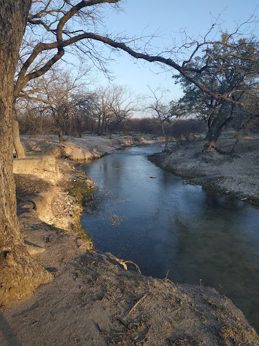
## Ciudad Acuña (Los Álamos) Hiking Area: What You Can Reliably Plan Around
Place name (as provided): Ciudad acuña
Category: Hiking area (rating: 5)
Address (as provided): Los Álamos, 26240 Ciudad Acuña, Coahuila, Mexico
Coordinates: 29.3232963, -100.9514187
This pin sits in Ciudad Acuña, Coahuila, a border city on the Rio Grande / Río Bravo opposite Del Rio, Texas.
If you’re using this location as a “quick nature break” while you’re in town (or crossing the border), the most useful, verifiable planning context is about Acuña as a base and the reputable trail directories that catalog hikes nearby—because I did not find an authoritative public land-manager page that clearly names this exact coordinate as a signed, formal trailhead in the sources available.
—
## Where you are, in plain terms
Ciudad Acuña is a city in Coahuila, Mexico, located on the Rio Grande (Río Bravo) at the U.S.–Mexico border.
It connects with Del Rio via the Del Rio–Ciudad Acuña International Bridge, which crosses the Rio Grande.
That geography matters for hikers for two practical reasons:
– Access and services are urban-adjacent. You’re not starting from a remote mountain town; you’re starting from a city with supplies and paved access roads.
– Conditions can be semi-arid. In this region, hydration, heat management, and sun exposure are the dominant constraints (more than elevation).
—
## How to find real trails near Ciudad Acuña (and avoid guessing)
If your goal is to hike near Ciudad Acuña (not necessarily only at this exact pin), the most defensible approach is:
### 1) Start with trail catalogs that show routes and GPS tracks
– Wikiloc lists 140 trails for Ciudad Acuña (various activities, including hiking/walking). | Trails of the World
– AllTrails also indexes trails for Ciudad Acuña and Acuña, including user reviews, maps, and directions.
These platforms are not official land managers, but the fact that they list routes is verifiable—and they’re often the fastest way to validate whether a pin corresponds to an actual path network versus a generic map label.
### 2) Cross-check with protected-area sources when you want “officially designated nature”
Acuña’s municipality includes Los Novillos National Park, a federally protected area documented by CONANP (Mexico’s protected areas agency). CONANP describes it as being located in the municipality of Villa Acuña (Acuña) and notes an extensive forest of walnut trees. ANP
If your priority is a “real park day” rather than an informal walk, Los Novillos is the strongest official anchor in the area based on accessible sources.
—
## What to expect on a hike here (only what’s safe to state)
Because the exact on-the-ground trail character at 29.3232963, -100.9514187 isn’t documented in an official public source I can cite, the safest way to plan is to assume you’re doing a short, flexible outing unless you confirm a mapped route first.
### Reliable planning assumptions for this region
– Sun exposure is likely high for much of the year (bring sun protection).
– Water planning matters more than technical gear for most casual routes.
– Navigation is easiest with offline maps (download ahead; cell coverage can vary by micro-area).
(Those are recommendations, not claims about the specific trail’s infrastructure.)
—
## A practical, low-regret hiking plan (works even if signage is minimal)
### Before you go
– Save the coordinates offline: 29.3232963, -100.9514187
– Pull at least one route track from AllTrails or Wikiloc nearby so you have a known “there and back” option. | Trails of the World
– Tell someone your return time if you’re hiking solo.
### What to pack for a short hike/walk
– Water you can actually finish (and a bit extra)
– Sun protection (hat + sunscreen)
– A small snack
– Offline map + a power bank
### On the ground: how to validate the spot quickly
– If you arrive and there’s no obvious path, don’t force it—switch to a verified track you already saved from a trail directory. | Trails of the World
—
## If you want an “official nature” option: Los Novillos National Park
If your trip is specifically about nature rather than a quick local walk, Los Novillos National Park is the clearest, official protected-area reference tied to the Acuña municipality. CONANP’s listing is the most authoritative public source I found for a designated natural area in the immediate region. ANP
What that means for you:
– You’re more likely to find recognized recreation use (picnic day / nature day patterns) than at an unlabeled neighborhood pin.
– Your “plan B” is stronger because parks tend to have known access points.
—
## Notes on accuracy (so you don’t publish something brittle)
– The city-level context (Acuña on the Rio Grande border; the international bridge connection) is well-documented.
– The existence of trail listings near Ciudad Acuña on Wikiloc and AllTrails is verifiable. | Trails of the World
– I cannot confirm from an official land-manager source that the exact pin at Los Álamos, 26240 is a formally designated trailhead with signage, maintained routes, or specific facilities.
—
## Internal link inserts (need your site’s exact URLs)
If you share two RealJourneyTravels.com URLs (or your standard Mexico/category structure), I can place them naturally in-context without guessing. The two most relevant link targets for this post are typically:
– Your Mexico → Coahuila / Ciudad Acuña destination hub (if you have one)
– A hiking safety / what-to-pack evergreen guide (works across destinations)
Table of Contents
Key Highlights
Ciudad acuña
Location
Places to Stay Near Ciudad acuña
Find and Book a Tour
Explore More Travel Guides
No reviews found! Be the first to review!
Traveler Reviews for Ciudad acuña
There are no reviews yet. Be the first one to write one.
Have you visited Ciudad acuña? Help other travelers by sharing your review.
You Might Also Like
Catretera Amistad Dam
Parque Nacional Los Novillos
estatua de Manuel acuna
Find Accommodations Nearby
Recommended Tours & Activities
Visitor Reviews
There are no reviews yet. Be the first one to write one.
Share Your Experience
Have you visited Ciudad acuña? Help other travelers by leaving a review.