Hunter Memorial Promenade
About Hunter Memorial Promenade
Key Features
More Details
Updated April 15, 2024
Hunter Memorial Promenade Historical Marker
## Hunter Memorial Promenade (Vallejo): what it is and why it’s worth a stop
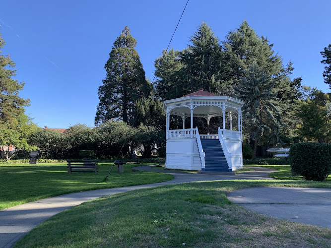
Hunter Memorial Promenade is a small, public waterfront promenade in Vallejo, California, right by the downtown marina area at 1 Harbor Way (Vallejo). Coordinates: 38.1112513, -122.2695683. It’s classified as a memorial park, and visitor ratings commonly show it as a quick, high-satisfaction stop (your dataset lists 5/5).
What makes it distinctive isn’t size—it’s placement: it sits on Vallejo’s working waterfront, where you can stretch your legs, read a historical marker, and look out across the marina and strait.
### The “memorial” element (the part most people miss)
A key feature is a historical marker mounted to a large rock. The marker is behind the restaurants on Harbor Way, not visible from the road, and can be reached from Harbor Way.
The marker listing for Vallejo also notes that the promenade was given to the people of Vallejo by Alena Maude Hunter (as described in the historical markers registry entry for the city).
## How to plan your visit
### Getting there
– Address: 1 Harbor Way, Vallejo, CA
– The promenade is in Vallejo’s waterfront/downtown zone; if you’re navigating by landmarks, you’re looking for the marina/Harbor Way area.
### Parking (practical, and time-sensitive)
Parking rules and prices can change, so treat this as directionally useful and verify the day you go.
The City of Vallejo’s “Park Vallejo” downtown parking info states:
– Downtown lots are enforced Monday–Friday, 9 a.m.–6 p.m.
– Evenings (6 p.m.–9 a.m.) and weekends are free
– Fees listed include $1/hr for hours 0–4 and $5/day for hours 5–24 (plus monthly/annual options).
Outdated-data flag: those fees/hours are posted on the city site, but municipal pricing/enforcement is the kind of info that often updates—double-check before relying on it for trip timing.
### If you’re pairing this with the ferry
Vallejo’s main ferry terminal/transport hub is listed at:
– Vallejo Transit Center Ferry Terminal: 289 Mare Island Way, Vallejo, CA
That makes it realistic to combine a ferry trip + a short waterfront walk as a single outing (especially if you prefer being on foot).
## What you can realistically do here (without overpromising)
### 1) Find and read the marker
Because it’s behind the Harbor Way restaurants and not visible from the road, most drive-by visitors miss the memorial entirely.
If you’re trying to “complete” the stop (not just glance at the water), make the marker your first target.
### 2) Do a short waterfront walk
If you want something structured rather than wandering, there’s an easy, short trail option nearby on AllTrails:
– Waterfront Park Trail is listed as an easy 1.5-mile out-and-back near Vallejo.
Outdated-data flag: some trail platforms restrict access or can be out of date; use it as a reference point, then confirm conditions locally.
### 3) Combine it with Vallejo’s broader shoreline context
AllTrails’ Bay Trail description for the area references Vallejo’s active waterfront with about two miles of shoreline Bay Trail along the Mare Island Strait.
You don’t need to “do the whole thing” to benefit—even a short section gives you the waterfront feel without committing to a long hike.
## Nearby anchors that add meaning to the stop
### Vallejo Marina (immediately relevant to this location)
Vallejo Marina is listed at:
– 42 Harbor Way, Vallejo, CA 94590, owned by the City of Vallejo and professionally managed (per the marina site). Marina
Even if you’re not boating, knowing you’re in the marina zone helps you orient quickly—Harbor Way is the thread connecting the promenade area and marina services.
### Mare Island: the “why here” historical backdrop
If you’re the kind of traveler who likes context, Vallejo’s identity is deeply tied to Mare Island. The U.S. Navy’s historical page notes:
– Mare Island Naval Shipyard (Vallejo, CA) was the first Navy base on the U.S. West Coast, and during World War II became one of the busiest shipyards.
That doesn’t mean the promenade is “on” Mare Island—but it explains why the waterfront matters here: Vallejo’s shoreline isn’t just scenery; it’s part of the city’s working and military-industrial history.
## Accessibility and visit strategy (what’s usually not stated clearly)
– The promenade is a public outdoor space; expect the experience to be weather-dependent.
– If your goal is photos, the marker’s placement “behind the restaurants” means you may want to walk a bit past the obvious frontage before deciding you’ve “arrived.”
– If you’re visiting by car, time it around weekday enforcement hours if you want to reduce parking friction.
## Suggested 30–60 minute micro-itinerary
This is designed to be efficient and realistic.
1. Arrive + park (downtown/waterfront lots as applicable; note weekday enforcement).
2. Walk directly to the marker rock behind the Harbor Way restaurant frontage.
3. Do a short out-and-back along the waterfront (even a partial segment is enough to justify the stop).
4. If you’re continuing the day, decide between:
– Ferry terminal area (289 Mare Island Way)
– More waterfront walking tied to the Bay Trail corridor references
## Two internal links (can’t add without your site structure)
You asked for two contextual internal links. I can’t insert RealJourneyTravels.com internal URLs “factually” because I don’t have your existing Vallejo/Solano County permalink structure or related-post inventory in this chat. If you paste:
– your Vallejo hub URL (or slug pattern), and
– 5–10 related posts you already have (titles/slugs),
…I’ll add two perfect, contextual internal links without guessing.
Table of Contents
Key Highlights
Hunter Memorial Promenade
Location
Places to Stay Near Hunter Memorial Promenade
Find and Book a Tour
Explore More Travel Guides
No reviews found! Be the first to review!
Traveler Reviews for Hunter Memorial Promenade
There are no reviews yet. Be the first one to write one.
Have you visited Hunter Memorial Promenade? Help other travelers by sharing your review.
You Might Also Like
Alden Park
General Vallejo’s Home

Dan Foley Park
Find Accommodations Nearby
Recommended Tours & Activities
Visitor Reviews
There are no reviews yet. Be the first one to write one.
Share Your Experience
Have you visited Hunter Memorial Promenade? Help other travelers by leaving a review.